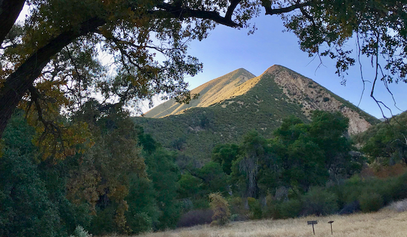
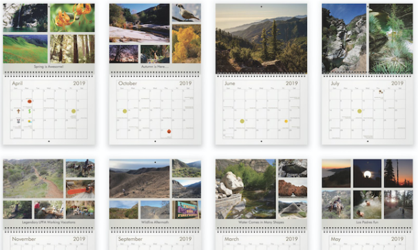
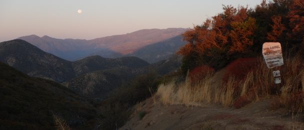
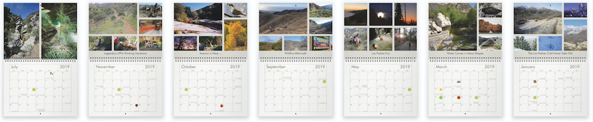
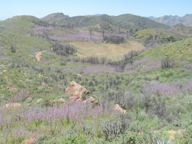
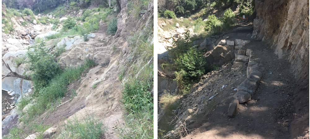
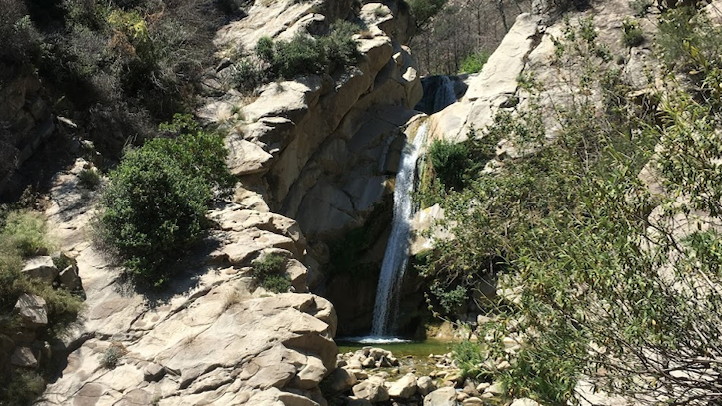
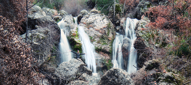
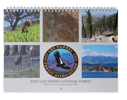
Los Padres Fire Restrictions, Closures, Hunting Season and Openings

Above Ojai, Pratt Trail showing off some new post-Thomas Fire summer regrowth, photo LPFA
Hello Friends,

It’s been a busy few weeks here in the Los Padres featuring additional fire restrictions and the onset of A-Zone South general deer hunting season.  We’ve also had a lot of questions of late about what is and what is not open across the Los Padres.  Lots going up and down the Los Padres, especially for the dog days of summer, lets get to it!

— • — • — • —


The Dry and Extra Crispy Little Pine Mountain
ADDITIONAL FIRE RESTRICTIONS

The Forest Service announced on August 9th some additional fire restrictions.  You can read the fine-print at the link here but basically:

  • No campfires allowed across the forest.  PERIOD.
  • No target shooting allowed outside of Winchester and Ojai Valley (Rose Valley) Gun Clubs.
  • No camp stoves outside of designated Campfire Use Sites.
    • Yes, that means no hot coffee or stove cooking for backcountry travelers!

Obviously 2018 has already been a horrendous wildfire year with more than 15 large fires currently burning across California.  So far (knock, knock) the LP has avoided any large fires this season and lets hope it stays that way.  Be safe everyone!

— • — • — • —

Big Pine Mountain, sadly the pines have been slow to recover after the 2007 Zaca Fire, photo Taryn AshlockA-ZONE SOUTH HUNTING SEASON

A-Zone South general hunting season started August 11 and lasts through September 23.  While there are many hunts across the Los Padres, the A-Zone South general season is by far the busiest.  A-Zone South covers almost all of the Los Padres from Monterey down through SLO, SB and a large portion of Ventura County.  You can see the map showing the coverage area here.  Each year we hear concerns from non-hunters who are caught off guard coming across groups of hunters.  Be aware that hunters will be out and about this time of year and if that’s not your cup of tea you might want to head elsewhere in the Los Padres.  Pine Mountain above Ojai and the Mt Pinos area are both outside of A-Zone South and should be nicer this time of year due to their higher elevations.  Once again, be safe everyone…..

— • — • — • —

While not quite as impressive as the Black Gate of Mordor, it’ll feel just as imposing if you find it closed when you thought it was supposed to be open!YOU SHALL (NOT) PASS!

We get a ton of questions from forest-users asking about which gates are open? is that gate closed? is this trail open? can I go here,? etc….?  BTW, we love helping with these questions so please keep them coming!  While the Forest Service website does a great job of sharing this information, we thought it was probably time to share some of the answers we’ve been helping people with over the past months.  We’re focusing on either the recent changes or the major questions we frequently receive.  For more details please check the Los Padres website linked above or call your local Ranger District:

  • MONTEREY RANGER DISTRICT
    • HIGHWAY 1: After being closed since May 19, 2017, the GIANT slide at Mud Creek finally reopened on July 18.  Highway 1 through what is known as the Big Sur Coast is now open from Morro Bay to Monterey.  That being said, there are still some one lane delays and the occasional nighttime closure.  If you are planning a trip along this section of Hwy 1 be sure to check ahead of time to with CalTrans to make sure you can safely get through.
    • PALO COLORADO ROAD: Palo Colorado Road sustained major damage following the 2016 Soberanes Fire and 2017 winter season.  The road remains closed three miles above Hwy 1 but people can hike up the road to access Bottcher’s Gap and the Northern Terminus of the Condor Trail.  While the road is open to pedestrians, understand that there is no parking along the road so you’ll have to arrange for a drop-off if you plan on hiking up to Bottcher’s. Palo Colorado is scheduled to reopen by the end of October.
    • PINE RIDGE TRAIL & FRIENDS: The Pine Ridge, Terrace Creek and Ventana Camp Trails remain the largest and most substantial closure across the Los Padres as well as the # 1 question we get about closures.  Pine Ridge Trail remains closed from Highway 1 at Big Sur Station up-canyon to beyond Redwood Camp.  This includes Ventana Camp, Barlow, Terrace Creek, Sykes and Redwood.  The trail was damaged in both the Soberanes Fire as well as the 2017 storms.  There is no timetable as to when the trail or access to the camps will be reopened.
  • SANTA LUCIA RANGER DISTRICT
    • HI MOUNTAIN ROAD: Hi Mountain Road was reopened in late April after being closed for over a year due to lack of maintenance.
    • BATES CANYON: Closed above Bates Campground due to road issues and slides.
  • SANTA BARBARA RANGER DISTRICT
    • ROMERO CAMUESA ROAD: The Romero Camuesa Road remains closed to vehicle traffic beyond Romero Saddle along East Camino Cielo.
    • DIVIDE PEAK OHV: Divide Peak is open but riders will need to park at Romero Saddle.
    • FIRST CROSSING: Open.
    • BUCKHORN ROAD OHV: Closed at Upper Oso due to Rey Fire damage and adjustments to the Camuesa Road OHV.  More on that to come…..
    • SB FRONTCOUNTRY TRAILS: Most of the frontcountry trails have reopened but the lower sections of Cold Spring and Hot Springs remain closed as well as the entire West Fork Cold Spring Trail.  More on this to come soon as well……
  • OJAI RANGER DISTRICT
    • MIDDLE LION CAMPGROUND: Open, after being closed due to the Thomas Fire.
    • ROSE VALLEY CAMPGROUND: Open, same as above.
    • NORDHOFF RIDGE ROAD: Open, same as above.
    • ORTEGA TRAIL: Open, same as above.
    • CHERRY CREEK: Open, seasonal.
  • MT PINOS RANGER DISTRICT
    • RANCHO NUEVO / TINTA, MT PINOS RD: The road to Rancho Nuevo TH and lower Tinta TH was closed for an extended period of time due to gullies and washouts.  The road has been recently reopened to both trailheads.
    • WEST DRY CANYON ROAD, MT PINOS RD: Dry Canyon Road, which connects Santa Barbara Canyon to the upper Tinta TH and Cuyama Peak remains closed due to gullies sustained during the 2017 winter season.
— • — • — • —


So much brown, dry photos; lets mix in some green and a July waterfall along the Sisquoc

Los Padres Fire Restrictions and Sisquoc Trail Work

Don’t listen to Home Depot, spending a hot summer afternoon on the Deck is anything but relaxing, photo L.Lagendyk
Hello Friends,
We hope you’re enjoying the summer, staying cool and still finding some time to enjoy the Los Padres.  Even with the high temps and disappearing water flow, the forest has plenty of hidden and not-so-hidden gems that can make you rethink your summer Los Padres hibernation plans.  Some people head to the heights and large shade producing trees of the Mt. Pinos Ranger District for their summertime LP fix.  Others might seek lower elevations along the coast, hoping for some cool morning fog.  And others still embrace the heat by soaking in any of the perennial flowing creeks, rivers, pools and waterfalls.  All are great options, just remember to be safe.  There has been a flurry of heat related rescues across the forest over the past month.  If you’re going to head into the forest and encounter the heat be sure to plan accordingly.  Tell someone where you are going, leave an itinerary at home and try to follow these 9 rules for hiking in hot weather.  Be safe, have fun and if you don’t mind sharing, we’d love to see some of your summertime photos from the across the Los Padres.
— • — • — • —
The sun has set on backcountry campfires for the season, photo Humphrey
FIRE RESTRICTIONS
The big news across the Los Padres this past week is the change in fire restrictions.  Due in part to the recent rash of wildfires around the forest (Piru, Fillmore, Goleta, FHL, etc….), the Forest Service raised fire restrictions across the Los Padres banning campfires outside of designated Campfire Use Sites, prohibiting target shooting outside of designated target ranges and prohibiting smoking outside of an enclosed vehicle, building or at a designated Campfire User Site.  We’re no strangers to fire restrictions and should all be well aware of what can happen should a campfire get away (see Soberanes Fire).  Cooking stoves are still permitted in the backcountry with a California Campfire Permit and hunting is still permitted during the regulated seasons (A-Zone South General opens August 11).  If you have any questions please contact the Los Padres Forest Supervisors Office or your local District Office.  Be smart.

— • — • — • —


Speaking of big shade producing trees and waterfalls, the Sisquoc Trail through the Bear Camps has plenty of both

SISQUOC TRAIL PROJECT
July 20-22
The LPFA and our fantastic volunteers have been busy working the Sisquoc Trail in the San Rafael Wilderness.  We’ve cleared over 300 downed trees this year (2018) and at last count had less than 20 trees left!  For those of you who know the Sisquoc Trail, that’s pretty amazing to say there are only 20 downed trees along the 30+ miles of trail.  But we’re not happy and want to get them all…..  If you are interested, please join us the weekend of July 20-22 as we head to the Upper Sisquoc to clear the remaining 20 downed trees and continue work along the section of trail between Alamar Saddle and Lower Bear Camp.  We’ll be driving in from Upper Oso on Friday July 20 and basecamping at Bluff Cabin for the weekend.  We’ll drive up to Alamar on both Friday and Saturday to work the Sisquoc Trail.  This section of trail is over 5,000ft and mostly shaded with pines and cedars.  We’re hoping the shade and nearby waterfalls will help us push through the heat and complete the work.  If you are interested in signing up or hearing more details, please email INFO@LPForest.org.  We’re happy to have seasoned trail veterans as well as green trail rookies.  It should be a great project and a fantastic opportunity to give back to the trails you love and explore this remote section of the Los Padres.  We hope to hear from you soon……
— • — • — • —June 30 Montecito Trails Day, Over 100 Volunteers Helped Maintain 3 Miles of Thomas Fire Damaged Trails – Yee Haw!
FOREST 411

• The LPFA was featured last month in the Santa Barbara Independent Blue and Green issue highlighting one of our Working Vacations from April 2018.  Check it out…… and three cheers for all the great volunteers who make the Working Vacations so successful and fun!  Cheer……  Cheer……  Cheer……

• Reminder that HikeLosPadres.com continues to be a great resource for knowing current trail conditions and water conditions across the forest.  Be sure to check HLP before you head out and update it when you get back.  Sharing information helps everyone.  Thanks…..

• In case you missed it, the Thomas Fire was officially declared out last month after starting December 4, 2017.

• On a loftier note, the flock of condors in San Luis Obispo are doing great and beginning to expand their territory.

• The LPFA will be expanding our paid Trail Crew this summer and are looking for experienced Los Padres trail workers interested in working for the LPFA Trail Crew.  The work will be primarily in Ventura and SB Counties and will range from day projects to week-long overnight backcountry hitches.  If you are interested in throwing your name into the hat or hearing more details, please email INFO@LPForest.org

— • — • — • —


The Los Padres is calling and I must go
, photo JO Chung

Thomas Fire Closure Update & NTD 2018

Naked Matilija Wilderness
THOMAS FIRE CLOSURE LIFTED
The Forest Service unexpectedly lifted their Thomas Fire closure last week.  This reopens all of the Los Padres portion of the Thomas Fire burn scar to most of its normal use.  While the majority of the public should be rejoicing at the chance to get back into the forest, it’s not all sunshine and rainbows.  Here are a few tweaks and warnings you should be aware of before relaunching into the forest:

  • While the Forest Service has reopened their previously closed land, both the City and County of Santa Barbara have decided to keep their portions of the burn area closed.  You can read more details on the Noozhawk article by Ray Ford.  The City and County of SB control much of the lower portions of the Santa Barbara Frontcountry, including the trailheads at Cold Spring, San Ysidro and Hot Springs Canyon.  This means that while the upper Frontcountry within the Los Padres is open, people cannot access the trails through the more popular lower trailheads.  This has created a bit of a conundrum as stakeholders and trail-users attempt to figure out the best ways to legally enjoy the trails.  We’ll keep you posted as news develops……..
  • The LPFA has been busy over the past days installing yellow warning signs at the trailheads around the Thomas burn area, see photo below.  Please do be careful if you are within the burn area.  There are many loose rocks and hazard trees that have not succumbed to gravity quite yet.  Pay special attention on switchback sections where people above might trigger a loose rock on trail users below.  Also, if you plan on camping in the burned area, be really careful of hazard trees and limbs that might fall.
  • Portions of the town of Montecito remain in a state of disrepair as they continue to deal with repercussions from the Thomas Fire and January 9 debris flows.  There is still a lot of heavy equipment moving rocks and pushing dirt, and some shocking house damage remains within the community.  Please be mindful and respectful.
  • The Romero Camuesa Road from Romero Saddle down towards Pendola remains closed to vehicles/motorcycles as does Divide Peak OHV.  Hikers and bicyclists are able to use these roads.  No timetable has been set as to when the road and OHV route might reopen but don’t count on it happening anytime soon.
  • Both Rose Valley Campground and Middle Lion Campground remain closed.  No news as to when they might reopen.
  • While the forest is open, most of the trails have received little or no trail work since the winter rains.  You should plan on the trails taking significantly longer to travel than normal and be careful attempting shuttle trips as there may be some impassable sections of trail that may cause changes in your plans.
  • There have been some reports from within the burn area of the dreaded fire-follower plant called the Poodle Dog Bush.  Our unfriend, the Poodle Dog, causes human reactions similar to poison oak.  It’s a very picturesque purple flower that can grow in large robust fields that look like something you should dance through rather than skirt around.  Google search it please…….

Other than that, the forest has been reopened from the lower Sespe out to Gibraltar Road and up to Hwy 33.  Enjoy, be safe and please let us know if you come across any downed trees or horrible sections of trail that need significant work.  We’re helping compile a list of trail issues and any assistance you can provide would be greatly appreciated.

Please share your reports on www.HikeLosPadres.com.  THANKS and be safe!

— • — • — • —

This was (is) Matilija Camp? NATIONAL TRAILS DAY

National Trails Day is this coming Saturday, June 2 and the Los Padres has four trail projects scheduled within our forest:

MATILIJA TRAIL, Ventura County
The LPFA is organizing a trail project into the Thomas Fire burn area and focusing on restoring the lower portion of the Matilija Trail from the trailhead up to Matilija Camp.  The trail is covered in downed trees (crosscut sawyers needed) and burnt brush that we’ll be clearing from the trail corridor and if time allows we might work to uncover Matilija Camp, which was buried in boulders.  We’ll be meeting Saturday at 8am at Wheeler Gorge Visitor Center and working until 2pm.  REI will be joining us back at Wheeler Gorge with their famous “CHILL ZONE” and we’ll have a quick BBQ for the volunteers around 3pm.  It should be a special day and a lot of fun.  For more information check us out here or email INFO@LPForest.org

DAVY BROWN TRAIL, Santa Barbara County
The LPFA will also be hosting a trail project on June 2 along the Davy Brown Trail, off of Figueroa Mountain near Los Olivos.  We’ll be meeting at the upper Davy Brown Trailhead at 8am and from there working down Davy Brown and perhaps out the Willow Spur Trail.  Work will be mainly clearing downed trees and brush from along the trail.  Mike Smith is the project leader and we’ll work until the afternoon before returning to the trailhead.  Davy Brown is one of the more scenic trails in the area providing ocean views from the trailhead as well as views of Hurricane Deck.  It’s also home to a great variety of plants and flowers that make Figueroa Mountain so famous.  We hope to see you there.  Please RSVP if you can make it (INFO@LPForest.org) and click here for more details.

BOULDER CANYON TRAIL, Ventura County
Mark Subbotin will be leading a sawyer assault down the Boulder Canyon Trail along the northern slope of Pine Mountain.  There is an estimated 20+ trees down along the trail and we’re fairly certain they’ll get them all!  This is also part of the Condor Trail.  Details will be provided by Mark and the Mt Pinos Volunteers, you can reach Mark at: MSubbotin76@Gmail.com.

HORSEPASTURE TRAIL, Monterey County
The VWA is hosting a car-camping potential multi-day project along the Horsepasture Trail.  They’ll be working hard on Saturday and then playing equally hard on Sunday.  Sounds like a great project and a terrific way to get to know the area and the people who help keep the trails open.  RSVP required, please click here for more details.

— • — • — • —

The Quick Gray Fox Jumps Over the Newly Restored Trail, photo Humphrey
FOREST 411

• As if this weekend wasn’t busy enough, the Wheeler Gorge Visitor Center is hosting a special talk on Saturday at 11am by local hiking author Dr. James Caballero entitled “Hiking Be Prepared”.  It doesn’t matter if you are a seasoned hiking stud or a trail newbie, you’re assured to learn something new!  See you at Wheeler……. and stay for the REI BBQ!

GREAT NEWS!  The Ojai Ranger District released a scoping letter last week outlining an environmental proposal to approve all the ORD trails for Level 1-2 trail maintenance.  See attached letter to learn more and please respond if you’d like to see the Ojai trails improved.

• This weekend marked the launch of a temporary shuttle service that shuttles visitors from the Big Sur Station parking lot down to Pfeiffer Beach and back.  Beach access to Pfeiffer and overcrowding has been a serious problem over the past decade and the shuttle service is a pilot project to see if a shuttle can prevent traffic jams along Sycamore Canyon Road.  By most accounts the first weekend was a big success.  We’ll share more information on this in a future email.

— • — • — • —


Pay Attention to the Thomas Fire Warning Signs, and Especially Pay Attention to the Signs of Thomas Fire Warnings, photo Gordon J.

Spring 2018 LPFA Update

Dust Still Settling on the Rock Slide vs Oak, Rancho Nuevo Canyon

Hello Friends – Happy Mother’s Day!  It’s been a while since we’ve sent out a LPFA Forest update and we figured what better day to send out a Los Padres update than Mother’s Day.  Lets get to it…….

We’ve all heard the saying about if a tree falls in the woods and no one is there to hear it…….right?  While we can’t exactly prove that one, we can tell you that if a tree is obliterated in the woods by a rock slide and someone is there to hear it…… it’s scary and loud as hell!  On a recent trail survey up Rancho Nuevo Canyon, one of our volunteers witnessed first hand a rock slide that literally destroyed and smashed a substantial oak tree into pieces.  The volunteer watched in astonishment from less than 50 yards away as the cliff face let loose down the canyon, taking out trees and covering the trail that he was seconds away from hiking.  After the dust had mostly settled, he quickly took a photo of the carnage (see above) and high-tailed it out of there.  It was a crystal clear cool spring morning, no wind, no earthquakes, this area hadn’t burned since the Zaca Fire and no recent rain.  Fortunately, there had been a few smaller rock falls just before the final large one that kept him from continuing down the trail and into the cross-hairs of the slide.  The main takeaway of the story is to always pay attention while in the forest.  It doesn’t need to be a stormy day for disaster to strike.  We might want to put the headphones away, listen to the forest sounds, stay alert and follow your gut.  While the slide was scary for sure, it must have been an incredible sight to see as well……  Has anyone else witnessed tree falls, rock slides or other random acts of nature in the Los Padres.  We’d love to hear about it…..

—-  —-  —-  —-  —-  —-

While not part of the Tour of California, the Blue Canyon switchbacks are looking good enough to ride again!
Compliments of a February 2018 LPFA volunteer project.

2018 TOUR OF CALIFORNIA

Each May, cyclists from around the world descend on California to participate in the Amgen Tour of California bike race.  The Tour of California is a week long race that sends the cyclists 645 miles up and down California highlighting the spectacular sights and roads that make California such an attractive destination.  The routes and stages change from year to year and as luck would have it in 2018, two of the stages pass through the Los Padres National Forest:

STAGE 2, MAY 14: Ventura to Santa Barbara
This stage might as well be called the Tour de Thomas Fire.  It starts in Ventura, heads out through Oxnard and Camarillo before heading north up Hwy 150 through Santa Paula literally right past the point of origin of the Thomas Fire.  From there the race goes through Ojai, passes the Ojai Ranger District, along Hwy 150 to Carpinteria, across to Santa Barbara and then ascends freshly paved Gibraltar Road into the Los Padres and up to the finish at East Camino Cielo.  The riders will be seeing most of the burned areas during their 100 miles in the saddle.  Gibraltar Road is sure to be a wild scene for those who’d like to see the race in person, otherwise you can watch on NBCSN live from 1 – 4pm.

STAGE 3, MAY 15: King City to Laguna Seca
The following day the Tour heads to the northern Los Padres starting in King City near the Monterey Ranger District.  From King City the riders will circle around to Greenfield, head towards Arroyo Seco, veer onto Carmel Valley Road, passing briefly through the Los Padres on their way to Carmel Valley and finally north up to the finish at Laguna Seca Raceway.  In all the riders will cover 122 miles and you can catch the live TV coverage from 1:30 – 4pm on NBCSN.

—-  —-  —-  —-  —-  —-

Imagine if there were no trail volunteers, I wonder if you can….
VOLUNTEER PROJECTS & NATIONAL TRAILS DAY

Sadly, we’re nearing the end of the regular season for Los Padres volunteer projects.  Soon the temperatures will get too hot, the water will fade away and many of us will head east to higher and greener summertime pastures.  BUT NOT YET!  We’ve got a bunch of upcoming trail projects across the LP through mid-June highlighted by National Trails Day on June 2nd weekend.  As usual, a full list of volunteer trail opportunities is outlined at the bottom of this email as well as some specific events with details posted here.  If trailwork is not your thing but you’re still looking for ways to volunteer, the LPFA is always looking for help with administrative tasks, website updates, helping organize events and/or providing information for public forest-users.  If you’ve got the time and interest, we’d love to hear from you.  Contact us at INFO@LPForest.org for more information.  THANKS……..

—-  —-  —-  —-  —-  —-

Hoppy Poppy and the Hurricane Deck….  We might be on to something here……
FOREST 411

 • Helen Tarbet of the Santa Lucia Ranger District does a fantastic job each spring documenting the flower show along Figueroa Mountain.  While the flower season hasn’t been nearly as ‘all-time’ as last year, there’s been a fair amount of color if you know where to look.  Attached is Helen’s latest installment of the Figueroa Mountain Wildflower Update.  Check it out……

• Since it is Mother’s Day, we wanted to reach out to each and every mother out there and send our thanks and best wishes!  You are all the best…….

Wheeler Gorge Visitor Center is back open and looking better than ever.  We used the downtime caused by the Thomas Fire to do some renovations at Wheeler Gorge and the work turned out fantastic!  Thanks to all the volunteers who helped in the renovation, in particular Gordie Hemphill, Kasey Moorse and Cindy and Terry Wright.  We’ll share more pictures of the Visitor Center soon, including an introduction to our newest family member: Freedom.  The next event at Wheeler is Saturday May 19 when we welcome Ranger Kris to talk about the World of Bats.  Hope you can fly on by……

• Tragically, a mountain lion was killed along Hwy 101 near San Luis late last month.

—-  —-  —-  —-  —-  —-


The Doors are Once Again Open, Wheeler Gorge Visitor Center

Late Spring Volunteer Projects

Here Pollywog Pollywog, photo Humphrey

LATE SPRING 2018 TRAIL PROJECTS

Hi Everyone,

Here’s a list of some upcoming LPFA and non-LPFA trail projects and specific contacts in case you’d like to volunteer.  Hope to see you out there……..

May 16 – White Rock Trail Work: The LPFA continues work clearing brush along the Figueroa Mtn network of trails.  Up next is White Rock Trail.  Led by Bryan Conant, we’ll be focused on brushing a middle 1/2 mile section of the trail.  Please RSVP via email: INFO@LPForest.org

May 18-21 – Bluff Camp Sawyer Trip: Led by Mickey McTigue, we’ll be driving in to Bluff Cabin via the Buckhorn Rd and Upper Oso.  From Bluff we’ll be day-tripping up to both the Mission Pine and Sisquoc Trails (part of the Condor Trail) to cut out fallen trees across the trail.  Work will be primarily crosscut with some brushing intermixed.  This work is within Santa Barbara County within the San Rafael Wilderness.  For information or to sign up please contact Mickey at: mickey.joecache@gmail.com

May 19 – Santa Barbara Canyon Crosscut: Join Mark Subbotin as he leads a project to cut out two large oak trees along the Santa Barbara Canyon Trail (along the Condor Trail).  The first tree is 3.2 miles from the trailhead while the second is 4.1 miles.  To sign up please email Mark at: msubbotin76@gmail.com

May 20 – Tumamait Trail Crosscut: Mark will be at it again, this time working the Tumamait Trail high atop the Chumash Wilderness.  They’ll be cutting out three downed trees about 2.5 miles out from the trailhead.  Mark can be reached at: msubbotin76@gmail.com

May 26 – Sulphur Spring Sawyer Project: Bob Burtness has been caring for the Sulphur Spring Trail since the 1970’s.  It’s become impassable due to fallen downed trees.  Bob will be leading a project on May 26 to help cut out the downed trees along the trail.  The work will either be using chain saws or crosscut, depending on PAL fire levels.  Sulphur Spring Trail is located off of Figueroa Mtn Rd near the San Rafael Wilderness.  For more information please contact: INFO@LPForest.org

June 2 – Chorro Grande Trail: The LPFA will once again celebrate National Trails Day by hosting a much overdue trail projects.  This year we’ll be working the Chorro Grande Trail within the Ojai Ranger District.  Chorro Grande is a lovely trail nestled between Hwy 33 and Pine Mtn ranging in elevation from 4,000ft to over 6,000ft.  We’ll be primarily brushing the middle portion of the trail.  Jasonn Beckstrand will be leading the efforts.  For more information email: INFO@LPForest.org

June 2 – Boulder Canyon Trail: Mark Subbotin will be leading a chain saw or crosscut project down the Boulder Canyon Trail (Condor Trail) focused on clearing an estimated 20+ trees.  This will also be part of the National Trails Day celebration.  For more information or to sign up, please email Mark: msubbotin76@gmail.com

June 8-10 – Alamar Trail Sawyer & Tread: The LPFA will be hosting one last project this year focused on clearing the Alamar Trail (part of the Condor Trail) within the Dick Smith Wilderness.  Led by Bryan Conant, we’ll be driving to Alamar Saddle and working from the Saddle down 3 miles into the canyon.  The majority of the work will be crosscut with some brushing and tread work mixed in for good measure.  INFO@LPForest.org to sign up or learn more.

June 15-18 – Upper Sisquoc Trail Project: Mike Smith is leading another assault on the Upper Sisquoc.  The exact location of this project is TBD but it will be somewhere between Alamar Saddle and Heath Camp.  For more information or to sign up please email Mike at: TrailSmith@LPForest.org

Alamar Downed Tree, Snow No Longer Included


Condor, Sycamore and Baer……. OH MY!

BAER Trail Protection, San Ysidro Trail, photo Carr
Hello Friends – We hope you are doing well and finding some time to splash in the puddles!

If you’ve been anywhere near a fire over the past few years, you’ve probably heard the words “BEAR WORK” and might not know exactly what that means.  We get asked about it all the time and it’s BAER WORK (pronounced BEAR).  So what is BAER?  This is directly from the Los Padres NF website:

The US Forest Service Burned Area Emergency Response (BAER) team’s purpose is to assess threats to life, property, and cultural and natural resources from fire-induced changes to the watershed that can cause erosion, sedimentation, flooding, and debris flows.
Basically what happens is that after any larger scale fire, the USFS dispatches a team of specialists to study and survey the future impacts that fire might play within the downstream communities and to the resources within the forest.  This team is called the BAER team (see acronym above) and they’re usually the first people on the ground as the flames die down.  The BAER team studies all the potential risks from the fire, generates reports outlining those risks, prescribes treatments designed to mitigate those potential risks and then performs those treatments within the forest.  BAER studies include archaeology, road engineering, trail protection, fisheries, soils, hydrology and more.  All the Thomas Fire reports are published on the FS website in case you are interested in the details.  So remember, the next time you hear a post-fire BAER reference, you can amaze your friends by telling them it has nothing to do with Smokey or Boo-Boo and then for bonus nerd points follow that up with a NIRA reference (National Industrial Recovery Act).
— • — • — • —

It just feels like Burkittsville, along the Condor Trail
CONDOR TRAIL TALK
Is the Condor Trail on your bucket list?  Do you fear you’ll kick the bucket if you attempt the Condor Trail?  Do you enjoy exploring new places across the Los Padres?  If you answered YES to any of those questions then you have to come to the Condor Trail Talk on Friday March 23 at the Balboa Building in Santa Barbara.  The Trail Talk is being hosted by the Condor Trail Association, LPFA and REI and we’ll be welcoming 4 sets of hikers who either finished the CT in 2017 or came really really close.  Each set of hikers will share stories from their journey across the Los Padres and it should be really cool hearing how different each journey was based on time of year and what they encountered along the way.  The talk is free, doors open at 6:30pm, we’ll have a raffle, silent auction, maybe a game or two and some beverages to kick your weekend off in style.  Come one, come all – as long as space allows!  Hope to see you there……
Condor Trail 2017 Hikers
Friday March 23 – Doors Open 6:30pm
Balboa Building – 735 State Street – Santa Barbara
*parking can be tough, suggest Paseo Nuevo*
— • — • — • —
Toejam Taking in the Lower Sisquoc, January 2018
LOWER SISQUOC WORKING VACATION
Sycamore Camp, April 14-22
We’re happy to announce our latest and greatest LPFA Working Vacation, this time along the Sisquoc Trail, based at Sycamore Camp in the spectacular San Rafael Wilderness.  The plan is to drive in to the Jackson Trailhead along the Sierra Madres on Saturday morning April 14.  From there we’ll backpack 4 miles down to Sycamore Camp, which will be our camp for the week.  We’ll be joined by the usual cast of mule packers and exquisite backcountry cooks that make camping life so enjoyable while on a Working Vacation.
Our mission for the week is to clear the trail from Sycamore Camp downstream to Big Bend Canyon. As mentioned, we’ll have mule support to bring in tasty food and cold sudsy beverages while Rich Scholl will once again be cooking up a storm, providing the best in wilderness camp cooking, including the now infamous “COFFEE’S READY, HUH!”.  No joke, some people come just to hear coffee’s ready, huh!  Or is it the Woot Woot that they come for?  Either way, all food is provided for volunteers and we promise you’ll never leave hungry.
While we’ll be at Sycamore for a whole week, there will be plenty of opportunities for shorter stays and we’ll make room for you if you can spend 3, 4, 5 or more days on the Working Vacation. Let us know what works for your schedule and we can most likely make it work for us.  You will have to backpack in 4 miles to the camp, including a hard steep hike back out at the end of the WV.  We usually work from 8am – 3pm but we’ll take however many hours you’re willing to give.  Most of the work will be using loppers to cut back the brush, the occasional sawing of a branch and clearing ravel from the trail corridor.
The Working Vacations are always a great time! It’s a terrific way to give back to the trails you love, explore some new parts of the forest, get into a backcountry groove and meet great friends along the way.
To sign up or to learn more please email: INFO@LPForest.org

— • — • — • —

Doesn’t that look a whole lot more inviting!

FOREST 411
– There has been a bit of controversy surrounding post-fire reseeding and if it’s beneficial or not, in particular with the recent Thomas Fire.  We reached out to the FS as well as the California Chaparral Institute to learn about what their recommendations are.  Attached you’ll find some notes and letters with opinions.  Enjoy……

– Tragically, on February 15 there was an accidental self-inflicted gunshot caused death at the Glass Factory target shooting area along East Camino Cielo.  Due to the investigation of the shooting, the Glass Factory will remain closed until March 27.

– Highway 1 along the Big Sur Coast remains closed just north of Salmon Guard Station at Mud Creek.  There have been a few additional slides that have caused delays and/or closures due to the recent storms but all of those have been cleared.  If Hwy 1 is on your radar, be sure to check CalTrans or BigSurKate ahead of time.

– Even with the recent “March Marvel” (we can’t call it a miracle just yet), we remain well below the average rainfall totals across the forest for the season.  We’re still fighting to overcome a February that had single digit percentages of average rainfall across most of the Los Padres.  Figueroa Mountain received only 2% of their average rain in February, Three Peaks in the Silver Peak region only 7%.  By comparison, Fig Mtn is 174% of normal for March so far and Three Peaks is a whopping 757% of normal!  March is off to a good start and fortunately the storms have been light and steady within the fire areas.  Lets pray for more of the same……

– In case you hadn’t heard, the Whittier Fire closure has been lifted and West Camino Cielo is once again open, barring temporary rain closures.  Please tread lightly.  While West Camino is open, the Tequepis Trail remains inaccessible due to the closure of Circle V Ranch.

– Speaking of the Whittier Fire, the cause of the fire was released last month, read here for more information.

– The Thomas Fire closure remains in effect with all of the burned areas (the black) still closed to public access.  This includes access east of Gibraltar Road along East Camino Cielo and all the trailheads accessed via Rose Valley (yes, even Piedra Blanca Trailhead).  There has been no timetable set as to when the Thomas closure will be lifted.

– There’s been some good news coming from the Thomas Fire specifically related to fire impacted animals surviving the fire.  Here’s one about the use of fish skin bandages to help repair burns and the release of two of those bears and a mountain lion cub.  And this article talking about condor #871’s first flight across the Sespe.

– Thanks to the fantastic work of CalTrans, Highway 33 has remained open through all the past series of storms.  Those guys are amazing!  Thanks CalTrans!  That being said, if you plan on driving Hwy 33, please be aware that it could close at any moment and especially around rain events.

– The Los Padres Forest is requesting comments to reissue power-line permits through the forest.  For more information start here.

— • — • — • —

Smokin Hot, Cold Spring Sunset

Volunteer Projects FOR YOU!

The Lower Sisquoc & Its Most Famous Wilderness Sign, January 2018

Hello Friends,

Quick reminder on some upcoming volunteer projects that you might want to help with and a cruz’in Thomas fundraiser.  Lets get to it…..

— • — • — • —
LOWER SISQUOC TRAIL PROJECT
February 16-19, Manzana Schoolhouse

“COFFEES READY!”  The LPFA will be leading a 4-day trail project working on the Lower Sisquoc Trail from Manzana Schoolhouse up towards Water Canyon Camp.  The project will be led by Mike Smith.  We’ll have drive-in times to the Schoolhouse on both Friday and Saturday mornings and using the Schoolhouse as our base for the 4 days.  We plan on leaving Monday morning 2/19 (President’s Day) with the hopes of being back home by early afternoon.  Work will be primarily brushing the trail corridor and clearing slough from the trail-bed but there will be some opportunity for crosscut sawyer work as well.  The Lower Sisquoc is a special location with a rich history.  It’s really neat being able to drive in and enjoy this backpacking style campsite with all the conveniences of a car-camping setup.  The Lower Sisquoc is also part of the Condor Trail (although we cannot guarantee you’ll see the rare and illusive CT through-hiker while on this trail project).  All food will be provided by the LPFA, compliments of backcountry cook extraordinaire Rich Scholl.  While we’ll be out there for 4 days, you are welcome to join us for any part of that time as long as you can hike in via the 8 miles from NIRA or 5 miles from Zaca Cedros Saddle.  This is a great opportunity to explore a new corner of the forest or revisit one of your favorite haunts from the past.  For more information or to sign up please email: INFO@LPForest.org
— • — • — • —
CHERRY CREEK CLEANUP

February 10, Cherry Creek off Highway 33

The Ojai Ranger District and LPFA will be partnering again this Saturday to cleanup some of the areas that were recently burned in the Thomas Fire.  Last weekend was Rose Valley, this weekend we’ll be moving a little further up Hwy 33 (which is now open!) and focusing on Cherry Creek.  Until recently Cherry Creek was a popular target shooting destination off the Upper Sespe along Hwy 33.  To put it bluntly, the area was trashed over the previous decades by target shooters blasting the trees and leaving target remains up and down the road.  A few years ago target shooting was prohibited and a series of cleanups organized to haul away much of the target remains and trash.  The Thomas Fire burned much of Cherry Creek, revealing in the absence of brush a new wave of trash.  Our objective is to get in there and pick up as much remaining trash as we can.  The Forest Service will be providing lunch for all volunteers so please RSVP with Mike Porter and let him know if you want veggie or meat sandwich:

mporter@fs.fed.us – 805.646.4348

We’ll be meeting at the Ojai Ranger Station (1190 E. Ojai Ave.) at 8:30am and plan to be back by 4pm.  All supplies will be provided but please wear closed-toe shoes and bring snacks, water, sunglasses and gloves if you have them.  Hope to see you there…….

Hey, we could have used those! 
You never know what “trash” you’ll find after a fire?
— • — • — • —
SANTA CRUZ BIKES – THOMAS FIRE FUNDRAISER
There’s been quite a few Thomas Fire related fundraising events over the past month or so and we wanted to share a really cool fundraiser that Santa Barbara Mountain Bike Trail Volunteers (SBMTV) is working on with Santa Cruz Bikes.  You can read all about it at the link below but basically you can buy $5 tickets to win one of two brand new Santa Cruz bikes!  And even better, the proceeds from the ticket sales are going to support trails impacted by the Thomas Fire.  There is a little more to it than that as SBMTV will be splitting the money raised with a Santa Rosa based mountain bike group who will be using their share of the money to work on trails damaged in their fire.  Again, you can read all the fine-print below.  This is a great fundraiser that supports our trails, huge kudos to Santa Cruz Bikes for being so supportive and SBMTV for making it happen.  Check it out, get your tickets while you can and good luck with winning the second bike – since I’ll be winning the first bike!  😉
— • — • — • —
He’s not kidding!  Don’t mess with Smokey……

State of the Winter, So Far…..

Matilija Canyon Changed Forever, Again – Nov 2017 & Jan 2018

Hello Friends,

This winter has not exactly gone as planned, has it?  We were in uncharted waters heading into the rainy season with the largest fire in California history still burning across the southern Los Padres and the already scorched mountains laying helplessly baron, devoid of any vegetation.  Our mountains are no strangers to fire but they’ve usually grown a protective five o’clock shadow of at least a few months of post-fire regrowth before the rains kick in.  We did not have that luxury with the Thomas Fire.  We were all hoping for extended light rain which might fend off the drought while at the same time not causing too much soil erosion.  That certainly has not been the case.  Rainfall totals are way down for the year, with most of the forest receiving well under 40% of average rainfall totals to date.  And all the rain that we have had essentially came in that one horrible storm on January 8.  So much for light rain over an extended period of time, we ended up with hard rain all at once; which, as you know, resulted in the tragic Montecito debris flows.  As of today, there is no rain in the extended forecast and we’re looking at what might be nearly a whole month in the heart of winter without any rain.  It’s really hard to know what to root for from here on out.  It might be best to get through the winter with as little rain as possible and sink back into what will be the 7-year drought.  Or perhaps we hope for rain and pray that we don’t get a repeat Montecito debris-flow.  Then again perhaps we stick to the gameplan and continue to root for light rain spanning the end of winter and into spring.  Who knows.  We’ve already seen so much destruction below the forest and so much change within it.  No matter what outcome we get please be careful.  The forest remains closed within the Thomas and Whittier Fire perimeters and should remain that way for quite some time.  For those looking to take advantage of the good weather, there are plenty of great trails to explore outside the burn perimeters.  It might require a slightly longer drive but there is water in most of the creeks, areas that have not burned and new trails to explore.
— • — • — • —

United States Hero & Los Padres’ Own, David Dahlberg
FOREST 411
• In case you missed it, David Dahlberg was recognized earlier this week as part of President Trump’s State of the Union Address.  Dahlberg is a Los Padres Fire Prevention Technician and heroically saved the lives of over 60 people stranded at Circle V Ranch near the onset of this summers Whittier Fire.  While the Los Padres has been making national news of late, it was special to see David get a well deserved round of applause.  David, next rounds on me…..

Fire Restrictions were lifted on January 19 permitting campfires and target shooting.  See attached PDF for more information.  Please PLEASE, be careful with your fires and pick up your brass if target shooting.

Highway 33 remains closed between Ojai and Lockwood Valley Road.  It is possible the road will reopen on February 7 but you’ll want to confirm with CalTrans before attempting to drive through.

• The Thomas Fire was officially called 100% contained on January 12 at an astounding 281,893 acres.

Highway 1 along the Southern Big Sur Coast remains closed at Mud Creek due to the epic landslide from last spring.  It remains on schedule to reopen his summer.

• The FS will be implementing annual prescribed burns across the forest as conditions allow.

• As if TOTALITY wasn’t enough, yesterday we had the pleasure of witnessing the SUPER BLUE BLOOD MOON LUNAR ECPLISE, try saying that fast 10 times in a row.  It was spectacular.  In case you missed it, we will have another blue moon in March, just can’t promise the SUPER or LUNAR ECLIPSE parts.

— • — • — • —


The SUPER BLUE BLOOD MOON LUNAR ECLIPSE, from Aliso Canyon, photo Orr
UPCOMING EVENTS

This time of year is supposed to be too rainy for any trail projects…..  Not this year and as you’ll see below, there are a lot of upcoming volunteer projects and events across the Los Padres that are taking advantage of the unseasonable weather.  We wanted to give you a heads up about one project in particular that popped up late this week:
ROSE VALLEY CLEANUP
Saturday February 3
8:30am at the Ojai Ranger Station
The LPFA is partnering with the Forest Service to arrange a special cleanup around Rose Valley.  Rose Valley burned in the Thomas Fire, revealing decades old trash that was buried in the brush.  We’ll be caravaning up to Rose Valley from Ojai to help cleanup the trash.  Hwy 33 remains closed to the public so it’s important to arrive on time in order to be part of the caravan through the barricades.  Once at Rose Valley, we’ll be spreading out, exploring the area and picking up any trash we see along the way.  Should be a special opportunity to see the burned area up close and help the forest in the process.  For questions you can email INFO@LPForest.org, check the link above and we hope to see you on Saturday at 8:30am sharp.
— • — • — • —

Troop 111 from Ventura recently replaced the San Rafael Wilderness sign on the Judell Trail.  GREAT WORK!

newly restored trail sign along Davy Brown Trail.
The sign restoration was part of an Eagle Scout project compliments of Orcutt Scout Troop 91.

Condor Trail Talk: CANCELLED

Cold Spring Trailhead, Montecito, January 9.  
Where’s the trail?  For that matter where’s the road?  Like a giant spoon was drug down the canyon.
Photo
Ray Ford

CONDOR TRAIL TALK: POSTPONED

Due to yesterdays tragic debris flows that ravaged the Thomas Fire and communities downstream, we’re postponing the Condor Trail Talk tonight and will reschedule for early February.  Words can’t describe the devastation that was witnessed yesterday, mainly throughout the Montecito community.  As I’m sure you all know, access along Hwy 101 is closed from Ventura to Santa Barbara and most of the side streets remain closed due to piles of debris, downed trees and everything else stacked up along the creek banks and roadways.  Much of the community remains isolated and it seems likely even more devastation and loss will be uncovered as crews work to regain access.  While most of the news understandably has been focused on Montecito, there has to be similar mudslides and flows in other communities as well.  From what we’ve heard, Ojai seems to have fared okay but Hwy 33 is closed due to road damage above Wheeler Gorge (see photo below).  We’ll certainly hear more in the coming days and lets hope for better news than we received from Montecito.  It’s even scarier that this storm won’t be our last and most likely won’t be the largest either.  Round 1 is in the books, Mother Nature 1, People 0.

The promising news is that warm drying weather is in the forecast for the next week or more.  Access in and around the Los Padres will remain limited with closures occurring yesterday on just about all the Highways used to access the LP from Hwy 1 in Big Sur to Hwy 166, 150, 33 and of course 101.  Be safe everyone and we hope to see you at the Condor Trail Talk in February.

— • — • — • —

Highway 33 Undercut, photo CalTrans

Lets Talk Condor Trail & Winter Storm Warning

The Thomas Fire Didn’t Burn Everything, It Just Feels Like It Did
CONDOR TRAIL TALK
Wednesday January 10 – 6pm – Balboa Building – 735 State St – Santa Barbara
The LPFA and Condor Trail Association are partnering this Wednesday (Jan 10) to host a special Trail Talk focused on the Class of 2016-17 Condor Trail hikers.  We’re really fortunate to have 4 groups of hikers at the event this Wednesday to share stories and photos from their individual exploits along the Condor Trail.  While each of them hiked the same miles, their journeys along those miles are very very different.  It doesn’t matter if you’re dreaming of one day doing the CT or happy just weekend warrior’ing around the Los Padres; you’ll enjoy hearing the fun and sometimes sketchy adventures of these brave CT hikers.  421 miles across the Los Padres – that’s a long way!  Come on out to the Balboa Building at 6pm on Wednesday to hear their tales from the Condor Trail.

In addition we’ll dedicate some time to discuss the Thomas Fire and what the fire means to the Los Padres Forest.  We’ll also have a raffle, some frothy beverages to enjoy compliments of Hollister Brewing Company and enough time to catch up with old fiends and hopefully meet some new ones too.  We hope to see you there.

Any questions or inquiries, please email: INFO@LPForest.org


The Class of 2016-2017 CT Hikers
— • — • — • —


Matilija Trout, Facing Some Rough Days Ahead, photo Humphrey
THOMAS FIRE UPDATE
Speaking of the Thomas Fire, the predicted containment date of January 7 has come and gone with the fire holding at 92% containment and having burned 281,893 acres.  The containment % should see an increase over the next few days as most of the Los Padres braces itself for the first large storm of the season.  The storm is currently hitting the Northern Los Padres and has dumped close to two inches already along the Big Sur Coast.  The majority of the storm will hit this evening into tomorrow morning with forecasts predicting 2-6 inches of rain in select locations with downpours potentially at the rate of one inch per hour.  Due to the potential for flash flooding within the fire areas and subsequent debris flows downstream from the fire areas, mandatory evacuations have been issued for most communities under the burn scars covering over 60 miles east to west from Santa Paula Canyon to Refugio including the Thomas, Sherpa and Whittier burn areas.  It’s crazy that less than a month ago the Thomas Fire was threatening to burn houses and now those same houses are threatened from flash flooding.  Good luck to everyone and your homes, be safe……

The closure order for portions of the Los Padres remains intact, closing all forest entry into areas that burned during the Thomas Fire.  There has been a lot of confusion and frustration regarding the closure, including the temporary closing of some of the trails outside the burn area.  Suppression repair is wrapping up and BAER (Burned Area Emergency Response) teams remain on the ground working to protect resources in advance of winter storms.  It’ll be a while before the Thomas closure is lifted, please remain patient and obey the closures.

— • — • — • —
Thomas’ Final Gasp?  Lion Canyon, January 2
FOREST 411
• Nearly 6 months after starting on July 8, 2017, the Whittier Fire was officially declared “out” on January 1, 2018.  While flames and smoke stopped months ago, there were a few hot spots that remained in portions of the canyons that were too steep and access too difficult to fully extinguish.  An IR flight team flew the Whittier Fire en route to the Thomas Fire and no heat was sensed from within Whittier.

• Sadly, a 40lb bear was euthanized earlier this week along the Sisar Trail.  The bear was burned during the Thomas Fire and was unable to recover.

• Much of the access to the Los Padres is in jeopardy at the moment due to the oncoming storm.  Slides are expected along forest access roads from Hwy 1 in Big Sur (Soberanes Fire) to 154 in Santa Barbara (Whittier Fire) and down through Hwy 192, 150 and 33 (Thomas Fire).  If you have plans to travel through the forest over the coming week, be sure to check access before you head out.  The CalTrans website is a great resource.

— • — • — • —

Great work by VWA volunteer sawyers along the Spruce Creek Trail in the Silver Peak Wilderness, photo Cypher