We’ve Seen Fire and We’ve Seen Rain

Thomas Fire Engulfs Wheeler Gorge – Early December 2017 – photo USFS

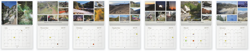
Hello Friends – HAPPY HOLIDAYS!

This will surely be a week of reflection for most of us as we look back at the Thomas Fire, which started just about a year ago on December 4, 2017.   Not only was the Thomas Fire the largest wildfire in California’s history but the timing of the fire also led to the destructive and deadly Montecito debris flows just a few weeks later.  Having wildfire that late in the season validated the now common statement that “Wildfire Knows No Season”.  Unfortunately, we saw the same thing again this year with the Camp and Woolsey Fires starting late in the “wildfire season”.  So far I’m not a very big fan of the new normal.  There is a ton of commentary about why we’re dealing with such large fires, who is to blame and how moving forward we can protect ourselves and our forests against these ever-growing conflagrations.  I’m not going to pretend to know the answers.  I don’t know if anyone knows the answers.  It’s likely that the answers here in the Los Padres are different than the answers in the Cleveland or Santa Monica’s or the Sierra Nevada dead pine tree belt.  While we might not know the answers, Outside Magazine recently created a four-part podcast series covering wildfires that does a really good job of outlining some of the questions.  If you’re interested in the subject of wildfires, I think you’ll enjoy listening to the Outside podcast.  Wildfire is certainly a hot topic of late, not just here in the Western United States but across the world, even grabbing the attention of our President.  Lets hope that sometime in the future we’ll look back at this new normal era with solutions that can prevent all the damage and death we’ve had to endure of late.
— • — • — • —

2019 LOS PADRES CALENDAR
Back by popular demand, the LPFA has once again released a Los Padres themed wall calendar.  We went back to the larger size for 2019 and have full color themed months featuring great photos and content from across the Los Padres.  This is the 6th year we’ve done a LP wall calendar and once again we had a lot of fun choosing photos and compiling them into the calendar.  The calendar costs $12.00 with any proceeds going to the LPFA Trail Fund.  Check it out and get one for your friends, co-workers, family, yourself or all the above!  You’ll love em.

AND BIG THANKS TO ALL OUR FRIENDS WHO CONTRIBUTED PHOTOS!  You’ll be seeing yours in the mail soon…… 


— • — • — • —

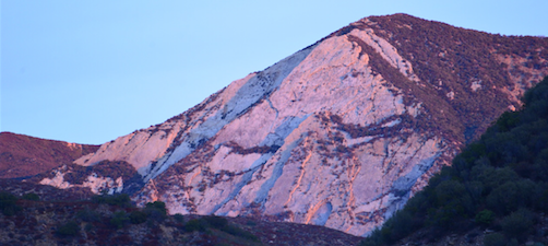
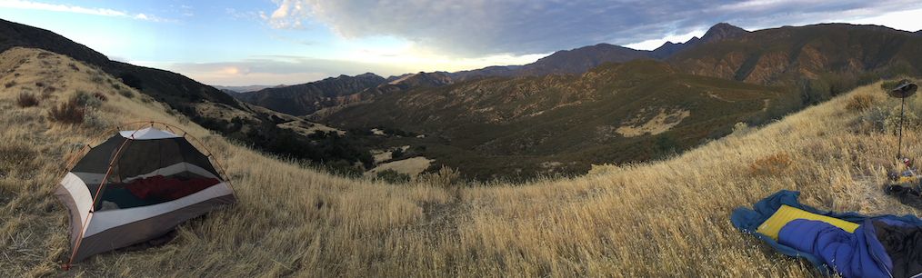
Tent or No-Tent, the First Light Redondo Views are Amazing!

FOREST 411
• The Los Padres is in the midst of our first large winter storm of the 2018-2019 rain season.  Most of the forest is set to see anywhere between 1-5+ inches of rain depending on location.  The rain has fallen hard at times so expect to see some extended road closures and some slides and trees down across the trails.  There is more rain on tap for next week along with some colder temperatures.  If you’re heading into the forest be sure to check the weather in detail before you go and let someone know where you’re going and when you’ll be back.  And if you come across any fresh downed trees or trail slides, take photos and post on HLP and we’ll make sure a nearby trail crew gets the call.  Have fun and be safe…..

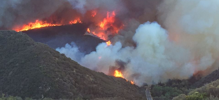
• In advance of this most recent storm, the LPNF has begun closing some of their seasonal and wet weather gatesHikeLosPadres.com and the Los Padres NF website are good places to check road closures but we strongly suggest calling your local Ranger Station in advance to make sure of the gate status.  NOTE: The Ojai District plans on closing their seasonal gates on December 15, which includes Pine Mtn.  NOTE: Hwy 1 in southern Monterey County is closing as needed in advance of any larger storm.

• The Front Fire Closure has been lifted and Rockfront OHV is once again open to the public.  This includes the Gifford and Adobe Trails.  That being said, Rockfront was closed this week in advance of the storms but should be reopened once the roads have a few days to dry.  Be sure to check with SLRD if you plan on hitting up Rockfront.

• Reminder that even with this wet weather fire restrictions remain in effect across the Los Padres.  Hopefully the fuel moisture levels will improve so that the FS can safely adjust the fire restrictions.  Usually the restrictions are lifted after the forest has received 2″ of rain.

• Certainly a storm theme to this email….  A privately funded group called The Partnership for Resilient Communities is proposing to install 40+ steel nets across the canyons above Montecito designed to halt the flow of debris and rocks along the canyon.  Their current plan calls for the installation of 13 nets sometime in the coming months, two of which will block trail access.

• In the bummer category of news there have been a few break-ins at some of our trailheads over the past few months.  Total bummer.  We don’t want any successful break-ins as that usually fuels repeat criminal visits.  REI has done a good job of coming up with 10 Tips to Deter Trailhead Theft, read it here.

• There are two proposed Forest Thinning Projects in the Mt. Pinos District along Tecuya Ridge and Cuddy Valley.  Earlier this week the FS released their proposed action for Cuddy Valley, click the link for specifics.  You can learn more here, here and here.

— • — • — • —

South Fork, Bring on the Rain!  photo Beeman

Condor, Sycamore and Baer……. OH MY!

BAER Trail Protection, San Ysidro Trail, photo Carr
Hello Friends – We hope you are doing well and finding some time to splash in the puddles!

If you’ve been anywhere near a fire over the past few years, you’ve probably heard the words “BEAR WORK” and might not know exactly what that means.  We get asked about it all the time and it’s BAER WORK (pronounced BEAR).  So what is BAER?  This is directly from the Los Padres NF website:

The US Forest Service Burned Area Emergency Response (BAER) team’s purpose is to assess threats to life, property, and cultural and natural resources from fire-induced changes to the watershed that can cause erosion, sedimentation, flooding, and debris flows.
Basically what happens is that after any larger scale fire, the USFS dispatches a team of specialists to study and survey the future impacts that fire might play within the downstream communities and to the resources within the forest.  This team is called the BAER team (see acronym above) and they’re usually the first people on the ground as the flames die down.  The BAER team studies all the potential risks from the fire, generates reports outlining those risks, prescribes treatments designed to mitigate those potential risks and then performs those treatments within the forest.  BAER studies include archaeology, road engineering, trail protection, fisheries, soils, hydrology and more.  All the Thomas Fire reports are published on the FS website in case you are interested in the details.  So remember, the next time you hear a post-fire BAER reference, you can amaze your friends by telling them it has nothing to do with Smokey or Boo-Boo and then for bonus nerd points follow that up with a NIRA reference (National Industrial Recovery Act).
— • — • — • —

It just feels like Burkittsville, along the Condor Trail
CONDOR TRAIL TALK
Is the Condor Trail on your bucket list?  Do you fear you’ll kick the bucket if you attempt the Condor Trail?  Do you enjoy exploring new places across the Los Padres?  If you answered YES to any of those questions then you have to come to the Condor Trail Talk on Friday March 23 at the Balboa Building in Santa Barbara.  The Trail Talk is being hosted by the Condor Trail Association, LPFA and REI and we’ll be welcoming 4 sets of hikers who either finished the CT in 2017 or came really really close.  Each set of hikers will share stories from their journey across the Los Padres and it should be really cool hearing how different each journey was based on time of year and what they encountered along the way.  The talk is free, doors open at 6:30pm, we’ll have a raffle, silent auction, maybe a game or two and some beverages to kick your weekend off in style.  Come one, come all – as long as space allows!  Hope to see you there……
Condor Trail 2017 Hikers
Friday March 23 – Doors Open 6:30pm
Balboa Building – 735 State Street – Santa Barbara
*parking can be tough, suggest Paseo Nuevo*
— • — • — • —
Toejam Taking in the Lower Sisquoc, January 2018
LOWER SISQUOC WORKING VACATION
Sycamore Camp, April 14-22
We’re happy to announce our latest and greatest LPFA Working Vacation, this time along the Sisquoc Trail, based at Sycamore Camp in the spectacular San Rafael Wilderness.  The plan is to drive in to the Jackson Trailhead along the Sierra Madres on Saturday morning April 14.  From there we’ll backpack 4 miles down to Sycamore Camp, which will be our camp for the week.  We’ll be joined by the usual cast of mule packers and exquisite backcountry cooks that make camping life so enjoyable while on a Working Vacation.
Our mission for the week is to clear the trail from Sycamore Camp downstream to Big Bend Canyon. As mentioned, we’ll have mule support to bring in tasty food and cold sudsy beverages while Rich Scholl will once again be cooking up a storm, providing the best in wilderness camp cooking, including the now infamous “COFFEE’S READY, HUH!”.  No joke, some people come just to hear coffee’s ready, huh!  Or is it the Woot Woot that they come for?  Either way, all food is provided for volunteers and we promise you’ll never leave hungry.
While we’ll be at Sycamore for a whole week, there will be plenty of opportunities for shorter stays and we’ll make room for you if you can spend 3, 4, 5 or more days on the Working Vacation. Let us know what works for your schedule and we can most likely make it work for us.  You will have to backpack in 4 miles to the camp, including a hard steep hike back out at the end of the WV.  We usually work from 8am – 3pm but we’ll take however many hours you’re willing to give.  Most of the work will be using loppers to cut back the brush, the occasional sawing of a branch and clearing ravel from the trail corridor.
The Working Vacations are always a great time! It’s a terrific way to give back to the trails you love, explore some new parts of the forest, get into a backcountry groove and meet great friends along the way.
To sign up or to learn more please email: INFO@LPForest.org

— • — • — • —

Doesn’t that look a whole lot more inviting!

FOREST 411
– There has been a bit of controversy surrounding post-fire reseeding and if it’s beneficial or not, in particular with the recent Thomas Fire.  We reached out to the FS as well as the California Chaparral Institute to learn about what their recommendations are.  Attached you’ll find some notes and letters with opinions.  Enjoy……

– Tragically, on February 15 there was an accidental self-inflicted gunshot caused death at the Glass Factory target shooting area along East Camino Cielo.  Due to the investigation of the shooting, the Glass Factory will remain closed until March 27.

– Highway 1 along the Big Sur Coast remains closed just north of Salmon Guard Station at Mud Creek.  There have been a few additional slides that have caused delays and/or closures due to the recent storms but all of those have been cleared.  If Hwy 1 is on your radar, be sure to check CalTrans or BigSurKate ahead of time.

– Even with the recent “March Marvel” (we can’t call it a miracle just yet), we remain well below the average rainfall totals across the forest for the season.  We’re still fighting to overcome a February that had single digit percentages of average rainfall across most of the Los Padres.  Figueroa Mountain received only 2% of their average rain in February, Three Peaks in the Silver Peak region only 7%.  By comparison, Fig Mtn is 174% of normal for March so far and Three Peaks is a whopping 757% of normal!  March is off to a good start and fortunately the storms have been light and steady within the fire areas.  Lets pray for more of the same……

– In case you hadn’t heard, the Whittier Fire closure has been lifted and West Camino Cielo is once again open, barring temporary rain closures.  Please tread lightly.  While West Camino is open, the Tequepis Trail remains inaccessible due to the closure of Circle V Ranch.

– Speaking of the Whittier Fire, the cause of the fire was released last month, read here for more information.

– The Thomas Fire closure remains in effect with all of the burned areas (the black) still closed to public access.  This includes access east of Gibraltar Road along East Camino Cielo and all the trailheads accessed via Rose Valley (yes, even Piedra Blanca Trailhead).  There has been no timetable set as to when the Thomas closure will be lifted.

– There’s been some good news coming from the Thomas Fire specifically related to fire impacted animals surviving the fire.  Here’s one about the use of fish skin bandages to help repair burns and the release of two of those bears and a mountain lion cub.  And this article talking about condor #871’s first flight across the Sespe.

– Thanks to the fantastic work of CalTrans, Highway 33 has remained open through all the past series of storms.  Those guys are amazing!  Thanks CalTrans!  That being said, if you plan on driving Hwy 33, please be aware that it could close at any moment and especially around rain events.

– The Los Padres Forest is requesting comments to reissue power-line permits through the forest.  For more information start here.

— • — • — • —

Smokin Hot, Cold Spring Sunset

State of the Winter, So Far…..

Matilija Canyon Changed Forever, Again – Nov 2017 & Jan 2018

Hello Friends,

This winter has not exactly gone as planned, has it?  We were in uncharted waters heading into the rainy season with the largest fire in California history still burning across the southern Los Padres and the already scorched mountains laying helplessly baron, devoid of any vegetation.  Our mountains are no strangers to fire but they’ve usually grown a protective five o’clock shadow of at least a few months of post-fire regrowth before the rains kick in.  We did not have that luxury with the Thomas Fire.  We were all hoping for extended light rain which might fend off the drought while at the same time not causing too much soil erosion.  That certainly has not been the case.  Rainfall totals are way down for the year, with most of the forest receiving well under 40% of average rainfall totals to date.  And all the rain that we have had essentially came in that one horrible storm on January 8.  So much for light rain over an extended period of time, we ended up with hard rain all at once; which, as you know, resulted in the tragic Montecito debris flows.  As of today, there is no rain in the extended forecast and we’re looking at what might be nearly a whole month in the heart of winter without any rain.  It’s really hard to know what to root for from here on out.  It might be best to get through the winter with as little rain as possible and sink back into what will be the 7-year drought.  Or perhaps we hope for rain and pray that we don’t get a repeat Montecito debris-flow.  Then again perhaps we stick to the gameplan and continue to root for light rain spanning the end of winter and into spring.  Who knows.  We’ve already seen so much destruction below the forest and so much change within it.  No matter what outcome we get please be careful.  The forest remains closed within the Thomas and Whittier Fire perimeters and should remain that way for quite some time.  For those looking to take advantage of the good weather, there are plenty of great trails to explore outside the burn perimeters.  It might require a slightly longer drive but there is water in most of the creeks, areas that have not burned and new trails to explore.
— • — • — • —

United States Hero & Los Padres’ Own, David Dahlberg
FOREST 411
• In case you missed it, David Dahlberg was recognized earlier this week as part of President Trump’s State of the Union Address.  Dahlberg is a Los Padres Fire Prevention Technician and heroically saved the lives of over 60 people stranded at Circle V Ranch near the onset of this summers Whittier Fire.  While the Los Padres has been making national news of late, it was special to see David get a well deserved round of applause.  David, next rounds on me…..

Fire Restrictions were lifted on January 19 permitting campfires and target shooting.  See attached PDF for more information.  Please PLEASE, be careful with your fires and pick up your brass if target shooting.

Highway 33 remains closed between Ojai and Lockwood Valley Road.  It is possible the road will reopen on February 7 but you’ll want to confirm with CalTrans before attempting to drive through.

• The Thomas Fire was officially called 100% contained on January 12 at an astounding 281,893 acres.

Highway 1 along the Southern Big Sur Coast remains closed at Mud Creek due to the epic landslide from last spring.  It remains on schedule to reopen his summer.

• The FS will be implementing annual prescribed burns across the forest as conditions allow.

• As if TOTALITY wasn’t enough, yesterday we had the pleasure of witnessing the SUPER BLUE BLOOD MOON LUNAR ECPLISE, try saying that fast 10 times in a row.  It was spectacular.  In case you missed it, we will have another blue moon in March, just can’t promise the SUPER or LUNAR ECLIPSE parts.

— • — • — • —


The SUPER BLUE BLOOD MOON LUNAR ECLIPSE, from Aliso Canyon, photo Orr
UPCOMING EVENTS

This time of year is supposed to be too rainy for any trail projects…..  Not this year and as you’ll see below, there are a lot of upcoming volunteer projects and events across the Los Padres that are taking advantage of the unseasonable weather.  We wanted to give you a heads up about one project in particular that popped up late this week:
ROSE VALLEY CLEANUP
Saturday February 3
8:30am at the Ojai Ranger Station
The LPFA is partnering with the Forest Service to arrange a special cleanup around Rose Valley.  Rose Valley burned in the Thomas Fire, revealing decades old trash that was buried in the brush.  We’ll be caravaning up to Rose Valley from Ojai to help cleanup the trash.  Hwy 33 remains closed to the public so it’s important to arrive on time in order to be part of the caravan through the barricades.  Once at Rose Valley, we’ll be spreading out, exploring the area and picking up any trash we see along the way.  Should be a special opportunity to see the burned area up close and help the forest in the process.  For questions you can email INFO@LPForest.org, check the link above and we hope to see you on Saturday at 8:30am sharp.
— • — • — • —

Troop 111 from Ventura recently replaced the San Rafael Wilderness sign on the Judell Trail.  GREAT WORK!

newly restored trail sign along Davy Brown Trail.
The sign restoration was part of an Eagle Scout project compliments of Orcutt Scout Troop 91.

Condor Trail Talk: CANCELLED

Cold Spring Trailhead, Montecito, January 9.  
Where’s the trail?  For that matter where’s the road?  Like a giant spoon was drug down the canyon.
Photo
Ray Ford

CONDOR TRAIL TALK: POSTPONED

Due to yesterdays tragic debris flows that ravaged the Thomas Fire and communities downstream, we’re postponing the Condor Trail Talk tonight and will reschedule for early February.  Words can’t describe the devastation that was witnessed yesterday, mainly throughout the Montecito community.  As I’m sure you all know, access along Hwy 101 is closed from Ventura to Santa Barbara and most of the side streets remain closed due to piles of debris, downed trees and everything else stacked up along the creek banks and roadways.  Much of the community remains isolated and it seems likely even more devastation and loss will be uncovered as crews work to regain access.  While most of the news understandably has been focused on Montecito, there has to be similar mudslides and flows in other communities as well.  From what we’ve heard, Ojai seems to have fared okay but Hwy 33 is closed due to road damage above Wheeler Gorge (see photo below).  We’ll certainly hear more in the coming days and lets hope for better news than we received from Montecito.  It’s even scarier that this storm won’t be our last and most likely won’t be the largest either.  Round 1 is in the books, Mother Nature 1, People 0.

The promising news is that warm drying weather is in the forecast for the next week or more.  Access in and around the Los Padres will remain limited with closures occurring yesterday on just about all the Highways used to access the LP from Hwy 1 in Big Sur to Hwy 166, 150, 33 and of course 101.  Be safe everyone and we hope to see you at the Condor Trail Talk in February.

— • — • — • —

Highway 33 Undercut, photo CalTrans

Lets Talk Condor Trail & Winter Storm Warning

The Thomas Fire Didn’t Burn Everything, It Just Feels Like It Did
CONDOR TRAIL TALK
Wednesday January 10 – 6pm – Balboa Building – 735 State St – Santa Barbara
The LPFA and Condor Trail Association are partnering this Wednesday (Jan 10) to host a special Trail Talk focused on the Class of 2016-17 Condor Trail hikers.  We’re really fortunate to have 4 groups of hikers at the event this Wednesday to share stories and photos from their individual exploits along the Condor Trail.  While each of them hiked the same miles, their journeys along those miles are very very different.  It doesn’t matter if you’re dreaming of one day doing the CT or happy just weekend warrior’ing around the Los Padres; you’ll enjoy hearing the fun and sometimes sketchy adventures of these brave CT hikers.  421 miles across the Los Padres – that’s a long way!  Come on out to the Balboa Building at 6pm on Wednesday to hear their tales from the Condor Trail.

In addition we’ll dedicate some time to discuss the Thomas Fire and what the fire means to the Los Padres Forest.  We’ll also have a raffle, some frothy beverages to enjoy compliments of Hollister Brewing Company and enough time to catch up with old fiends and hopefully meet some new ones too.  We hope to see you there.

Any questions or inquiries, please email: INFO@LPForest.org


The Class of 2016-2017 CT Hikers
— • — • — • —


Matilija Trout, Facing Some Rough Days Ahead, photo Humphrey
THOMAS FIRE UPDATE
Speaking of the Thomas Fire, the predicted containment date of January 7 has come and gone with the fire holding at 92% containment and having burned 281,893 acres.  The containment % should see an increase over the next few days as most of the Los Padres braces itself for the first large storm of the season.  The storm is currently hitting the Northern Los Padres and has dumped close to two inches already along the Big Sur Coast.  The majority of the storm will hit this evening into tomorrow morning with forecasts predicting 2-6 inches of rain in select locations with downpours potentially at the rate of one inch per hour.  Due to the potential for flash flooding within the fire areas and subsequent debris flows downstream from the fire areas, mandatory evacuations have been issued for most communities under the burn scars covering over 60 miles east to west from Santa Paula Canyon to Refugio including the Thomas, Sherpa and Whittier burn areas.  It’s crazy that less than a month ago the Thomas Fire was threatening to burn houses and now those same houses are threatened from flash flooding.  Good luck to everyone and your homes, be safe……

The closure order for portions of the Los Padres remains intact, closing all forest entry into areas that burned during the Thomas Fire.  There has been a lot of confusion and frustration regarding the closure, including the temporary closing of some of the trails outside the burn area.  Suppression repair is wrapping up and BAER (Burned Area Emergency Response) teams remain on the ground working to protect resources in advance of winter storms.  It’ll be a while before the Thomas closure is lifted, please remain patient and obey the closures.

— • — • — • —
Thomas’ Final Gasp?  Lion Canyon, January 2
FOREST 411
• Nearly 6 months after starting on July 8, 2017, the Whittier Fire was officially declared “out” on January 1, 2018.  While flames and smoke stopped months ago, there were a few hot spots that remained in portions of the canyons that were too steep and access too difficult to fully extinguish.  An IR flight team flew the Whittier Fire en route to the Thomas Fire and no heat was sensed from within Whittier.

• Sadly, a 40lb bear was euthanized earlier this week along the Sisar Trail.  The bear was burned during the Thomas Fire and was unable to recover.

• Much of the access to the Los Padres is in jeopardy at the moment due to the oncoming storm.  Slides are expected along forest access roads from Hwy 1 in Big Sur (Soberanes Fire) to 154 in Santa Barbara (Whittier Fire) and down through Hwy 192, 150 and 33 (Thomas Fire).  If you have plans to travel through the forest over the coming week, be sure to check access before you head out.  The CalTrans website is a great resource.

— • — • — • —

Great work by VWA volunteer sawyers along the Spruce Creek Trail in the Silver Peak Wilderness, photo Cypher

Thomas Fire on the Los Padres

Sisar Peak Fire Cam, Trending Social Media Star – December 10, 2017
THOMAS FIRE UPDATE

Everyone, even that one guy living in a cave, has been following the Thomas Fire and its week long path of destruction across Ventura County, into the Los Padres and crossing into southeastern Santa Barbara County.  We’ve been talking to so many different people involved and impacted by the fire ranging from fire crews to 80 year old LP lifers and the consensus is that Thomas is “the gnarliest fire we’ve ever seen”.   A couple quick stats:

  • Thomas is now 230,500 acres and growing!  That ranks 5th all-time in California wildfire history and the 2nd all-time largest Los Padres wildfire, just a hair behind the 240,207 acre Zaca Fire of 2007.
  • By comparison it took Zaca 117 days to burn approximately the same acreage that Thomas has chewed up in a week.  Thomas could surpass Zaca later today.
  • Thomas also ranks #10 in most destructive California wildfires and #1 for a LP incident with 790 destroyed structures.  Acreage, shmacreage – lets hope Thomas stops at #10 on this list for sure.  #1 on this list was the Sonoma/Napa fires from October 2017 which burned 5,643 homes!  Quite a destructive fall wildfire season.
  • 65,000 of the 230,500 burned acres are within the Los Padres with most of the LP acreage burning within the past 2-3 days.
  • Thomas is currently 15% contained with nearly 6,400 fire crews and support personnel engaged in the fight.
  • The cause of the fire has not yet been shared.

The catastrophic loss of homes is just so sad.  Many of you reading this email probably know someone who has lost their house or a friend of a friend who is now homeless.  It’s really hard to put it all into words and we’re not out of it yet.  The fire rages on now above Montecito, Summerland and Carpinteria with still 18,000 structures threatened.  Schools are closed, frequent power outages, middle of the night emergency evacuation messages and those wishing for a White Christmas got their wish as most Santa Barbara County residents have been living in N95 face masks.  It’s been just as the 80 year old man told us, “gnarliest fire we’ve ever seen”.

— • — • — • —

North Fork Matilija Engulfed, December 7
LOS PADRES UPDATE
It’s difficult focusing on the Los Padres with all the Thomas urban destruction but we’ve been getting a lot of questions about how the forest is holding up and what impacts are out there at the moment.  We’ll hit on a few of those here:


Q: Is the forest open?
Much of the Southern Los Padres is now closed (closure order and map).  The closure covers large portions of the Santa Barbara and Mt. Pinos Ranger Districts and all of the Ojai.  This closure, in some shape or formation, will be here for a while.  It is expected that the fire will continue burning within the LP until we get some sizable winter rains.  At that point the footprint of the fire will dictate the closure perimeter and based on past FS closure orders we’d expect that footprint to remain closed well into the spring.

Q: What’s the best source of information?
Good question and no shortage of answers.  We’ll share a few links and you can probably find better links that are more appropriate for what you are looking for:
KEYT News Channel 3 has been doing a solid job streaming the fire since it entered SB County.
InciWeb is the best source for overall incident information including evacuation warnings, maps, etc….
– Lots of maps: NWCG, DirectRelief, SARTopo, WIFIRE, Public Information
– Twitter is fantastic in natural disasters, search #ThomasFire and then include your local community for a more specific search.  Ex: #ThomasFire Ojai

Q: What trails burned?
We’ll spend more time on this once the fire is wrapped up but as of now the following areas/trails received at least some fire damage: Santa Paula Canyon (including East Fork), Santa Paula Peak, Topatopas, Sisar, Red Reef, Lion Canyon, Horn, Gridley, Pratt, Bear Heaven, Howard, Cozy Dell, Fuelbreak, Shelf, Wheeler Gorge (the Visitor Center survived!), Dry Lakes, Ortega, Matilija, Matilija Falls, Murietta, Franklin, Monte Arido, South Pot Seco Rd, Upper Santa Ynez, Alder Creek, Ocean View, Divide Peak, Juncal, Romero and Blue Canyon.  Awful seeing a list that long.  We might have missed a few as well, again we’ll focus more on this later and unfortunately this list might continue to grow.  NOTE: Pendola Station is wrapped, fingers crossed!

Smoke Filled IC Briefing


Q: At least those trails are clear now?
While we appreciate the optimism, in almost all cases fire does not help trails.  Vegetation is what makes trails, especially along steeper trails, it holds the soil in place and keeps the tread intact.  Without vegetation, the trails will (in a best case scenario) be covered in ravel after this winter.  Most likely we’ll have to wait a season or two for the vegetation to come back before removing that ravel and starting to restore the tread.  With all the fires over the past decade we’ve become far too familiar with fire trail recovery.  Most of the trails impacted by the fire will remain closed for a while and might need some major repairs in order to reopen.  Not good.  And there has been so much work done over the past years to repair many of these trails, it’s sad seeing all that work go up in smoke.

Q: What about the animals?  Will they have water to drink?
We’re not biologists but those animals that were able to run away from the fire and/or hunker down should be fine.  Water within the creeks did not evaporate, there will still be water.  Plants regrow quickly and there will be plenty of nearby wild areas that the animals can head towards.  We saw fresh deer tracks well within the black less than a week after the 2016 Rey Fire, we expect the same with Thomas.  That being said, the animal population was certainly hit hard.  Here’s a story regarding California condors threatened by the Thomas Fire.


Q: What does this mean for winter storm damage?
Great question.  There are hydrologists assigned to the fire who are working on this right now.  Most wildfires occur in the summer, giving the burned plant life at least a few months to regrow before winter kicks in.  That plant regrowth helps hold soil in place for when the winter rains start.  We’re in uncharted waters here as the rain could come any week now giving the plants such a short period of time to start coming back.  It might mean unprecedented levels of sedimentation into Matilija, Jameson and Gibraltar reservoirs.  It could also mean extended road closures, Hwy 33 for example is normally closed a few weeks each winter due to landslides, it could be closed all winter.  Who knows…..  Ray Ford wrote an article in Noozhawk this week in regards to previous fires stating “it wasn’t the fire that hurt so much, it was the floods that came through the next winter.”

Q: What does the LPFA do to help, how can we help?
Another great question.  The LPFA has been assisting however we can with fire logistics and sharing information but most important right now is for all of us to just stay away and let the fire crews do their thing.  Once the fire is contained the FS will start getting BAER (Burned Area Emergency Response) teams involved in quickly assessing and fixing potential winter storm damage within the forest.  They might be started on that already.  LPFA will assist with that as needed as well.  Then when the time is right we’ll start working with the FS to survey trails, photo-document trail conditions, share that with the public and ultimately work with the FS and other groups to restore and reopen the damaged trails.  As of RIGHT NOW, there’s not much any of us can do within the forest other than stay out.  That being said, if any of you could use help with any fire related cleanup or anything the LPFA might be able to assist with outside the forest, let us know as we’ve received quite a few emails from volunteers asking how they can help.

Thomas Fire Approaching Divide Peak, December 9

— • — • — • —

The 2018 Los Padres Calendar is printed and ready to ship!  They turned out great.
Help support the LPFA while at the same time chipping away at your holiday shopping list

And if you like these emails and would like to support the LPFA, donations and memberships are always welcome!


1st Thursday Holiday Party and Pritchett Success

The Ojai Pink Moment, Cara Blanca, photo Humphrey

Hello Friends,

We hope this email finds you doing well and hopefully a little sore after a great weekend on the trails!  The LPFA is a little sore as well after having over 70 volunteers on the trails this weekend doing trail maintenance and enjoying their time outside.  The one positive to not having much early season rain is that we’ve been able to host our regularly scheduled trail projects without being shutdown by rain.  That’s the good, the bad is that most of the Los Padres has received very very little rain so far.  It’s early but Santa Barbara County is only at 16% of normal rainfall for the season (Sep-Aug).  The lack of precipitation means that fuel moisture levels have remained low across the LP and as a result the Forest Service has not been able to change the fire restriction level.  Even with the cold/freezing nights we remain in Level III Fire Restrictions.  You can learn more about Level III here.  The fire restrictions were lifted by this time last year but it appears we’ll have to wait a few more weeks this time around.  We’ll keep you posted if anything changes, be patient and you might want to start dusting off the rain dance attire just in case……

— • — • — • —

Susan Guy Giving New Light to Some of Our Favorite Los Padres Settings, Recognize Them?

SUSAN GUY 1st THURSDAY LPFA HOLIDAY OPENING
Local artist, LP explorer and Ojai Search and Rescue alum Susan Guy will be sharing her artwork at The Press Room in Santa Barbara on Thursday December 7 as part of the SB 1st Thursday art events. 1st Thursday has become a monthly tradition where galleries and art-related venues across SB feature visual and performing art within their regular social environment. They are a lot of fun. What’s even more fun about this event at The Press Room is that Susan will be donating a portion of all her art sales from the night to the LPFA Trail Care program – awesome, right? You’ll certainly notice a lot of local Los Padres vistas and landscapes in her paintings.  And, as if it couldn’t get any better, we’re going to try to turn the Press Room into a LPFA holiday party that night as well. So come on down Thursday around 7pm, have a drink, lets talk trails and favorite camp sites, mingle while admiring some amazing art, leave with some of that art, wear that holiday sweater or Los Padres themed attire and keep your eyes peeled for that mistletoe. It’s going to be a lot of fun, hope you can make it!
1st Thursday, Featuring Artist Susan Guy
The Press Room
15 East Ortega St.– Santa Barbara
Thursday December 7
7-10 pm
 

— • — • — • —

Don Jack along the Pritchett Trail, Santa Barbara Botanic Garden

PRITCHETT TRAIL SUCCESS
Last episode of the LPFA Email Newsletter we talked a little about some of the great partnerships that have developed around the forest.  Along those lines we wanted to share a success story from the Pritchett Trail at the Santa Barbara Botanic Garden (SBBG).  Earlier this year the LPFA was approached by the Botanic Garden about some trail damage they were dealing with along some of their over 5 miles of trails, in particular the more remote Pritchett Trail.  The trail was sustaining some major erosion damage and had one section near the bottom that was losing its battle with gravity and needed some serious work.  The LPFA does a lot of work in the deeper parts of the backcountry where we really don’t get a chance to visit and see our work during the storms that cause all the damage.  The idea of working on a trail just outside town where we could come and watch the water control structures do their thing right in the middle of a storm was very appealing.  So we reached out to longtime LPFA volunteer and nearby resident Don Jack to see if he’d be interested in helping the Botanic Garden with some trail restoration.  He was all about it and got started immediately working with the SBBG staff on plans and designs to fix the trail.  Fast forward a few months and Don had completed building water control along the entire stretch of trail in addition to constructing a rather complicated retaining wall at the bottom of the trail.  We recently took a tour of the trail with Don and the work he’s done in partnership with the Botanic Garden is amazing!  It will be really valuable for Don to visit the trail throughout the winter months and see how the water structures hold up.  And then we really can’t wait for him to apply that knowledge to the Los Padres on the next Working Vacation as well…………
— • — • — • —

2018 Los Padres Calendars are Ready

The 2018 LPFA Los Padres Calendars have been sent to the printers!  Thanks to everyone who submitted well over 200 photos for the calendar!  We had a tough choice paring that down to the best 50 photos but we got it done.  The calendars are currently at the printers and should be ready in the next week.  There is a limited quantity available so if you’d like one be sure to place your order ASAP.  Calendars are $10 each with any proceeds going to the LPFA Trail Care program.  For more information or to order, click the link here!