
We get a lot of questions from new and seasoned backpackers alike about where they should go for their first (or dozenth) trip in the Los Padres. Depending on your goals, the options are virtually endless, but we find ourselves gravitating towards some trails and camps time and time again. This page describes a few of those locations to help inform your time in the backcountry.
First and foremost, it’s important to understand your individual skill and comfort levels in the backcountry. Know your limits, and pay attention to weather predictions before embarking on any trip. Make sure you understand any current trail closures, as well as fire restrictions. If you have questions about those, ask us at INFO@LPForest.org. If you plan to use a stove or have a campfire, be sure to have a valid California Campfire Permit. And make sure to ALWAYS practice Leave No Trace Principles anywhere in the forest. That means packing out your trash (including toilet paper!) and treating wildlife and other trail users with respect.
HikeLosPadres.com is an incredibly valuable resource when planning your Los Padres adventures. This site includes descriptions of every official trail and camp in the forest. And, most importantly, in contains user-submitted data on water, trail and camp conditions across the forest dating back over 10 years for many locations. What better way to estimate water quality than to check back through multiple years of reports? If you use this site to plan your trip, don’t forget to submit a report when you return! The more data we compile, the better the site works for everyone.
Santa Barbara Ranger District
North Cold Spring Trail from Cold Spring Saddle
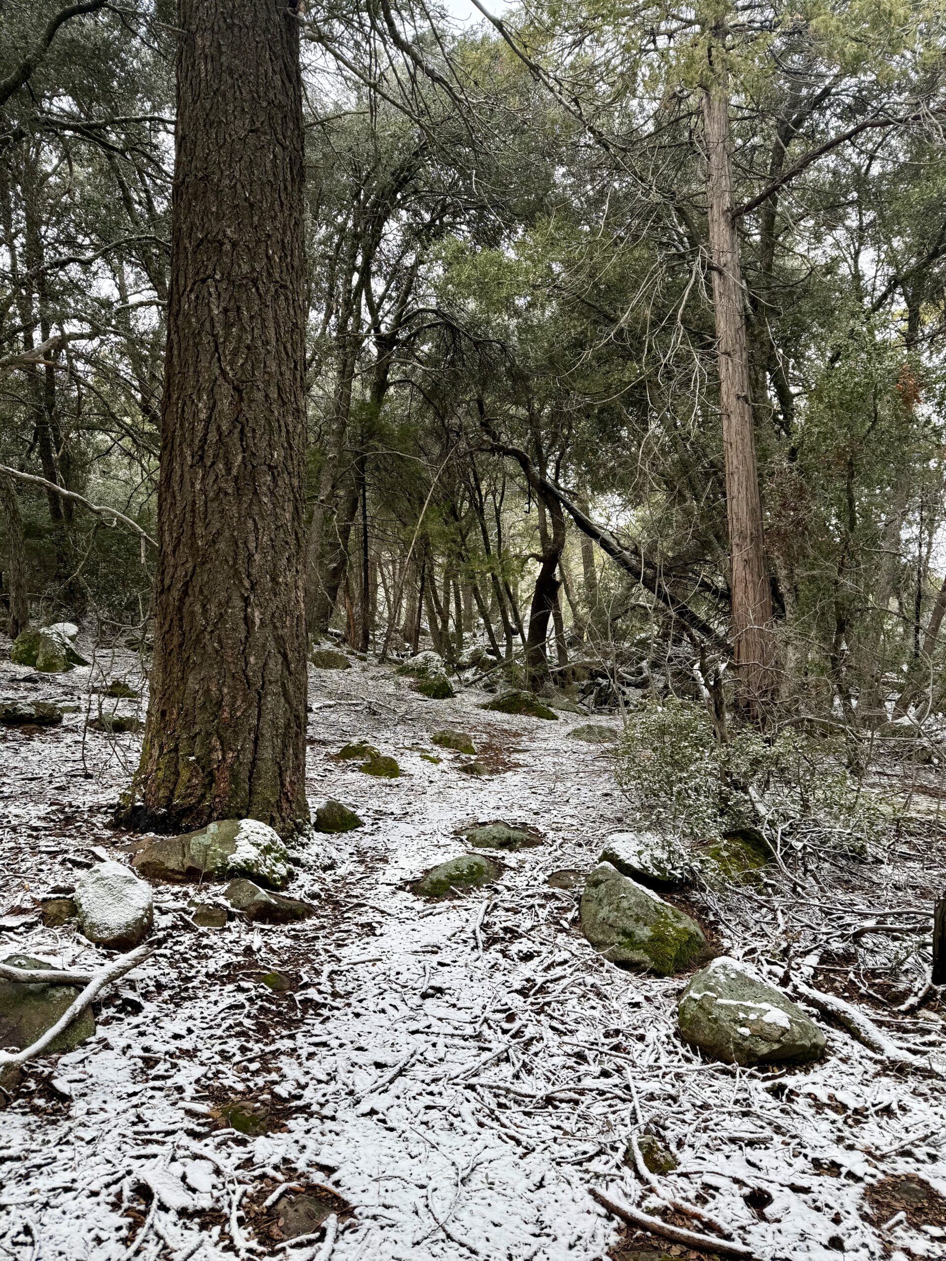
This trail begins at Cold Spring Saddle on East Camino Cielo high above the City of Santa Barbara and is an awesome first trip to the Los Padres. The trail descends steeply through mixed oak and chaparral woodland offering views of the upper Santa Ynez Valley and Dick Smith Wilderness. At 1.7 miles, Forbush Camp will be at your first junction to the left and offers a large meadow and tree-covered flat with room for several groups, as well as year-round water in all but the driest years. From there, those looking for a larger trip can explore east on the Blue Canyon Trail to its three overnight camps, or even take the Blue Canyon Connector Trail to Romero-Camuesa Road and head up Caliente Canyon. Upper Caliente Camp at over 11 miles one-way is best accessed from this trailhead and provides a remote backcountry experience to those willing to reach it. If one continues on the Cold Spring Trail from Forbush, Little Caliente Hot Springs is about 7 miles one-way, though overnight camping at the springs is prohibited. Just beyond the road junction with Little Caliente is the lower trailhead for the Mono-Alamar Trail which provides access deep into the Dick Smith wilderness for a longer and more strenuous trip.

Santa Cruz Trail from First Crossing
This route begins at First Crossing on Paradise Road and is an awesome gateway to the Los Padres backcountry. A parking pass is required and can be purchased at the Day Use Area. When the gate at First Crossing is open, one can also drive to Upper Oso Campground and park there to save 1.3 miles of road walking. After walking to the trailhead, the trail follows Oso Creek up Oso Canyon for a little over a mile through riparian areas and meadows with varied geology, reaching 19 Oaks Camp after 2 more miles. 19 Oaks Camp is a large, grassy, oak-studded mesa with views down canyon toward the Santa Ynez Mountains and up towards Little Pine Mountain. Those interested in a longer hike can continue on the Santa Cruz Trail to Little Pine Spring or Santa Cruz Station, another 9.2 miles up trail. Shortly after Santa Cruz Station, the trail enters the San Rafael Wilderness and eventually climbs to Mission Pine Basin. A more ambitions thru-hike might include continuing up to the Mission Pine Basin Trail or Grapevine Trail to reach the Los Padres high country and beyond. **Note: Santa Cruz Trail is closed indefinitely beyond 19 Oaks Camp due to failing crib walls and dangerous shale slides pending Forest Service funding to repair them. See how it’s going.**

Santa Lucia Ranger District
Manzana Trail upstream from NIRA Campground
The Manzana Trail out of NIRA Campground at the end of Sunset Valley Road is the gateway to the San Rafael Wilderness and one of the busier backcountry trailheads in the forest. The closest backcountry camp is Lost Valley Camp, located 1.1 miles upstream from the trailhead. The trail follows Manzana Creek through beautiful riparian areas with inviting pools and cobbles while offering glimpses up-canyon toward the San Rafael Mountains. Lost Valley Camp is a great first trip destination, but hikers can also continue further to Manzana Narrows Camp for a 7 mile one-way hike with numerous creek crossings, deep pools, canyon views, and shaded narrows, or stop at any of the other camps en-route. Those looking for a longer and more ambitious loop can continue on to the junction with the Hurricane Deck Trail at White Ledge Camp and return via the Hurricane Deck Trail and Lost Valley Trail, clocking about 25 miles round-trip. The upper Manzana Trail ends at the junction with the Sisquoc River Trail just before South Fork Camp, about 16 miles from the trailhead. Those looking for en epic adventure can continue up or down the Sisquoc to complete a variety of loops or thru-hikes in the San Rafael Wilderness.
Manzana Trail downstream from NIRA Campground
The lower Manzana Trail begins a half mile before NIRA Campground on Sunset Valley Road and provides access to the San Rafael Wilderness via the lower Manzana Creek drainage. Potrero Camp is located just 1.3 miles from the trailhead, and the upper camp does not require a creek crossing. This is a charming, grey pine and oak-shaded camp along Manzana Creek and the perfect first overnight in the Los Padres. The trail continues downstream through shaded alder channels and manzanita-filled flats, passing several other camps and crossing the creek nearly 30 times in the 8.2 miles to Manzana Schoolhouse Camp. The Manzana Schoolhouse is a Santa Barbara County Historic Landmark and popular overnight destination for new and returning hikers alike. Those looking for a fun but strenuous loop can continue briefly on the Sisquoc River Trail and take the Hurricane Deck Trail and Potrero Trail back to Potrero Camp and the Manzana Trail, totaling about 20 miles round-trip. For a larger loop option coming in at over 40 miles, the Lower Sisquoc Loop follows the Sisquoc River Trail upstream to South Fork Station and takes the upper Manzana Trail back to NIRA.
Ojai Ranger District
Gene Marshall-Piedra Blanca Trail
The Piedra Blanca Trail begins at the Piedra Blanca Trailhead at the end of Rose Valley Road off of Highway 33 in the Ojai District, though it can also be accessed at Reyes Creek Campground at its other terminus on the Mount Pinos District. The Piedra Blanca Trailhead provides access to the Sespe Wilderness and is one of the most popular trailheads for backcountry access in the Los Padres. The trail crosses Sespe Creek and ascends to the Piedra Blanca Rock formation, then drops back down and follows Piedra Blanca Creek through numerous meadows and oak flats before reaching Piedra Blanca Camp (2.9 mi one way). The camp is large enough for several groups and sits under a massive Live-Oak beside the perennial Piedra Blanca Creek. After Piedra Blanca Camp, the trail climbs steeply up until meeting the Cedar Creek Trail shortly before Pine Mountain Lodge Camp (6.5 mi from PB Trailhead) then continues up and down rolling sandstone saddles passing numerous camps along upper Piedra Blanca Creek, and eventually leaving the Piedra Blanca drainage to descend Reyes Creek to Reyes Creek Campground on the north side of Pine Mountain. Numerous thru-hike and longer out and back options are possible from this trail. One could join the Cedar Creek Trail and drop into Grade Valley and the Cedar Creek or Fishbowls area, continue on the Piedra Blanca Trail to any of its many camps or it’s terminus at Reyes Creek Campground 18 miles from the Piedra Blanca Trailhead, or jump on the Reyes Peak Trail just passed Haddock Camp and ascend to Haddock Peak, Reyes Peak and the greater Pine Mountain area. All of these options offer excellent views and access to mature conifer forest, which is someone rare in the Los Padres. **Note: an Adventure Pass is required to park at Piedra Blanca Trailhead and can be purchased at the Wheeler Gorge Visitor Center, Ojai Ranger Station, or several outdoor stores in Ventura County.**

The Sespe River Trail also begins at the Piedra Blanca Trailhead, and is actually the same as the Piedra Blanca Trail until you cross Sespe Creek. From that junction, bear right and follow the well-maintained and relatively flat route across chaparral-covered mesas along the Wild and Scenic Sespe Creek. After 4.3 miles, the trail passes through Bear Creek Camp on a large sand flat next to a long, deep pool shaded by cottonwood trees. The Sespe River Trail continues another 13 or so miles, crossing the Sespe numerous times and passing several camps, as well as a few hot springs, before meeting the Alder Creek Trail deep in the Sespe Wilderness. Along its length are numerous other overnight camps, hidden swimming holes and a few other trails for hikers looking for a larger trip to explore. For an ambitious loop, connect up the Red Reef Trail to Nordhoff Ridge Road, head southwest and take the Lion Canyon Trail back down toward the trailhead. One could also connect with the Alder Creek Trail for a longer thru-hike deep in the wilderness and on the edge of the Sespe Condor Sanctuary. **Note: an Adventure Pass is required to park at Piedra Blanca Trailhead and can be purchased at Wheeler Gorge Visitor Center, Ojai Ranger Station, or several outdoor stores in Ventura County.**

Mount Pinos Ranger District
The Santa Barbara Canyon Trail begins at its trailhead just beyond Cox Flat on Santa Barbara Canyon Road. The trailhead can be accessed by vehicle May 1st – December 1st, but is closed at the Reyes Ranch Gate during the winter seasonal road closures. The Santa Barbara Canyon Trail travels up Santa Barbara Canyon toward Madulce Peak through sage scrub and pinyon-juniper woodland, eventually reaching chaparral and mixed conifer forest. Incense Cedars are particularly prevalent higher up the trail and at Madulce Camp, 7.2 miles from the trailhead. Though there are no official camps en route to Madulce Camp, there are several open spots, as well as seasonal water in Santa Barbara Creek for those looking for a shorter trip. After Madulce Camp, one can continue up the Madulce Trail and Madulce Peak Trail to climb Madulce Peak, the highest peak in the Dick Smith Wilderness, which offers a commanding view of the majority of the southern Los Padres, the Channel Islands, and even the southern Sierra on a clear day. For a larger loop, one can continue up the Madulce Trail to the Buckhorn Road to connect to the Sisquoc Trail, then descend the upper Sisquoc and connect back to Sierra Madre Road via the Judell Trail.

Cedar Creek Trail and Grade Valley Trailheads
The Cedar Creek Trail begins near the end of Grade Valley Road, a dirt road that is usually open seasonally from May to December depending on the winter weather. High clearance vehicles are recommended. The hike remains relatively flat as it follows Cedar Creek through open Ponderosa Pine forest and sage scrub-dotted meadows all the way to Cedar Creek Camp (2.4 mi one-way). This camp is shaded by large conifers, including some massive Incense Cedars, with room for multiple groups. The perennial Cedar Creek flows beside camp in all but the driest years. An awesome and relatively moderate 10 mile loop can be made by connecting with the Fishbowls Trail. Take a stop at Fishbowls Camp before continuing on the the Fishbowls Trailhead and completing a short road walk back to the Cedar Creek Trailhead. Other trailheads nearby include the Thorn Point Trail which climbs to the old Thorn Point Lookout and offers views of the Cuyama Badlands, Mount Pinos and beyond, as well as the Johnston Ridge Trail, from which one can descend steeply over about 8 miles to the Sespe Hot Springs or connect with the Little Mutau Trail which heads east towards San Rafael Peak.
Monterey Ranger District
The Salmon Creek Trailhead is located on Highway 1 at the southern end of the Big Sur Coast and is a popular trailhead for day hikers and backpackers entering the Silver Peak Wilderness. Like all of the trails beginning on Highway 1, it does ascend rather steeply at first due to the rugged terrain. Follow the trail past the popular Salmon Creek Falls and ascend through potreros and mixed chaparral before dropping to the redwood-shaded Spruce Creek Camp (1.8mi one-way) at the confluence of Spruce and Salmon Creeks. The camp offers space for several groups and year round water. The trail continues up the Salmon Creek drainage passing Estrella Camp on its way to the upper trailhead on South Coast Ridge Road. For a larger 16 mile loop, one can head north on the road to the Cruickshank Trail and descend on the north side of Silver Peak to the Buckeye Trail which returns almost to the same spot on Highway 1. The junction with the Spruce Creek Trail is just before Spruce Creek Camp and provides access to the Dutra Trail, which can be used for a larger loop, or an out-and-back to explore the camps and rolling potreros above Dutra Creek and beyond.

The Pine Ridge Trailhead is located at Big Sur Station on Highway 1 and is likely the most popular backcountry trailhead in the Los Padres. A parking pass is required and can be purchased at the lot, or in Big Sur Station during operating hours. From the trailhead, descend briefly through Pfeiffer Big Sur Campground before climbing steadily up the Pine Ridge Trail as it follows the Big Sur River into the Ventana Wilderness. The trail takes you through mixed chaparral and redwood forest, boasting epic views back toward the Pacific and up toward Ventana Cone and Double Cone. At 4.1 miles, a spur trail leads steeply down to the spacious Ventana Camp which sits beneath redwoods on the edge of the Big Sur River near the confluence of Ventana Creek. The next camp is Terrace Creek, followed by Barlow Flat, both popular overnights or stops on the way to Sykes Camp. The Pine Ridge Trail continues for almost 23 total miles to the upper trailhead near China Camp Campground on Tassajara Road, making for an incredible shuttle-hike or big out-and-back with panoramic ocean views, numerous crossings of the Big Sur River, redwood groves below Pine Ridge and rolling wildflower-filled potreros above. One can also include the Terrace Creek Trail, North Coast Ridge Road, and Big Sur Trail for an epic 36 mile loop tour of the Ventana backcountry.

We always recommend further research and a good backcountry guide, as well as some form of GPS navigation. All of these guides are made with waterproof, tear-resistant paper and include mileages and topographic lines. They are excellent aids in trip planning and inspiration. You can pick one up at Wheeler Gorge Visitor Center, any Los Padres Ranger Station (call to ensure stock), or through the links below:
| Recreation Area | Map Suggestion |
|---|---|
| Sespe Wilderness, Ojai Frontcountry, Grade Valley | Tom Harrison – Sespe Wilderness |
| Chumash Wilderness | Trails Illustrated – Los Padres East |
| Dick Smith Wilderness, Matilija Wilderness, Santa Barbara Frontcountry, Santa Ynez Recreation Area | Bryan Conant – Matilija and Dick Smith Wilderness (at SBRD Office, ORD Office and Wheeler Gorge Visitor Center) |
| San Rafael Wilderness | Bryan Conant – San Rafael Wilderness |
| Machesna Mountain, Santa Lucia, Garcia Wildernesses | Trails Illustrated – Los Padres West |
| Ventana and Silver Peak Wildernesses | Green Trails Maps – Big Sur Ventana Wilderness or Trails Illustrated – Big Sur Ventana Wilderness |