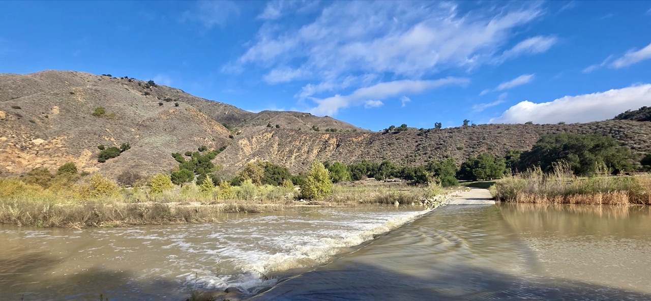
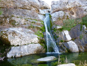
The Santa Ynez River flowing strong again over the Sage Hill Crossing. photo, Chris O.
Hi Friends,
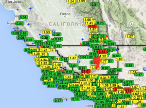
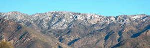
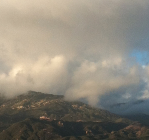
The Los Padres got a good and early soaking over the last 5 days. So early, in fact, it set the record for the most rainfall the Santa Barbara area has seen in November in recorded history. This storm seemed to focus heavily along the Santa Ynez Range, with rainfall totals in the mountains averaging about 11 inches, and San Marcos Pass (the lightning rod of LP rain accumulation) coming in just below 15 inches. Nordhoff Ridge saw over 10 inches, Cone Peak as well, and much of the backcountry and San Luis County LP got at least 5 inches. All in all a healthy and welcomed start to the season.
As tough as it is to do after a few days stuck inside, the best thing for the health of trails is to give them time to dry after significant rainfall. If your foot sinks down, turn around…. or something like that. With all that precip, we’re likely to see a few issues along the trails over the coming days. When you’re hiking around — after the trails dry out — let us know at INFO@LPForest.org if you come across any downed trees or trail damage and we’ll get out there to fix it up as soon as we can!
LPFA
For GivingTuesday this year, LPFA has our sights set on an epic network of trails through the Sespe Wilderness. We are raising funds to maintain the Ventura County section of the Condor Trail! The CT route through the Ventura backcountry begins at the Pothole Trailhead near Lake Piru, travels through the heart of the Sespe Wilderness, and heads up and over Pine Mountain to Ozena Station on Highway 33. Trails included in this project are: Pothole Trail, Agua Blanca Trail, Bucksnort Trail, Alder Creek Trail, Sespe River Trail, Piedra Blanca Trail, Reyes Peak Trail and Boulder Canyon Trail.
Got a favorite? Our goal is to maintain as many of the most overgrown, washed out and downed tree-covered sections of this route as we can in the next two years. If you use any of these trails, please consider donating to the LPFA 2025 GivingTuesday campaign, and share this fundraiser with your friends and family. Donations like yours are what keep us out in the forest, working hard, and ensuring these trails remain safe and open for all to enjoy.
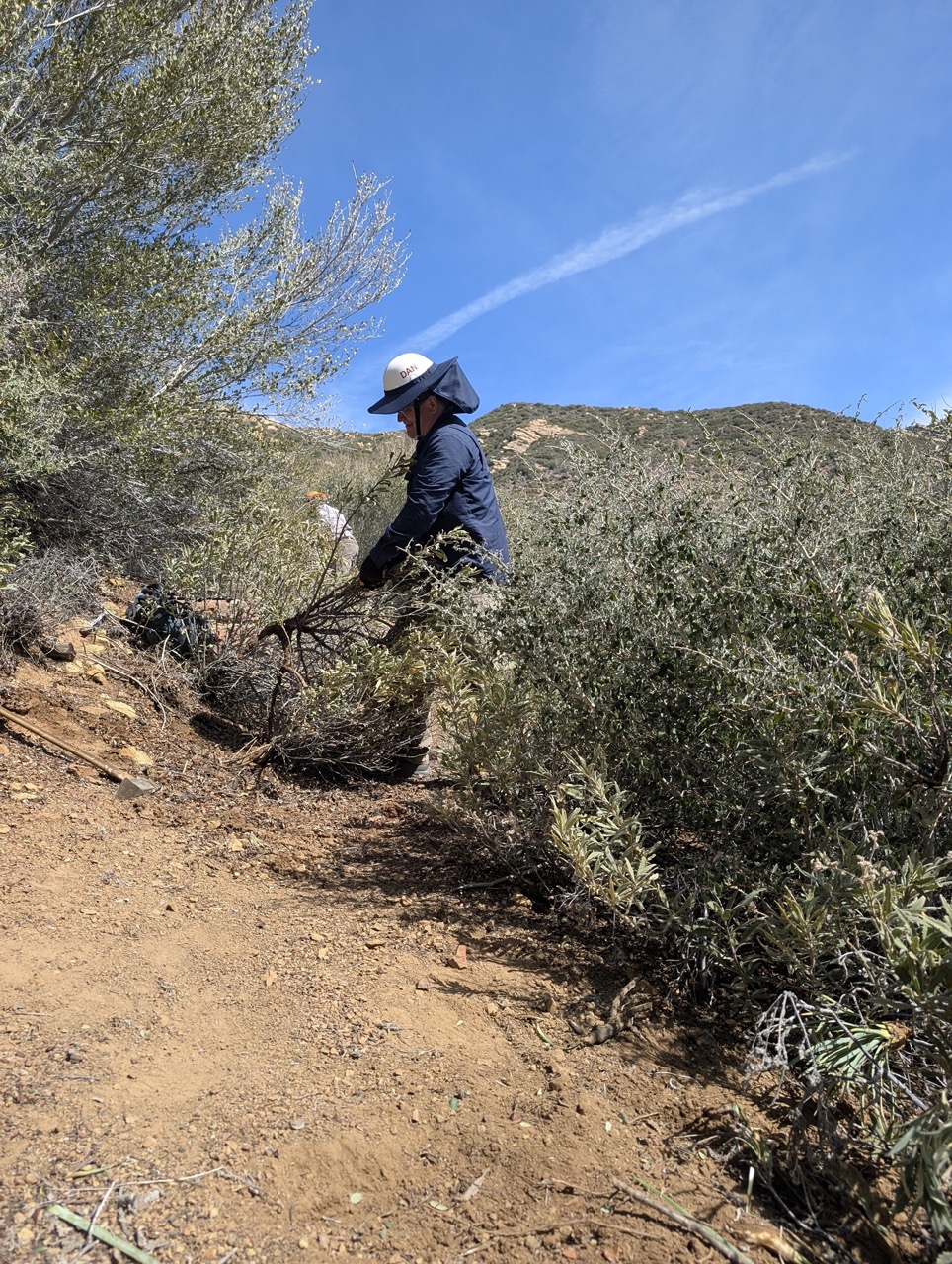
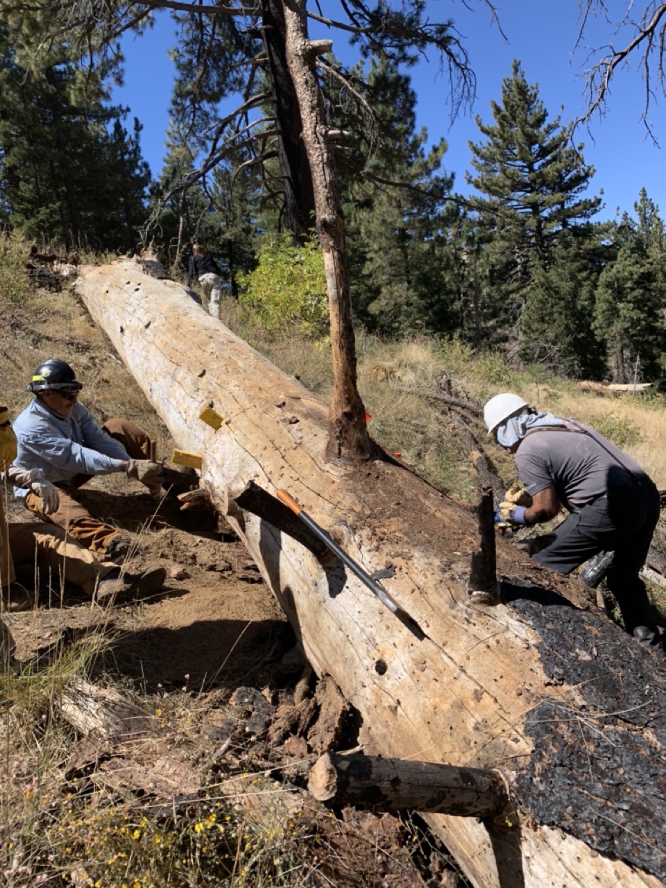
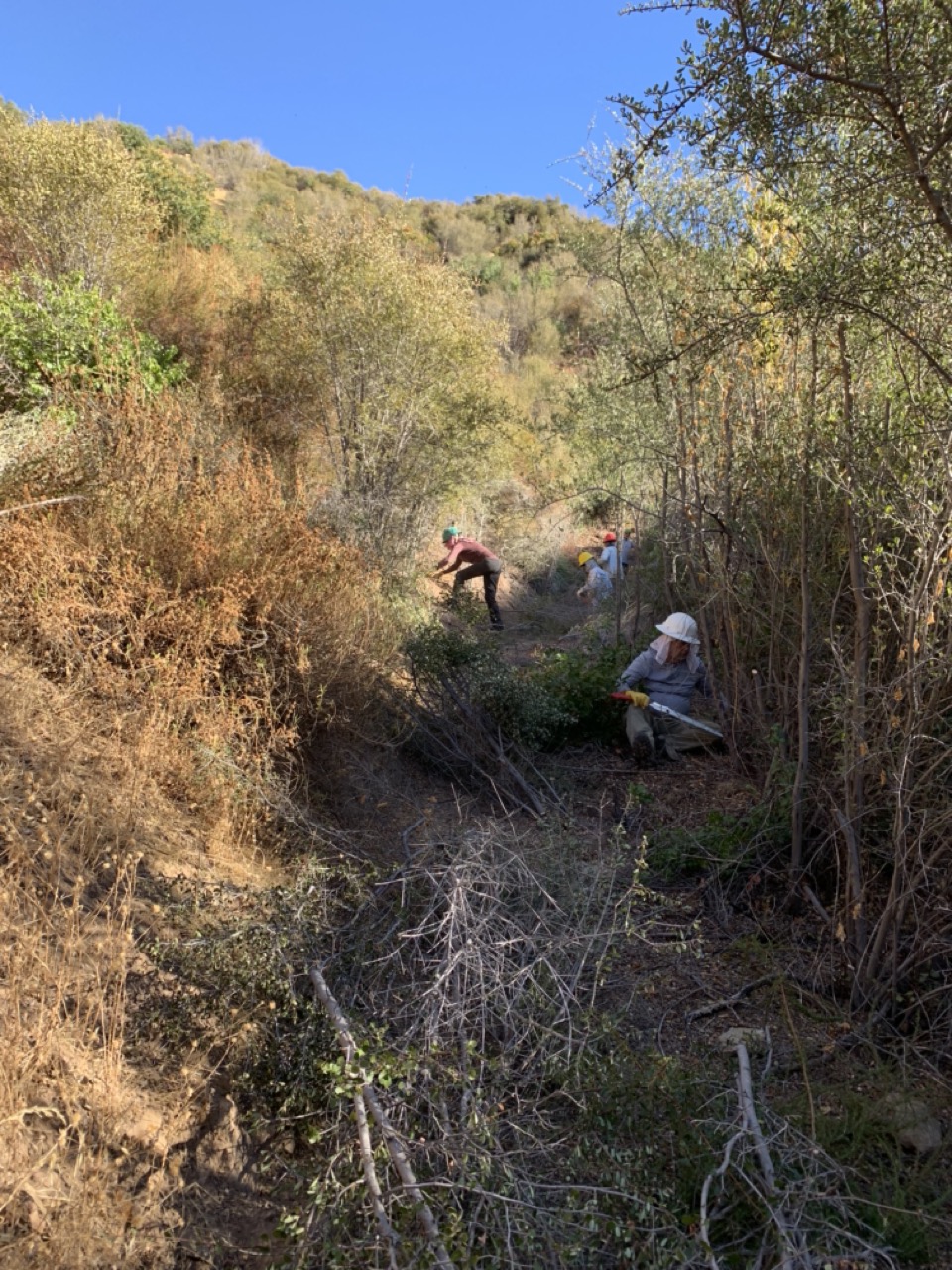
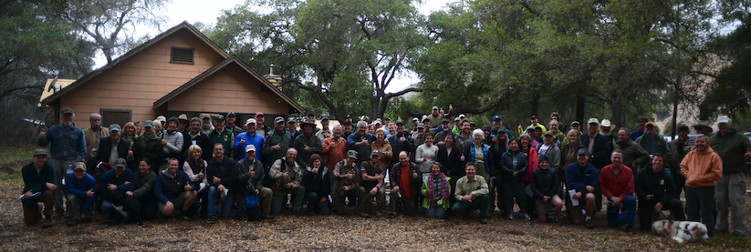
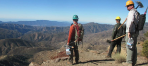
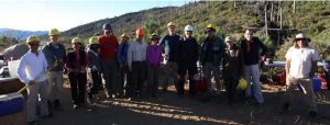
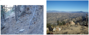
LPFA has spent a ton of time on the Ventura County Condor Trail the past two years, completing nearly 30 miles of trail maintenance to standard. Help us keep this project going strong! From left: Piedra Blanca Trail, Reyes Peak Trail, Alder Creek Trail with volunteers putting in the good work.
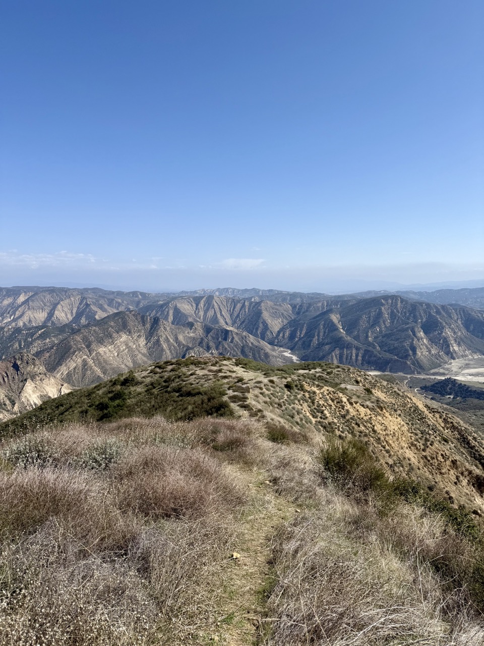
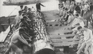
From up on the Pothole Trail….
POTHOLE WORKING VACATION, DEC 5 – 14
The fall LPFA Working Vacation will be from December 5 – 14th on the Pothole Trail! This is a project years in the making and a bit different from our typical Working Vacations. LPFA will be car camping and BUILDING NEW TRAIL by way of a reroute of the first 1.5 miles of the Pothole Trail! If you haven’t joined a Working Vacation in the past, they are an absolute blast. LPFA provides the food, drinks and tools and volunteers come out to work the trail, share some laughs, and have an all around great time.
If you couldn’t tell already, we are absolutely stoked to break ground on this project. Special thanks to Southern California Edison for funding this effort and United Water for helping push it along! Sign on up and let’s get out there!
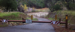
SEASONAL GATES SWING SHUT
With the first major storm system of the year, many gates in the forest have closed for the season. Some gates are opened/closed on established dates (Grade Valley, Pine Mountain), others are opened/closed around weather events – open during dry times and closed when rain is forecast (West Camino Cielo, First Crossing). At this point, all dirt roads in the forest are likely closed for the season. But, we recommend doing your homework ahead of time. Here are a few resources:
Resources
- The Forest Service has a page dedicated to road and campground closures. It may not be exactly up to date, especially following the shutdown, so give the Ranger Stations a call to confirm. Their phone numbers are also listed on the page.
- HikeLosPadres.com has a page with status and location of the gates that often provide (or deny) the most access. If you have any updates or would like to see gates added, let us know INFO@LPForest.org.
Seasonal Gates
- Grade Valley Rd
- Santa Barbara Canyon Rd
- Frazier Mountain Rd
- Rancho Nuevo Rd
- Dough Flat Rd
- Lockwood Creek Rd
- Scott Russell Rd
- San Emigdio Rd
Temporary Closures
- First Crossing
- West Camino Cielo (at Winchester Canyon)
- Sage Hill Crossing
- Sierra Madre Rd
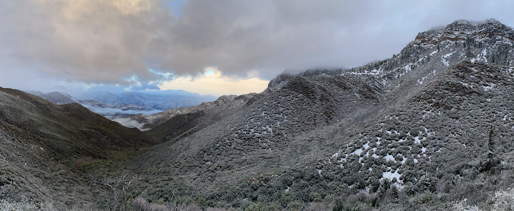
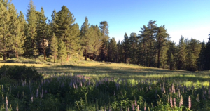
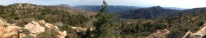
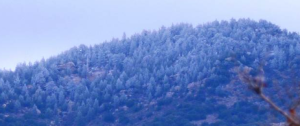
The Santa Barbara high country after the storm. No snow accumulation, but lots of early season green….


