Springing Additional Los Padres Trails

Over the cribwall and through the fields of flowers, to trail work we go…. Lower Manzana LPFA volunteer work, photo C Horgan

Hello Friends,

We hope this email finds you tired after a nice weekend on the trails. The Los Padres is in top form at the moment. If you haven’t found time to get out and explore… trust us, gotta make that happen. The BIG NEWS this week is that the Forest Service has released a new Forest Order which will again reduce the number of closed LP roads and trails. There has been a lot of work contributed by the Forest Service and partner groups in order to help restore this additional trail/road access. While this news is good for sure, there are still some fan-favorite trails which remain closed. We’ll be continuing our work helping to restore more trail access and we could certainly use your help either through upcoming volunteer projects, donations in support of our Trail Care or just let us know which trails you’d like to see reopened and lets see if we can figure out a way to make that happen together. One trail at a time, one step at a time…. Here are some notes from the latest order:

  • Monterey Ranger District
  • Santa Lucia Ranger District
    • Fig Mtn, Happy Cyn, Sunset Valley, NIRA, Davy Brown, Catway and Fig Mtn Campground have been reopened.
    • Most of the OHV trails out by La Panza / Navajo are reopened but some access roads remain closed.
    • Rockfront remains closed.
    • Machesna & Garcia Wilderness trails are closed.
  • Santa Barbara Ranger District
    • The most changes have occurred in the SBRD where the majority of the backcountry and mid-country trails have been reopened.
    • A few campgrounds have been reopened along Paradise Road and access beyond First Crossing is open for non-motorized use.
    • All OHV remains closed.
Santa Paula Cyn “Trail”? – Mary Mary
  • Ojai Ranger District
    • Not many changes on the Ojai to report mainly due to the continued closure of Hwy 33, which provides most access for the still closed trailheads and campgrounds.
    • The LPFA will be working out of Piedra Blanca in May, please come join the fun!
  • Mt Pinos Ranger District
    • The Pinos was not closed as part of the initial closure due mainly to the fact that most of the district trails were either covered in snow or behind seasonal closure gates.
    • As the snow begins to melt, the MPRD is starting to assess storm damage and will be delaying their seasonal gate opening date back from May 1 to June 1. Note that the gates could open earlier or later depending on discovered storm damage. Stay tuned or call the MPRD with questions.
    • Road access has been cleared up to Chula Vista and Mt Pinos.

Happy Volunteers Clearing Trail, Learning New Skills & Making Friends – photo MImes

VOLUNTEER OPPORTUNITIES

Listed below are the upcoming LPFA volunteer projects & events. Come one, come all! You can signup through the website or email us with any questions: VOLUNTEER@LPForest.org

  • Horn & Santa Paula Cyn, Ojai – April & May 2023
    • We’re continuing our regular Tuesday & Thursday volunteer projects on the Horn Canyon and Santa Paula Canyon Trails in Ojai. We’re on Horn Cyn at least the next few weeks and will then be moving over to Santa Paula. Come join us…..
  • Santa Barbara Cyn, Dick Smith – Apr 21-24 & May 5-8
    • The LPFA will be leading two 4-day backpacking trail projects on the Santa Barbara Cyn Trail. Both projects will be led by Mike Smith and his famous pack goats. The backcountry is so nice right now, hope you can make it….
  • Sespe Working Vacation, Sespe – May 17-21
    • This will be great, we’ll be out on the Sespe working trail from May 17-21 hopefully car-camping at Middle Lion Campground. Over the course of the 5-days we’ll be working a combination of the Lion Cyn, Piedra Blanca and Sespe Trails. This is a must attend…..
  • Davy Brown Trail, Figueroa Mountain – April 25-26
    • The Davy Brown Trail is in bad shape, lets fix that! Come join us as we spend two days and a night helping to clear downed trees and branches from the beloved Davy Brown Trail. We’ll hopefully be car-camping at Davy Brown Campground and working up from there. Feel free to come out for a day or both days and camp with us. Should be great. Details still taking shape, you can sign up here or email at VOLUNTEER@LPForest.org.
  • Santa Cruz Trail, Paradise Road
    • One of the major goals for the LPFA this year was to restore the remaining sections of the Santa Cruz Trail between Upper Oso and Santa Cruz Station. Mother Nature had different plans and threw a couple good curve balls into the equation but with receding water levels we should be able to start working the Santa Cruz soon. We’ll likely have an assortment of different volunteer opportunities, let us know if you’d like to be on the list and we’ll share details as they take shape: VOLUNTEER@LPForest.org

The Latest on the Los Padres Forest Closure?

One of the many new barriers along the normally well-trodden Manzana Trail, photo Maki

Hello Friends,

As of February 7, the majority of the Los Padres Forest remains closed due to severe storm damage. This includes all of the Monterey, Santa Lucia, Santa Barbara and Ojai Ranger Districts. The Mt Pinos RD is open with the caveat that all their usual seasonal gates are currently closed for the winter.

We’ve been hearing the complaints and understand the frustration over the forest closure. We all want to be out in the forest doing what we do, going where we go and seeing what we see. Nothing beats a February backpacking trip in the Los Padres, it’s the best time IMO. The closure is no fun, we get it. That being said, many of us, including Forest Service staff, have been working real hard to try to get the forest reopened. Right now information is changing by the day but here’s our best update on what’s been happening, where we might be headed and what hopefully will be occurring soon:

A now typical Manzana Crossing. Trails gotta be over there somewhere….??? photo Lori Rafferty

The Storm

Big rains. Lots of damage. Safety takes precedence. Forest closes. The first couple weeks after the storm events were dedicated to road and infrastructure damage assessment, getting those roads open and restoring access for the hundreds of folks stranded behind damaged Forest Service roads. Click here for a recent Ray Ford article in Noozhawk which documents some the damage from around Santa Barbara County. 

Post storm damage trail clearing has begun, two happy LPFA crosscut sawyers singing along…. photo Rupert S

Trail Assessments

Sun shines. Water levels drop. People get out. Progress is made. Many roads across the forest have now been cleared and in some cases reopened. The Forest Service has begun assessing trail conditions and recreational forest access. This is where the LPFA and other partner groups have gotten involved. Over the past few weeks, LPFA staff and volunteers have now surveyed over 100 miles of trails across the forest and that number is substantially higher if you include all the surveys from other FS partners and FS staff. All of the assessment information is being shared within a central database so that the Forest Service can evaluate the magnitude of the damage and initiate a strategy for repair, reopening and requesting funds. A big focus of the surveys has been looking for extreme showstopper trail damage that would prevent a trail user from safely getting from point A to point B. We’ve found more than a few of these showstoppers.

The cribwall before Fish Camp has seen better days but she held… photo Maki

The Polygon Plan

The trail surveys began on the frontcountry trails, places where access to the trailheads is paved. From there the surveys have slowly ventured deeper into the forest including assessing some of the wilderness areas. We have collectively seen a lot of what happened across the forest and unfortunately the damage is significant. The Forest Service has been leading daily forest-wide update meetings and their sincere hope is to systematically reopen ‘forest polygons’ once trailhead access has been established and the trails within those polygons have been surveyed and adequately repaired. The FS is putting an emphasis on reopening the more popular frontcountry polygons but it is possible that some backcountry polygons might be the first ones to open up. There has been discussion that Wilderness and backcountry trails won’t need the same level of repairs as frontcountry trails since it is understood that Wilderness trails are more challenging for the trail user. As of today, two smaller non-forest managed polygons in the SB Frontcountry have reopened and more should be following soon.

Is that the Lost Valley Trail or the Lost Trail Valley? The trail should be traversing across that hillside, photo Addison

Grand Reopening?

Knowing that approved forest polygons are needed in order to reopen portions of the forest, many of the trail groups across the Los Padres have been working like crazy the past couple weeks strategically focusing on needed trail repairs within some of the low-hanging-fruit polygons. We’ve been fixing undercut sections of trail and sinkholes, clearing large washouts and downed trees and ramping in and out of flood cut gullies. Progress has been slow, but steady. It is likely that some larger polygons will be reopened soon, hopefully within the week – knock knock

— • — • —

While many of the frontcountry trails have been seen or documented on social media, we’re just starting to get eyes on the much bigger backcountry. The Ventana Wilderness Alliance has been surveying the Big Sur Backcountry and the LPFA was finally able to get into NIRA this past weekend to survey the trails up and down the Manzana. All the photos within this newsletter are from this past weekend within the San Rafael Wilderness. There’s still a lot more of the forest to assess but we’re basically seeing wildfire level trail damage at a forest-wide scale and instead of ash we’ve got flood scour. There is going to be major repairs on all the trails and while we documented hundreds of damaged sections of trail within the 25 miles of surveyed backcountry trails, we didn’t see any showstoppers nor any areas that were truly impassable.

The biggest issue we’ve seen is at the creek crossings. Just about every creek crossing has changed. Where you’d expect to see the trail is now covered in mud, roots and stacked logs with a 4-6ft climb in and out of the creek. In some cases it’s going to be years before the trails are back to where they were before these storms. That being said, we’re recommending that the NIRA polygon and hopefully other backcountry polygons be reopened with the understanding that the trails are not stock passable, that trail-users will at times have trouble following the trails, that trail users may get turned around somewhere out there by a showstopper and that trail users should expect to travel much slower than normal. We’re looking forward to continued reopening polygon discussions with the Forest Service later in the week. Stay tuned!

In the meantime, we’ll keep pushing hard to continue surveys, continue opening up trails and continue working with our partners and the Forest Service to define those polygons which can be reopened. If you’d like to help, we do have some volunteer opportunities listed below, donations always help and keep an eye on social media for more upcoming projects as well. Thanks everyone for your patience, it’s going to be a beautiful spring in the forest.

One volunteer, one trail day, one shovel load, it all adds up, photo Toejam

Los Padres Closure Update: JANUARY 23, 2023

NIRAging…. WOW! – Photo Roo Seaford, January 11
Hello Friends,

It’s been a busy couple weeks and we’ve been fielding a TON of questions about the current storm related closure that is impacting most of the Los Padres National Forest. Information is changing by the hour but here’s the latest as we come out of a beautiful winter weekend:
San Ysidro Trail, the whole mountain covered the trail within the red circle

• The majority of the Los Padres remains closed through March 14. This includes all of the Ojai, Santa Barbara, Santa Lucia and Monterey Ranger Districts. The Mount Pinos RD is open, yet all the usual winter seasonal gate closures are in effect and be prepared for additional closures or delays from other storm related road damage. If you plan on heading out to the MPRD, be sure to check in with CalTrans or other sources to ensure your roads are open and passable. Still a lot of storm related damage out there…..

• The Forest Service has been busy this past week primarily working on clearing roads, assessing infrastructure damage and assisting with the liberation of multiple stranded communities. There remain over 150 people stranded due to road closures and storm damage. Most of the access roads into the forest are closed and in some cases may remain closed for quite some time.

• In support of the Forest Service and other land agencies, the LPFA has started surveying many of the frontcountry trails above both Santa Barbara as well as Ojai. While the backcountry may be closed for some time due to road closures, the strategy is to get the frontcountry reopened as soon as possible and then work out and back from there.

• Unfortunately we’re seeing substantial damage (slides, washouts, gullies, sinkholes, etc….) across most frontcountry trails and in a few cases showstopper damage that won’t be repaired anytime soon.

• The LPFA Trail Crew has been working with Montecito Trails Foundation to repair some of the trails within and above Santa Barbara. We will be preparing weekly progress reports and sharing with agencies in order to hopefully modify the closure to reopen trails as they are repaired.

• We’ve also been collaborating with MTF and Santa Barbara County Trails Council to restore some of the trails that are outside the current forest closure. It’s a good idea, if you are ‘jonesing’ for a trail, to branch out and explore your local parks, open spaces and managed lands.

• We understand that many of us are frustrated at not being in the forest or visiting our favorite trail or camp. There is a lot of significant damage out there, please try to be patient. We’re pushing hard to help get the surveys completed, get damage repaired and hopefully get portions of the forest reopened as soon as possible.


This is one of at least three sections of San Ysidro Trail that will need significant work or adjustment. Many of the trails have sections that are literally gone and impassable.

EATING AN ELEPHANT

Some good news to share….. With the help of Montecito Trails Foundation, we will be leading 5 days of volunteer trail projects in the Santa Barbara Frontcountry starting Tuesday January 24. Please click the link below to sign up. Due to the nature of the needed trail work, we are limiting the number of volunteers each day. There have been a lot of you (THANK YOU) interested in volunteering and we’ll hopefully have some larger scale volunteer days ahead but for now we’ll be starting small and ramping up. We’re also hoping to have some volunteer days in Ojai soon as well, hint hint, lets do it!

VOLUNTEERS CLICK HERE!

We’re also in need of help with our hired Trail Crew. If you are looking for a job, love being in the forest and have some time to spend repairing damaged trail, please let us know.

TRAIL CREW APPLICANTS CLICK HERE!

Thanks everyone for your support and patience. While all the water has been super damaging, it’s a good thing in the long run. We’re going to have some amazing pools this spring and for years to come.

Sandstone Day Use Area on the Santa Ynez River. This is just below Red Rock. Hard to Recognize. Photo:  Morgan Jones

Lower Manzana 40″ Gray Pine Crosscut Time Lapse

Time lapse photo of a very large gray pine that five LPFA volunteer cut off the trail on May 10, 2022. The pine was measured at 40″ in diameter and took us almost five and a half hours to cut using a 72″ felling crosscut saw. Thanks to everyone who reported it to us. We can’t help maintain trails if we don’t know there is help needed. Good fun had by all……

Sunset Valley Road Closure: Cachuma Saddle to NIRA 2021-2022

CLOSED: Sunset Valley Road from Cachuma Saddle to NIRA, both NIRA and Davy Brown Campgrounds and the Old Catway OHV road / trail will be closed from July 30, 2021 through March 30, 2022

The Forest Service has been working with the National Fish & Wildlife Foundation and other partner groups to schedule the construction of two bridges which would replace the existing ‘Arizona crossings’ along Sunset Valley Road. When completed, the bridges will help assist aquatic organism passage within the Santa Maria, Sisquoc, Manzana and Davy Brown drainages. Sunset Valley Road is located in Santa Barbara County behind Figueroa Mountain and is most commonly used to access NIRA and the Manzana Trailheads. This bridge project has been in the works since at least 2017, with construction being delayed a few times due to COVID, etc…

In order to construct the bridges, the Forest Service will need to close both Sunset Valley Road and the Catway OHV (Old Catway) to all traffic including vehicles, bikes and hikers and as a result of the closure, both Davy Brown and NIRA Campgrounds will be closed.

READ THE CLOSURE ORDER HERE

The Arizona crossings at Davy Brown (left) & Lower Manzana (right)

While the initial reaction after hearing about this closure has been overwhelmingly negative, the long-term effects from the closure will be very positive. Obviously the bridges will greatly benefit fish passage along the Davy Brown, in addition the bridges will improve year-round access to NIRA and as an added bonus the Forest Service will be repaving Sunset Valley Road during the construction as well. This repaving might be worth it all by itself as that road has won the distinguished honor as the “worst road in the Los Padres” over the past couple years due to car-eating potholes.

The infamous first crossing of the Manzana. Pack up, walk 100ft, take your boots off….

NIRA is closed? Now what…..???

NIRA and the Lower Manzana is the main gateway to the San Rafael Wilderness and by far the busiest backcountry trailhead in Santa Barbara County, if not the entire Los Padres National Forest. There is no doubt that this 8 month closure is going to impact a lot of backpackers, hikers, equestrians and hunters who rely on NIRA and the Manzana for their backcountry access as well as Davy Brown and NIRA Campgrounds for somewhat easy and remote car-camping.

Forest-users tend to have favorite trails and camps that they revisit frequently and while that is terrific, this might be a good excuse to find a new favorite spot or search out that peak, camp or trail you’ve always wanted to visit. There are certainly plenty of other backcountry trailheads, trails and campgrounds worth exploring. We’re very fortunate in the Los Padres to have miles and miles of backcountry trails for all fitness and experience levels and quite a few other remote campgrounds worthy of loading up the larger tents and coolers.

If you have any questions about what other spots to check out, WE’D BE HAPPY TO HELP: check out HikeLosPadres or email us at INFO@LPForest.org and we can suggest a variety of trails and camps based on the time of year, what you are hoping to find and of course any of the current forest restrictions or closures.

And for those willing to hike the extra mile and push through some extra brush, just think how uncrowded the Narrows and Horseshoe Bend will be this year……

Springtime at NIRA, it’ll be here before we know it…….

LP Trivia Night & Wilderness Bill Update

Shall We Play A Game? – Los Padres Trivia Night
LP TRIVIA NIGHT – DRAUGHTSMEN – 6PM

Hello Friends !

In case you haven’t heard, the LPFA is hosting a Trivia Night tomorrow 10/18 at Draughtsmen Aleworks microbrewery and taproom in Goleta – 6pm.  Draughtsmen chose the LPFA as the non-profit benefactor for the month of October offering a donation of $1 for each Karma Tap beer consumed over the course of the month.  As part of the month-long celebration, we decided to try a Los Padres themed Trivia Night that should be a lot of fun.  It’s going to be typical barroom style trivia format where teams of 2-6 players compete for prizes over four rounds of questions.  What’s a little different about our Trivia Night is that our questions will all be Los Padres related and we’ve lined up 4 Los Padres VIP’s to host each of the rounds.  Our VIP’s are SB mountain bike guru Chris Orr, backcountry packer extraordinaire Susie Thielmann, Los Padres historian and author Criag Carey, and Santa Barbara District Ranger Pancho Smith.  We’ve reviewed most of the questions and it’s going to be tons of fun.  There are some softball questions but also some a few that will challenge even the most seasoned Los Padres explorer.  Each of the VIP’s incorporated questions based on their background within the forest so there will be plenty of answer opportunities for all types of different forest users.  Bring your A game and come play with your team or come alone and join on with another team, it’s going to be great!  See you there……..


— • — • — • —


Cairn For the Condor Trail, Get it?
CENTRAL COAST HERITAGE PROTECTION ACT
Earlier this week U.S. Representative Salud Carbajal and Senator Kamala Harris reintroduced the Central Coast Heritage Protection Act, which if passed would designate nearly 250,000 additional acres of wilderness in the Los Padres, create two new scenic areas, over 150 miles of Wild and Scenic Rivers and designate the Condor Trail as a National Recreation Trail.  2017 marks the third attempt for this bill with previous introductions in 2014 and 2015.  Here is a link from KEYT showing the Central Coast Heritage Protection Act introduction on Monday at the Santa Barbara Botanic Gardens and the link above is the actual language of the bill.  It’s not exactly clear if this iteration of the bill will be more successful than the previous two, time will tell.  Stay tuned and keep your eyes peeled for updates……..


— • — • — • —
 

Manzana Trail Cribwall, Before and After, Spring 2017

FOREST 411

• The WHITTIER FIRE was officially declared fully contained on October 5.  Whittier started on July 8 and while the the acreage has not grown over the past couple months, a few pesky hot spots kept the fire from 100% containment.  While the fire is contained the closure order remains in effect within the fire perimeter along West Camino Cielo from Lizard’s Mouth to Refugio including the Tequepis Trail.

• Deer hunting general season started this week in Zone D13, which covers much of the Ventura backcountry mostly within the Mt. Pinos Ranger District.  Click here for a map of D13 and here for general information.  D13 started October 14 and ends November 12.

MAY the FOREST be with you

Hi Everyone – Good Afternoon,

Quite a week for celebrations we’ve had…… 

  • Monday was May Day: a celebration of Spring and the giving of flowers.
  • Tuesday was Teachers Day: even to this day we all have teachers, it’s never a bad idea to say thank you!
  • Wednesday we caught our breath.
  • Thursday was Star Wars Day: May the fourth be with you!
  • And today is Cinco de Mayo: you can read about the history of May 5 but generally associated with Mexican heritage, margaritas and family.

All special days of course, but here in the Los Padres we celebrated yet another event this week as well…….

LOS PADRES GATE OPENING DAY: May 1

Generally speaking, the seasonal road closure gates across the forest close December 1 for the winter and then reopen May 1 after most of the rains have passed.  This is a relatively new holiday as many of the seasonal gates have not always been closed but none the less May 1 now provides reason for many of us here in the LP to celebrate.  We won’t get into MVUM or budgets or politics or any of the other reasons the gates are closed, instead lets focus on the good news that once again road access to more of the forest is open.  Here’s the latest and greatest from each of the five ranger districts:

Ojai Ranger District:
– Three seasonal roads have reopened including Reyes Peak Road (Pine Mountain), Dough Flat Road and Nordhoff Ridge Road (permit required).
– Cherry Creek Road remains closed.
– All campgrounds and trails are open!Mt. Pinos Ranger District:
– All roads, camps and trails have been reopened except for Snowy Trail, Cerro Noroeste, Dry Canyon Rd and Tinta / Rancho Nuevo Trailhead Gate at the Cuyama River / Hwy 33 junction.
– This includes Grade Valley, Alamo and Santa Barbara Canyon.
The new Romero Saddle gate at East Camino and Romero-Camuesa Rd, photo USFS
Santa Barbara Ranger District:
– The news is not so good in the SBRD……
– The Romero Camuesa Rd, which connects East Camino Cielo with the Upper Santa Ynez Recreation area sustained major structural damage this winter and remains closed to all vehicles.  A cribwall section of the road was severely undercut near the junction with the North Romero Trail and will require engineering before the road can be reopened.  As a result, the Forest Service has installed a new gate at the junction of East Camino and Romero-Camuesa at Romero Saddle where the pavement turns to dirt.  Divide Peak OHV remains open, so appropriate OHV vehicles (<50″) can pass around the new gate and continue to access Divide Peak but there is no vehicle travel down to Juncal, Pendola, the Calientes, etc…….  Staging for OHV is now at Romero Saddle.  This is major news, we’ll keep you posted as progress develops and timeframes established.
– First Crossing along Paradise Rd remains closed due to storm damage resulting from the Rey Fire.  The Forest Service expects First Crossing to reopen in the next few weeks.  Currently Upper Oso and the day use areas off River Road are closed.
– No news on when or if Buckhorn Rd / Camuesa will be reopened for OHV use.  The Buckhorn was hit hard by the Rey Fire and with most of the road resources going towards public access roads, it sounds like the Buckhorn will have to wait its turn.  We’ll keep you all posted on this as well.
– Happy Canyon has been cleared and is open for 2wd passenger car travel.Santa Lucia Ranger District:
– Santa Lucia is a bit more fluid than the other districts.  We suggest contacting the District before heading out to a trailhead or location.  Here’s the latest:
– All paved roads are open including Fig Mtn Rd, Sunset Valley.
– The dirt roads in the Fig Mtn Recreation Area are closed, including Fig Mtn Lookout, East Pinery, Catway and Old Catway.
– Sierra Madre is open from Rock Front east to McPherson Gate.
– Miranda Pine is closed at the junction with Sierra Madre.
– Bates is closed.
– Rock Front is open.
– Hi Mtn Rd remains closed at both Arroyo Grande and Salinas River sides.
– Pozo is open.
– Colson Canyon is open to Colson Camp but remains locked at the Rattlesnake Saddle gate (more on that below, see La Brea!)Monterey Ranger District:
– The Soberanes Fire Closure continues to impact the Monterey district with most of the Ventana Wilderness remaining closed.
– Hwy 1 is still closed at Ragged Point (south) and Big Sur Station (north).
– Nacimiento Ferguson is open as well as Prewitt and South Coast Ridge Roads.
– All Forest Service Camps along Hwy 1 are open but access is only via Nacimiento Ferguson.
– Palo Colorado is closed.
– Pfeiffer Beach is closed.
– Pfeiffer Big Sur and Andrew Molera State Parks are closed but should open in the coming weeks.Whew, that’s a lot, are you still with us?  It doesn’t feel like much of a celebration when you see all the closures that remain in effect.  We had quite a winter (rain) following quite a summer (fire).  Maybe we should start a band and call it Fire, Rain & Earth.  The FS is working hard to reopen the roads.  It’ll happen.  Remain optimistic we must…….

— • — • — • —
An Apple a Day, photo Aanjelae
FOREST 411

First Saturday Trail Project Ojai: May 6 on the upper Pratt Trail.  Meet at 8:30am at the Ojai Ranger Station to carpool to the Nordhoff Ridge trailhead.

La Brea Restoration Plan: The SLRD is hosting an Open House to discuss the proposed restoration project for the La Brea Fire closure that dates back to 2010.  Public is welcome, the Open House is May 8 from 4-7pm at the SLRD Ranger Station on Carlotti Drive in Santa Maria.

• Final LPFA Working Vacation of the season is May 20-29 at Madulce Camp in the Dick Smith Wilderness.  To learn more or to sign up, email INFO@LPForest.org or check here.

• Latest Figueroa Mountain Wildflower Update from our Forest Service wildflower expert Helen Tarbet, see attached.

Wood cutting permits are available later this month at the Chuchupate Ranger Station.  Dates are May 10, 24 and 31 from 10am – 2pm.  Call Chuchupate for more information: 661.245.3731

— • — • — • —
Stay Thirsty my Friends, photo Humphrey

THE SUPER LOS PADRES

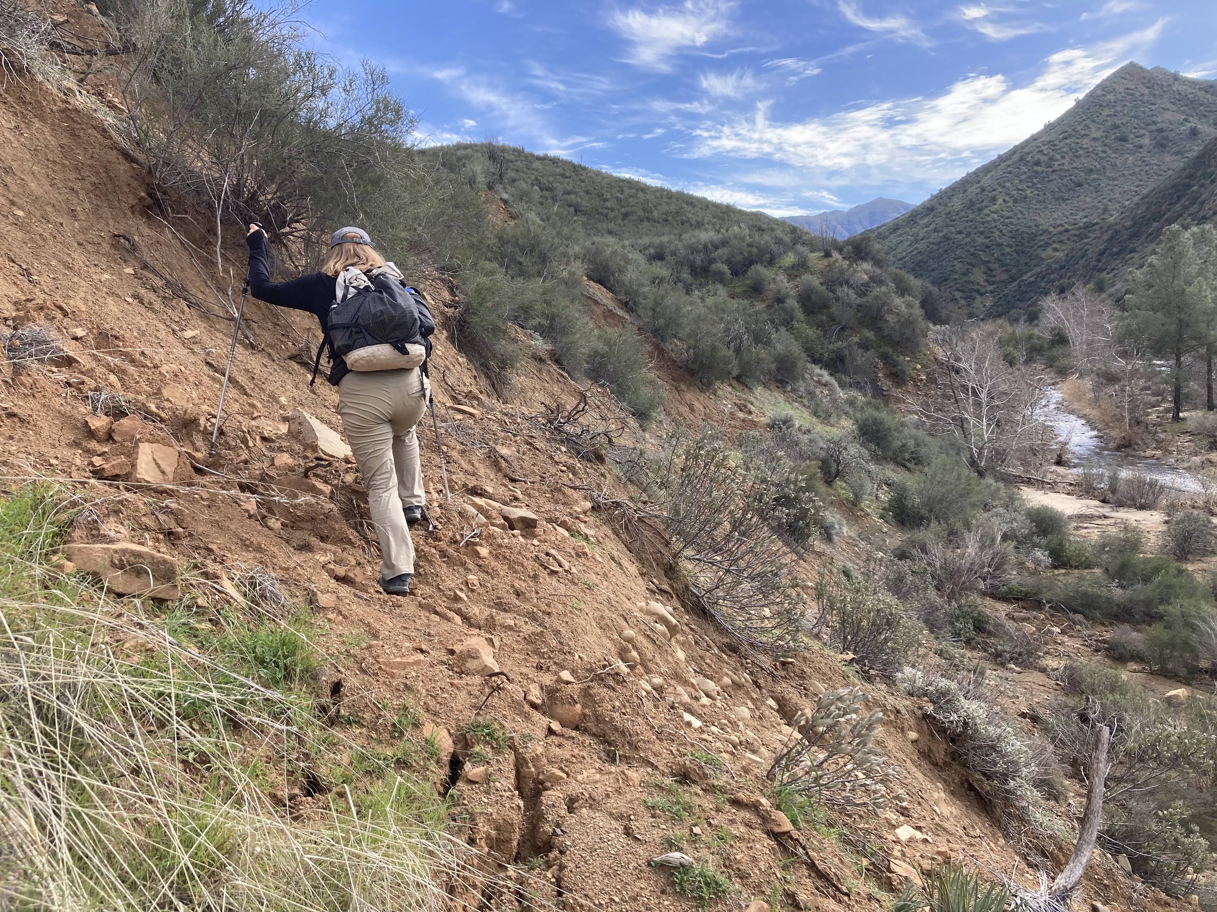
Aaron, before and after, sizing up a complex oak on Cold Spring Trail
TRAIL REPORTING

Hi Everyone – we hope you’re having a great Good Friday and an even better Good Friday evening,

We’ve got a lot to share today – this is probably the most jam-packed email we’ve ever sent.  So, slip into something more comfortable, pour yourself an ice-cold lemonade and enjoy the read.
If you read nothing else, please check out the massive list of upcoming events and trail projects at the bottom – thanks!

There is no shortage of activities and events going on right now in and around the Los Padres.  We’re right in the middle of what is typically the busiest time of year for the Los Padres.  The flowers are doing their thing (more on that below), the water is plentiful and the trailheads are crammed with hikers, riders and backpackers enjoying the forest.  While the trail-users are busy enjoying the trails, the trail crews and trail volunteers are doing their best to fix any damage sustained from this winters storms.  At the bottom of this email (way down there) is a list of upcoming trail projects.  Giving back to the trails and volunteering time to cut brush from the trail or remove a rock slide can be so rewarding.  We encourage all of you to find a trail event this Spring that inspires you and sign up to volunteer for a day or a weekend or even a 10-day Working Vacation.  You’ll love it!  There are plenty of options out there for everyone, we hope you can find some time to make it happen…….

In the meantime, there is something all of us can do while we’re out on the trails that will directly benefit the trails: TRAIL REPORTS.  Trail crews can’t fix a trail if they don’t know that the trail needs fixing, right?  So while you’re out for a ride or hike and if come across a section of trail with a downed tree or a slide or is buried in brush; take a picture and share it with your local trail group, Forest Service staff or post it to HikeLosPadres.com and we’ll make sure it gets into the right hands.  When taking the picture, it helps to position a friend or a hiking pole or your dog or something in the photo to give the feature some perspective so that we can tell exactly how big that downed tree is.  If you can include GPS coordinates that helps a lot as well.  HikeLosPadres has an easy user-interface that allows you to post pictures and include information like GPS and size estimates along with the photo.  It works great to share as much information as you can so that the trail crews can get out there and do what they love to do fixing these trail problems and issues.  Thank you all for the help and we hope you’re finding plenty of time on the trails this Spring……

— • — • — • —

A nice bouquet somewhere between Greenfield and the Pacific

WILDFLOWER SUPER BLOOM 2017

Look out at that hill, it’s a balloon, it’s a tie-dye, no it’s SUPER BLOOM!  You’ve probably seen the words ‘super bloom’ a lot over the past couple of weeks.  That’s the word being used to describe an exceptional eruption of wildflowers and after all our winter rains, California 2017 is certainly qualifying as a super bloom.  Social media is overflowing with pictures of pilgrimages to Death Valley, Joshua Tree and the Carrizo Plain.  In fact there are even pictures from outer space showing the 2017 super bloom.  While we can’t all be so lucky to join in these epic trips to the desert, never fear, chances are there are super blooms right outside your door.  Find some time in the next couple of weeks to revisit your favorite flower haunt or try to find a new one!  Helen Tarbet of the Santa Lucia Ranger District here in the Los Padres puts together a wildflower update for those people headed to Figueroa Mountain to see the wildflowers.  Her latest report from April 12 is attached with this email.  Check it out and remember to tread lightly so the next people can see the flowers just as you saw them.  Enjoy…….

— • — • — • —

The soon-to-be new Pfeiffer Gulch Bridge, CalTrans

FOREST ACCESS UPDATE

While the flowers are certainly out this year, the Los Padres hasn’t completely reopened after the winter storms.  Most of the dirt roads across the Forest remain closed and behind locked gates.  Some of the roads (such as Sierra Madre) have reopened but most of them will stay closed for at least a few more weeks.  The traditional gate opening ceremony usually occurs on May 1 but this year that might not be the case as some of the roads did sustain quite a bit of damage and are not passable yet.  The Forest Service is working on it.  If you’re heading out to the forest, it’s a good idea to call your local Ranger Station to check if the roads are open.  More details below:

  • The Soberanes Fire Closure remains in effect up in the Big Sur and Ventana Wilderness portions of the Los Padres.  No date has been established for when the fire closure will be lifted.
  • The Big Sur Coast remains somewhat isolated as CalTrans works to reopen Hwy 1.  Google search if confused.
    • Nacimiento Ferguson Road has reopened creating a connection to the coast but Hwy 1 is closed in both directions from there.
    • The Pfeifer Gulch Bridge in Big Sur is being rebuilt with an end of September estimated date of completion.
  • In Santa Barbara, First Crossing and Romero Camuesa Rd at Divide Peak remain closed due to storm flooding and debris flows related to the Rey Fire.
  • Highway 33 will start to see traffic delays as CalTrans continues to work on stabilizing slopes damaged by the storms (see attached).

— • — • — • —

The aforementioned Carrizo Super Bloom, photo Andy Quinn

FOREST 411

  • There is a lot of trail restoration activity going on at the moment in the San Rafael Wilderness.  The LPFA has been working on the Manzana Trail and is currently in the middle of a 10-day Working Vacation based at Happy Hunting Ground.  We’ll have additional crews based at Manzana Narrows starting next weekend through the middle of May.  In addition, the CREW is working on the Sisquoc Trail based out of South Fork working up towards Heath Camp.  These trails will be beautiful after all this work.  If you’re out there, be sure to thank the crews!
  • This is kind of cool, there was an officer in Solvang who got a video of a mountain lion chasing after a deer.
  • With all the recent fires and storms, there have become quite a few hazard trees hanging over campsites around the Los Padres.  Some of the trees have been documented, others have not.  It’s always a good idea to check the area for dead trees or leaners before setting up your camp and obviously camp elsewhere if there is a nearby hazard tree.  Take photos of any hazard trees and share with the Forest Service once you get home.
  • The Wheeler Gorge Open House will be Saturday April 22 from 10am – 2pm.  This years Open House will feature booths from local organizations, a Used Camping Gear Sale, BBQ and a visit from Smokey Bear.  If you have kids and like the forest, this is the place for you!  Come on out.  We’ve also released the summer program of talks at Wheeler.
  • The Big Sur International Marathon is April 30.  There is only one way in and out of Big Sur at the moment.  Unless you are running in the marathon, you might want to stay away from Big Sur that weekend.
  • Some personnel news in the Los Padres, more to come later, LP Supervisor Bob Baird has accepted a position as California Regional Fire Director for the USFS.  He will unfortunately be leaving the Los Padres next month.  While we say goodbye to Supervisor Baird, we also say hello to Ranger Brad Turberville who is taking on the Ranger duties at Mount Pinos Ranger District on a 120-day detail.  Welcome Ranger Turberville!
  • The Santa Barbara Trails Council is currently running a photo contest featuring the Gaviota Coast.  There are some really amazing photos being shared, including some from the Los Padres.  Proceeds from the contest will be used to complete the Baron Trail, which is a new trail being built along the Gaviota Coast.

Marching Towards April Working Vacations

Los Padres Greenery!

SAINT PATRICK’S DAY

Happy St. Patricks’s Day everyone!  While March 17 was originally set aside as a religious celebration of Saint Patrick, the foremost patron saint of Ireland, the date has morphed a little over the years into a more general celebration of Ireland.  In addition to the religious aspects of St. Patrick’s day, other time honored traditions have developed including wearing green, pinching those who do not wear green, drinking Irish adult beverages, an overall celebration of Irish descent and a celebration of the color green. Good times for sure!  Feel free to celebrate or enjoy as your beliefs and preferences allow.

Here is the Los Padres, St. Patrick’s Day couldn’t come at a more appropriate time of year.  While most of the country is still thawing out from winter, we’re in the prime of spring with GREEN all around.  Take some time this weekend (after your St. Patty’s celebrations of course) and go find some green in the forest.  It’s not hard to do right now.  It should be a beautiful weekend and you never know, you might just find that leprechaun hiding his gold in that patch of miners lettuce…..

— • — • — • —
Upper Sisquoc Views from the Manzana Trail
APRIL WORKING VACATIONS

The LPFA has two Working Vacation trail projects scheduled in April along the Manzana Trail in the San Rafael Wilderness.  The first WV will be from April 1-9 and will be based either at Manzana Camp (6 miles from NIRA) or Fish Camp (3 miles from NIRA).  The second WV will be from April 15-23 based at Happy Hunting Ground Camp (11 miles from NIRA).  While the trail projects last an entire week, you are welcome to come for as long or short as your schedule allows.  Both Working Vacation locations are upstream from the NIRA Trailhead and will take the better part of a day to travel to and from the base-camps.  We do ask that you commit to a day or two of trail work, which means you’ll need to set aside at least 3-4 days for the Working Vacations.  Better yet, come for the entire week, it’ll be beautiful out there!

For those of you who have been on LPFA Working Vacations, you know what to expect.  For those who have not, the Working Vacations are stock supported volunteer trail projects with designated cooks and all meals provided.  You can learn more here.  Basically, you show up and commit to volunteering on the trail and we’ll make sure you have tasty food to eat, hot coffee in the morning and cold drinks in the evening.  It’s great fun!  Mike Smith will be leading both of these Working Vacations and can answer any specific questions you might have or sign you up!  You can reach him at:  TrailSmith@LPForest.org

More than anything else, the Working Vacations are a fun way to get out in the backcountry, give back to the trails we love and hang out with like-minded fun people.  It’s great fun and very rewarding.  We hope to see you out there……

Rich Scholl, cooking up a storm, Madulce Working Vacation 2016

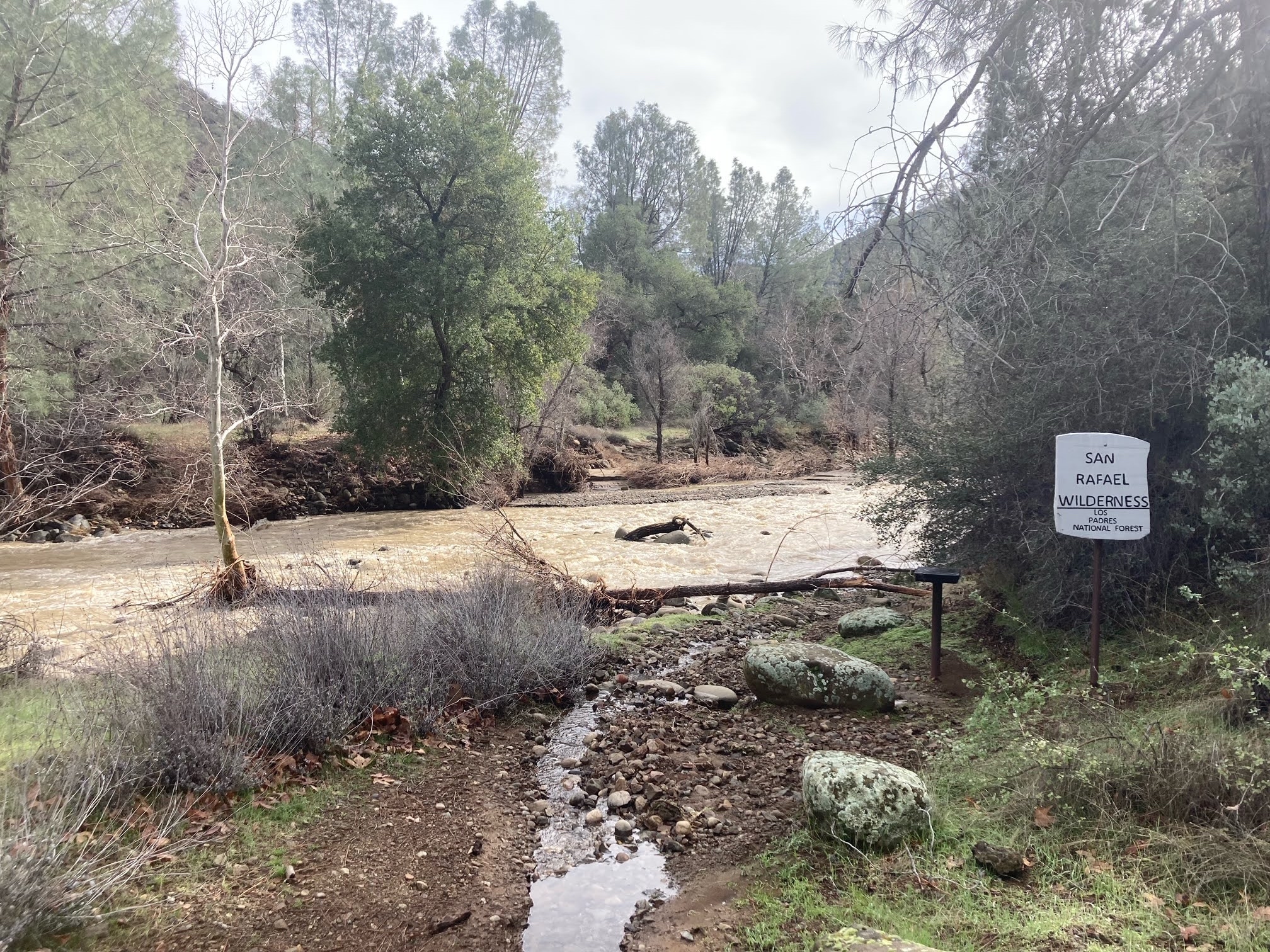
Rain Rain Stay Awhile – Lower Manzana Trail Project

Lower Manzana Sandwich, NIRA on Top and Potrero at Bottom

Hi Everyone – Hope you’re staying dry!

We’ve had some nice storms the past few days and a bunch more stacking up over the coming week thanks to the old Pineapple Express.  We’ve been hearing estimated rain totals as high as 18inches up in Big Sur and well over 4inches for most of the forest.  We’re certainly overdue for a larger scale rain event.  Based on all the rain in the forecast, it’s probably a good time to stay out of the forest and most of the seasonal gate closures will be closed this coming weekend.  But if you must get into the forest, if you get the LP itch (not poison oak), please be careful.  Hwy 1 south of Big Sur has been closed for the past day or two due to slides and there have been warnings issued for Hwy 33 as well.  Take it slow…..
— • — • — • —
LOWER MANZANA TRAIL PROJECT
JANUARY 14-16

Long range forecasts are starting to show a break in the storms for the three-day Martin Luther King Day weekend, Jan 14-16.  If the weather cooperates, we’re planning a 3 day trail project that weekend based at NIRA Campground and working downstream along the Manzana Trail.  Our focus will be clearing the trail down to at least Coldwater Camp with most of the work being brushing and slough removal along the trail.  Mike Smith will be the project leader and we’re still sorting out logistics but the LPFA will be providing at least dinner and breakfast for volunteers.  We’re hoping people would like to participate all three days but if you can come for even one day that would be great!  For more information or to sign up, email Mike Smith at TrailSmith@LPForest.org.  Hope to see you there……..
— • — • — • —
Sunset Wave, Before the Storm, Mission Pine Basin
TID BITS


Due to printing issues with the 2017 passes, 2016 ADVENTURE PASSES will remain valid through the end of February 2017.

• The Los Padres remains in Level II FIRE RESTRICTIONS, although that will probably be changing here really soon!