Springing Additional Los Padres Trails

Over the cribwall and through the fields of flowers, to trail work we go…. Lower Manzana LPFA volunteer work, photo C Horgan

Hello Friends,

We hope this email finds you tired after a nice weekend on the trails. The Los Padres is in top form at the moment. If you haven’t found time to get out and explore… trust us, gotta make that happen. The BIG NEWS this week is that the Forest Service has released a new Forest Order which will again reduce the number of closed LP roads and trails. There has been a lot of work contributed by the Forest Service and partner groups in order to help restore this additional trail/road access. While this news is good for sure, there are still some fan-favorite trails which remain closed. We’ll be continuing our work helping to restore more trail access and we could certainly use your help either through upcoming volunteer projects, donations in support of our Trail Care or just let us know which trails you’d like to see reopened and lets see if we can figure out a way to make that happen together. One trail at a time, one step at a time…. Here are some notes from the latest order:

  • Monterey Ranger District
  • Santa Lucia Ranger District
    • Fig Mtn, Happy Cyn, Sunset Valley, NIRA, Davy Brown, Catway and Fig Mtn Campground have been reopened.
    • Most of the OHV trails out by La Panza / Navajo are reopened but some access roads remain closed.
    • Rockfront remains closed.
    • Machesna & Garcia Wilderness trails are closed.
  • Santa Barbara Ranger District
    • The most changes have occurred in the SBRD where the majority of the backcountry and mid-country trails have been reopened.
    • A few campgrounds have been reopened along Paradise Road and access beyond First Crossing is open for non-motorized use.
    • All OHV remains closed.
Santa Paula Cyn “Trail”? – Mary Mary
  • Ojai Ranger District
    • Not many changes on the Ojai to report mainly due to the continued closure of Hwy 33, which provides most access for the still closed trailheads and campgrounds.
    • The LPFA will be working out of Piedra Blanca in May, please come join the fun!
  • Mt Pinos Ranger District
    • The Pinos was not closed as part of the initial closure due mainly to the fact that most of the district trails were either covered in snow or behind seasonal closure gates.
    • As the snow begins to melt, the MPRD is starting to assess storm damage and will be delaying their seasonal gate opening date back from May 1 to June 1. Note that the gates could open earlier or later depending on discovered storm damage. Stay tuned or call the MPRD with questions.
    • Road access has been cleared up to Chula Vista and Mt Pinos.

Happy Volunteers Clearing Trail, Learning New Skills & Making Friends – photo MImes

VOLUNTEER OPPORTUNITIES

Listed below are the upcoming LPFA volunteer projects & events. Come one, come all! You can signup through the website or email us with any questions: VOLUNTEER@LPForest.org

  • Horn & Santa Paula Cyn, Ojai – April & May 2023
    • We’re continuing our regular Tuesday & Thursday volunteer projects on the Horn Canyon and Santa Paula Canyon Trails in Ojai. We’re on Horn Cyn at least the next few weeks and will then be moving over to Santa Paula. Come join us…..
  • Santa Barbara Cyn, Dick Smith – Apr 21-24 & May 5-8
    • The LPFA will be leading two 4-day backpacking trail projects on the Santa Barbara Cyn Trail. Both projects will be led by Mike Smith and his famous pack goats. The backcountry is so nice right now, hope you can make it….
  • Sespe Working Vacation, Sespe – May 17-21
    • This will be great, we’ll be out on the Sespe working trail from May 17-21 hopefully car-camping at Middle Lion Campground. Over the course of the 5-days we’ll be working a combination of the Lion Cyn, Piedra Blanca and Sespe Trails. This is a must attend…..
  • Davy Brown Trail, Figueroa Mountain – April 25-26
    • The Davy Brown Trail is in bad shape, lets fix that! Come join us as we spend two days and a night helping to clear downed trees and branches from the beloved Davy Brown Trail. We’ll hopefully be car-camping at Davy Brown Campground and working up from there. Feel free to come out for a day or both days and camp with us. Should be great. Details still taking shape, you can sign up here or email at VOLUNTEER@LPForest.org.
  • Santa Cruz Trail, Paradise Road
    • One of the major goals for the LPFA this year was to restore the remaining sections of the Santa Cruz Trail between Upper Oso and Santa Cruz Station. Mother Nature had different plans and threw a couple good curve balls into the equation but with receding water levels we should be able to start working the Santa Cruz soon. We’ll likely have an assortment of different volunteer opportunities, let us know if you’d like to be on the list and we’ll share details as they take shape: VOLUNTEER@LPForest.org

Los Padres Forest: CLOSURE REVISION ISSUED

Olly olly oxen free! The Los Padres mostly reopens……

Hello Friends,

The Forest Service released a revised closure order which supersedes the previous January 13 sixty-day closure order. The new order will open large parts of the forest but some of the trails and roads will remain closed due to damage incurred as part of both the early January floods as well as the early March snow storm. Click the two links below to read the new revised closure order and to see a list of which areas will remain closed:

There is a lot to digest as you scroll through the above list of what is open and what remains closed. Here’s a few notes and tidbits that might be helpful:

• Most of the frontcountry trails across the Los Padres are now open. Please confirm on the link above for specifics.

• You might notice that most of the campgrounds (car camps) remain closed across the forest. This is largely due to the fact that many of the major roads that lead into the forest and to these campgrounds are still closed. This includes Highway 33, Highway 1 and most of the non-paved Forest Roads. It’s going to be a little harder this year finding a campground as we head into Spring Break but there are still some good options out there for car-camping. • Many of the roads that lead into the forest remain closed. Unfortunately, some of these roads were open as of two two weeks ago but had to be closed again due to snow damage from the early March storms. Some of the roads can be biked/hiked but in some cases we’re going to have to get creative connecting trails from where we can now park to where the usual trailhead might be. Call the Forest Service with questions or we’re happy to help too.

• Each of the Ranger Districts were in charge of determining which portions within their Districts should be opened and which should remain closed. There’s some variation between the districts but for the most part the majority of the Wilderness areas and trails have been reopened. The exceptions are: Portions of the Pine Ridge Trail and the entire Rocky Creek Trail within the Ventana Wilderness. The trails within the Machesna and Garcia Wildernesses. The Dick Smith Wilderness within the Santa Barbara Ranger District. The Santa Cruz Drainage within the San Rafael Wilderness. Matilija Wilderness and North Fork Matilija Trail. Potrero John within the Sespe Wilderness.

• Remember that pretty much all of the seasonal gates are currently closed across the forest and many of the gates that might normally be open are closed due to the recent snow. This includes most of the Mt Pinos Ranger District, which was not part of the January 13 closure. We strongly suggest calling the local Ranger District office before you head into the forest to get as much information as you can ahead of time.

• The trails and roads across the forest were hammered by the January storms and then hammered again a few weeks back by the snow. It was a one-two punch of flooding followed by snow downed trees. Despite all the recent trail work that has been accomplished since January, the trails are in rough shape. Couple things to consider before heading out onto the trails:

  • Be prepared to travel slower than normal. The creek crossings are going to big, there are going to be downed trees and there are going to be washouts. Be prepared to hike slower than normal or hike-a-bike in places that you might normally be riding.
  • You might encounter a showstopper out there or something that you can’t navigate around. Be ready for that potential when planning your day on the trail and don’t be afraid to turn around if you encounter a section of trail that makes you uncomfortable. Always better to be safe.
  • We learned long ago not to predict what is or is not stock passable. Where there’s a will, there’s a way and some packers seem to have enough will to get just about anywhere. That being said, this year is different and most of the trails we’ve seen are far from stock passable. We suggest that if you are hoping to take animals on any of the LP trails, scout them ahead of time on foot to make sure you can make it. We’re not advertising any trails as being stock passable at the moment. Sorry.
  • PLEASE PLEASE take photos of any sketchy sections of trail, slides, needed reroutes or any downed trees. It’s a good idea to have a friend pose in the photo or place a water bottle, bike or hiking pole so that there is a scale reference. It would be great to then share the photos and your trail report on HikeLosPadres, with your local trail group or with the FS – or better yet, all of the above! We can’t fix the trails if we don’t know what’s needing to be fixed. Your help with trail reports is so important!  
  • Last but not least, the Forest Service will be frequently revising the closure order as trails and roads are fixed and restored. Over the next few months things will be changing quite a bit as the snow melts and repairs occur. We’ll be working with the Forest Service to share information and help get as many areas reopened and as much road access restored as quickly as we collectively can. Be patient but at the same time let’s work to make sure the FS knows what areas should be prioritized to be reopened. This can be accomplished through focused volunteer efforts or sharing information from what people are seeing while in the forest. If you’d like to help, contact your local trail organization or the Forest Service. Let’s be part of the solution, not the problem…..

A lot to digest but it’s good to see that most of the forest is reopening, certainly a step in the right direction. Hopefully we’ll see more access reopened over the coming weeks and months as more work is accomplished.

There is another round of more heavy rain in the forecast for this evening through Wednesday but the weekend weather is looking pretty good. Enjoy the trails and we should have an epic Los Padres spring and summer ahead of us.

Thanks everyone…..

VOLUNTEER

The LPFA will be leading a volunteer project this weekend clearing snow-downed oak trees from Sunset Valley Road in order to help provide vehicle access to NIRA. If that doesn’t work then we’ll likely be working on the Davy Brown Trail off Fig Mtn. Details are TBD based on how the storm this week impacts the area but we’d love to see you out there helping!

CLICK HERE TO VOLUNTEER

LPFA TRAIL CREW

As we head into the busy Spring season we are looking to add a few more folks to the LPFA Trail Crew. Our Trail Crew works full time across the Los Padres helping to remove downed trees, clear slides and brush so that the trails stay open.

If interested click below or email directly: INFO@LPForest.org

CLICK HERE TO JOIN LPFA TRAIL CREW

It’s Time to Reopen the Forest

The Hurricane Deck shed a few layers during the January storms. Remarkable seeing all the recent slides coming off the southern face.

Dear Los Padres National Forest,

It’s time to reopen the forest.

It was the right decision to close the Los Padres Forest on January 13 after the devastating rains earlier that week. There was so much damage across our region, so many closed roads and so many unknowns. Closing the forest at that time in order to focus on making sure people were okay was certainly a wise decision.

Since then, over the past 6 weeks, you have done a great job of clearing roads, repairing infrastructure and leading the forest-wide damage assessment effort. Many of your partners, including the LPFA, have participated in these assessments as well. The LPFA alone has now surveyed over 200 miles of trails across the southern four ranger districts and altogether with other partner groups and Forest Service staff we’ve probably collectively seen most of the forest by now. The damage across the forest is unprecedented and certainly daunting for those of us who work to keep the forest trails open and passable. We’ve documented and shared more photos of trail damaging slides and gullies than we’d ever want to see. There is certainly a lot of work ahead of us in order to bring the trails back to where they were before the storm damage. It’s going to take some time for sure.

The Forest Service has been busy clearing roads, photo Beeman

While the extent of the trail damage is significant, we have not seen the type of showstopper trail damage that would warrant the majority of the forest remaining closed. Most of the trail damage we’ve seen are obstacles that savvy forest-users can easily walk around or bypass. While that’s not ideal, we can’t wait for every trail issue to be repaired, that’s going to take years. We understand that there are going to be some roads and trails which will need to remain closed. Some of these select trail closures may last months and in some cases years. Speaking on behalf of the forest-users, we understand the damage and we’re okay with having some of the trails remain closed.

We also understand that we won’t have the same road and trailhead access this season as we’re used to having in the past. That’s okay, we just want to get back into the forest and go where we can. Please, it’s time to reopen the forest.

We realize there is a laundry list of things to do before a forest closure can be lifted. More signage is likely needed, information shared and of course continuous trail maintenance is always needed; more so now than ever. The trail groups across the forest have been working like crazy these past 6 weeks repairing as many of the bad sections of trail as we can. A lot of progress has been made and many of the most popular trails are currently in fine shape.

Let us know how we, your partners and forest-users, can help move this forward. There are thousands of volunteers across the forest who would love to help however we can in order to get portions of the forest reopened. We’re here to help, please let us know how and what might be needed?

It would be a shame to have another beautiful wintery-spring weekend come and go without people enjoying their Los Padres. It’s time to reopen the forest. Let us know how we can help make that happen.

Thank you for all your work – sincerely,

Your Forest Users

Two movies for the price of one…. a Gandalf at the infamous Cliffs of Insanity…. You Shall Not Pass! The Santa Cruz Trail needs to remain closed.
Oak Flat along the Sespe, how nice are those pools going to be? Most of the Sespe will remain hard to access due to the extended closure of Hwy 33.
The San Rafael Wilderness, prime Los Padres backpacking. The Forest Service has done a great job clearing the road to NIRA.
Where’s the trail? Some of the trails don’t exist anymore, keep your eyes peeled for recently placed cairns and flagging. Photo Beeman
Lots of road damage remains, making for long road hikes or rides just to get to the usual trailhead. That’s okay, right? Hi Mtn, photo Toejam
ll the usual forest-wide trail organizations are working hard to repair the gnarlier sections of trails. Helping to get the forest reopened.
Let’s do this! It’s time to reopen the forest. Photos LPFA & Montecito Trails Foundation.

The Latest on the Los Padres Forest Closure?

One of the many new barriers along the normally well-trodden Manzana Trail, photo Maki

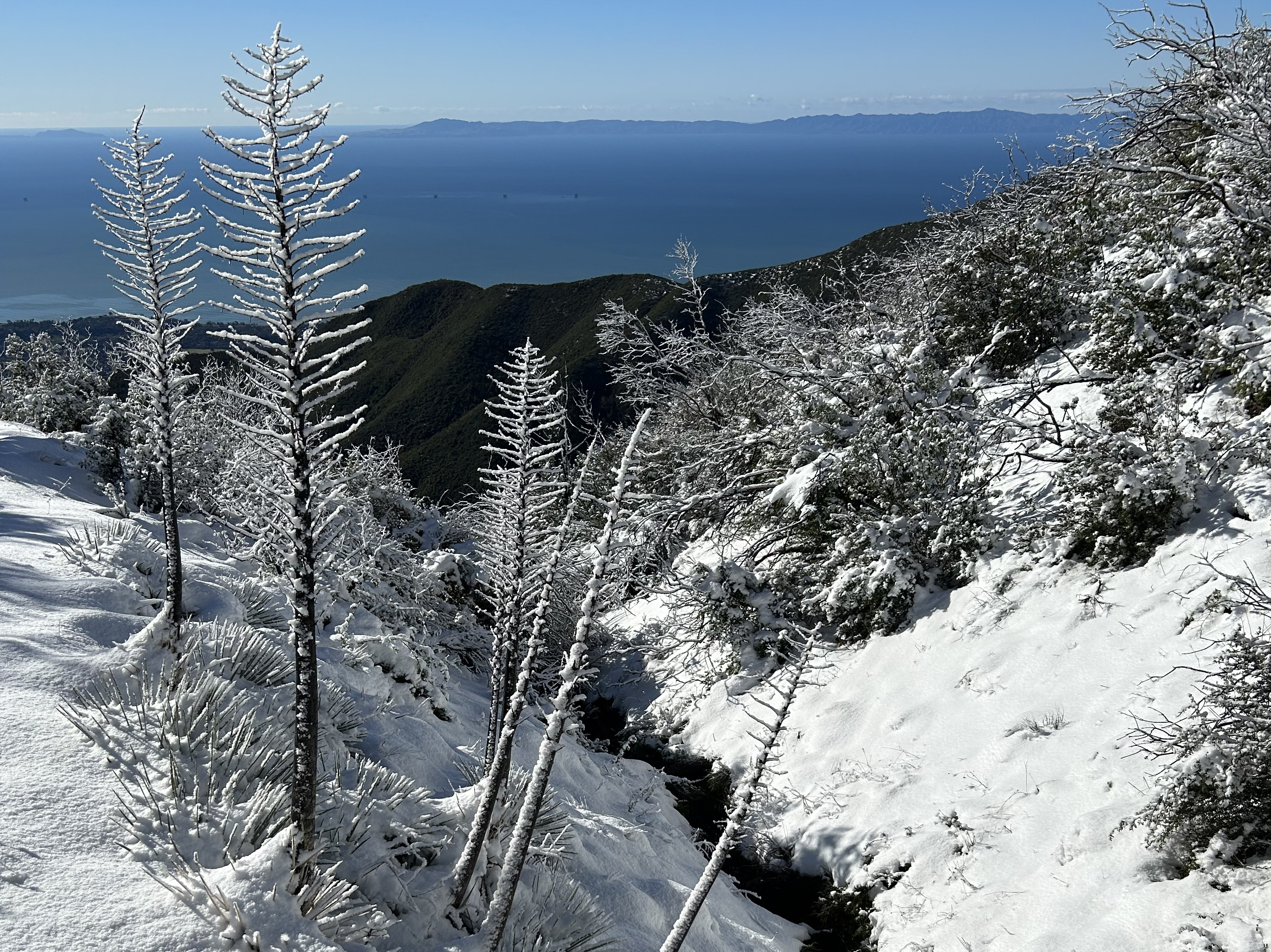
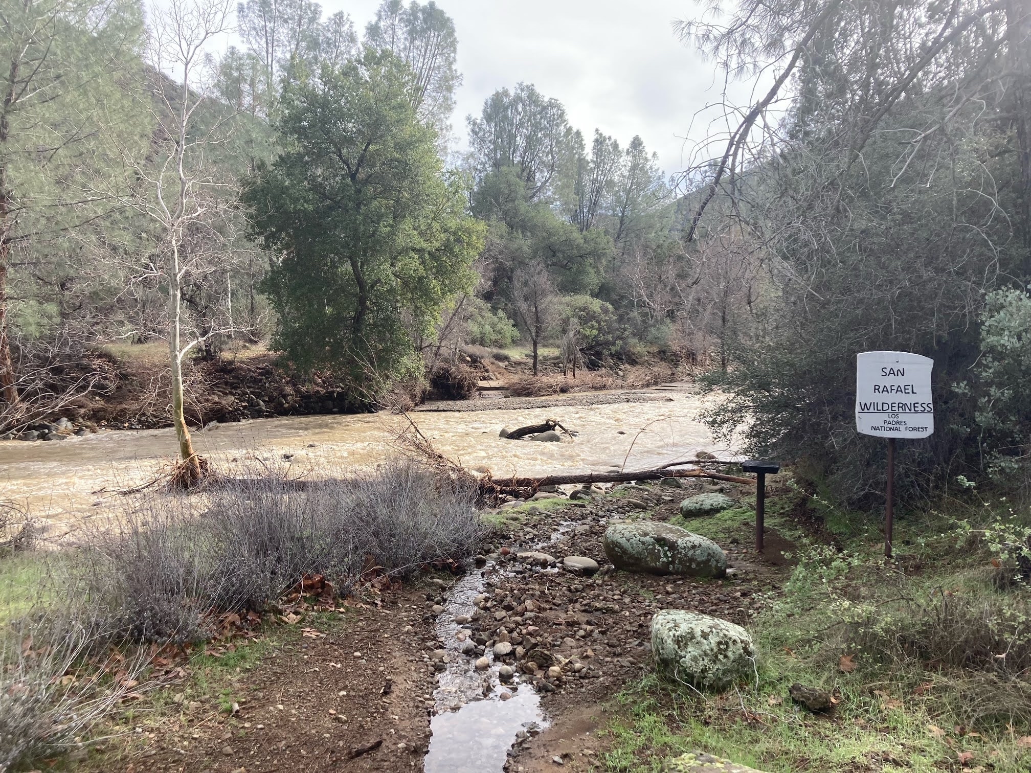
Hello Friends,

As of February 7, the majority of the Los Padres Forest remains closed due to severe storm damage. This includes all of the Monterey, Santa Lucia, Santa Barbara and Ojai Ranger Districts. The Mt Pinos RD is open with the caveat that all their usual seasonal gates are currently closed for the winter.

We’ve been hearing the complaints and understand the frustration over the forest closure. We all want to be out in the forest doing what we do, going where we go and seeing what we see. Nothing beats a February backpacking trip in the Los Padres, it’s the best time IMO. The closure is no fun, we get it. That being said, many of us, including Forest Service staff, have been working real hard to try to get the forest reopened. Right now information is changing by the day but here’s our best update on what’s been happening, where we might be headed and what hopefully will be occurring soon:

A now typical Manzana Crossing. Trails gotta be over there somewhere….??? photo Lori Rafferty

The Storm

Big rains. Lots of damage. Safety takes precedence. Forest closes. The first couple weeks after the storm events were dedicated to road and infrastructure damage assessment, getting those roads open and restoring access for the hundreds of folks stranded behind damaged Forest Service roads. Click here for a recent Ray Ford article in Noozhawk which documents some the damage from around Santa Barbara County. 

Post storm damage trail clearing has begun, two happy LPFA crosscut sawyers singing along…. photo Rupert S

Trail Assessments

Sun shines. Water levels drop. People get out. Progress is made. Many roads across the forest have now been cleared and in some cases reopened. The Forest Service has begun assessing trail conditions and recreational forest access. This is where the LPFA and other partner groups have gotten involved. Over the past few weeks, LPFA staff and volunteers have now surveyed over 100 miles of trails across the forest and that number is substantially higher if you include all the surveys from other FS partners and FS staff. All of the assessment information is being shared within a central database so that the Forest Service can evaluate the magnitude of the damage and initiate a strategy for repair, reopening and requesting funds. A big focus of the surveys has been looking for extreme showstopper trail damage that would prevent a trail user from safely getting from point A to point B. We’ve found more than a few of these showstoppers.

The cribwall before Fish Camp has seen better days but she held… photo Maki

The Polygon Plan

The trail surveys began on the frontcountry trails, places where access to the trailheads is paved. From there the surveys have slowly ventured deeper into the forest including assessing some of the wilderness areas. We have collectively seen a lot of what happened across the forest and unfortunately the damage is significant. The Forest Service has been leading daily forest-wide update meetings and their sincere hope is to systematically reopen ‘forest polygons’ once trailhead access has been established and the trails within those polygons have been surveyed and adequately repaired. The FS is putting an emphasis on reopening the more popular frontcountry polygons but it is possible that some backcountry polygons might be the first ones to open up. There has been discussion that Wilderness and backcountry trails won’t need the same level of repairs as frontcountry trails since it is understood that Wilderness trails are more challenging for the trail user. As of today, two smaller non-forest managed polygons in the SB Frontcountry have reopened and more should be following soon.

Is that the Lost Valley Trail or the Lost Trail Valley? The trail should be traversing across that hillside, photo Addison

Grand Reopening?

Knowing that approved forest polygons are needed in order to reopen portions of the forest, many of the trail groups across the Los Padres have been working like crazy the past couple weeks strategically focusing on needed trail repairs within some of the low-hanging-fruit polygons. We’ve been fixing undercut sections of trail and sinkholes, clearing large washouts and downed trees and ramping in and out of flood cut gullies. Progress has been slow, but steady. It is likely that some larger polygons will be reopened soon, hopefully within the week – knock knock

— • — • —

While many of the frontcountry trails have been seen or documented on social media, we’re just starting to get eyes on the much bigger backcountry. The Ventana Wilderness Alliance has been surveying the Big Sur Backcountry and the LPFA was finally able to get into NIRA this past weekend to survey the trails up and down the Manzana. All the photos within this newsletter are from this past weekend within the San Rafael Wilderness. There’s still a lot more of the forest to assess but we’re basically seeing wildfire level trail damage at a forest-wide scale and instead of ash we’ve got flood scour. There is going to be major repairs on all the trails and while we documented hundreds of damaged sections of trail within the 25 miles of surveyed backcountry trails, we didn’t see any showstoppers nor any areas that were truly impassable.

The biggest issue we’ve seen is at the creek crossings. Just about every creek crossing has changed. Where you’d expect to see the trail is now covered in mud, roots and stacked logs with a 4-6ft climb in and out of the creek. In some cases it’s going to be years before the trails are back to where they were before these storms. That being said, we’re recommending that the NIRA polygon and hopefully other backcountry polygons be reopened with the understanding that the trails are not stock passable, that trail-users will at times have trouble following the trails, that trail users may get turned around somewhere out there by a showstopper and that trail users should expect to travel much slower than normal. We’re looking forward to continued reopening polygon discussions with the Forest Service later in the week. Stay tuned!

In the meantime, we’ll keep pushing hard to continue surveys, continue opening up trails and continue working with our partners and the Forest Service to define those polygons which can be reopened. If you’d like to help, we do have some volunteer opportunities listed below, donations always help and keep an eye on social media for more upcoming projects as well. Thanks everyone for your patience, it’s going to be a beautiful spring in the forest.

One volunteer, one trail day, one shovel load, it all adds up, photo Toejam

Los Padres Closure Update: JANUARY 23, 2023

NIRAging…. WOW! – Photo Roo Seaford, January 11
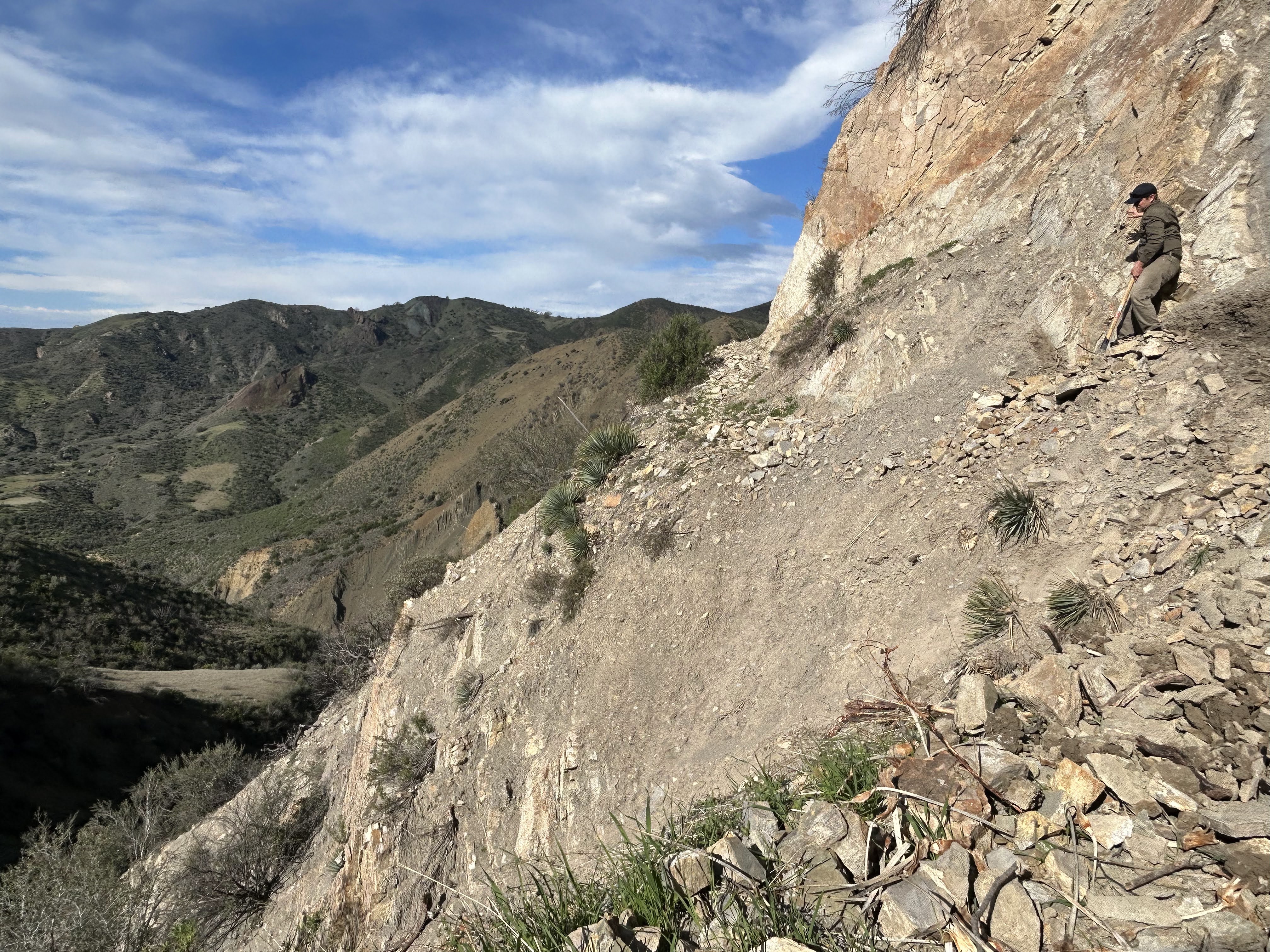
Hello Friends,

It’s been a busy couple weeks and we’ve been fielding a TON of questions about the current storm related closure that is impacting most of the Los Padres National Forest. Information is changing by the hour but here’s the latest as we come out of a beautiful winter weekend:
San Ysidro Trail, the whole mountain covered the trail within the red circle

• The majority of the Los Padres remains closed through March 14. This includes all of the Ojai, Santa Barbara, Santa Lucia and Monterey Ranger Districts. The Mount Pinos RD is open, yet all the usual winter seasonal gate closures are in effect and be prepared for additional closures or delays from other storm related road damage. If you plan on heading out to the MPRD, be sure to check in with CalTrans or other sources to ensure your roads are open and passable. Still a lot of storm related damage out there…..

• The Forest Service has been busy this past week primarily working on clearing roads, assessing infrastructure damage and assisting with the liberation of multiple stranded communities. There remain over 150 people stranded due to road closures and storm damage. Most of the access roads into the forest are closed and in some cases may remain closed for quite some time.

• In support of the Forest Service and other land agencies, the LPFA has started surveying many of the frontcountry trails above both Santa Barbara as well as Ojai. While the backcountry may be closed for some time due to road closures, the strategy is to get the frontcountry reopened as soon as possible and then work out and back from there.

• Unfortunately we’re seeing substantial damage (slides, washouts, gullies, sinkholes, etc….) across most frontcountry trails and in a few cases showstopper damage that won’t be repaired anytime soon.

• The LPFA Trail Crew has been working with Montecito Trails Foundation to repair some of the trails within and above Santa Barbara. We will be preparing weekly progress reports and sharing with agencies in order to hopefully modify the closure to reopen trails as they are repaired.

• We’ve also been collaborating with MTF and Santa Barbara County Trails Council to restore some of the trails that are outside the current forest closure. It’s a good idea, if you are ‘jonesing’ for a trail, to branch out and explore your local parks, open spaces and managed lands.

• We understand that many of us are frustrated at not being in the forest or visiting our favorite trail or camp. There is a lot of significant damage out there, please try to be patient. We’re pushing hard to help get the surveys completed, get damage repaired and hopefully get portions of the forest reopened as soon as possible.


This is one of at least three sections of San Ysidro Trail that will need significant work or adjustment. Many of the trails have sections that are literally gone and impassable.

EATING AN ELEPHANT

Some good news to share….. With the help of Montecito Trails Foundation, we will be leading 5 days of volunteer trail projects in the Santa Barbara Frontcountry starting Tuesday January 24. Please click the link below to sign up. Due to the nature of the needed trail work, we are limiting the number of volunteers each day. There have been a lot of you (THANK YOU) interested in volunteering and we’ll hopefully have some larger scale volunteer days ahead but for now we’ll be starting small and ramping up. We’re also hoping to have some volunteer days in Ojai soon as well, hint hint, lets do it!

VOLUNTEERS CLICK HERE!

We’re also in need of help with our hired Trail Crew. If you are looking for a job, love being in the forest and have some time to spend repairing damaged trail, please let us know.

TRAIL CREW APPLICANTS CLICK HERE!

Thanks everyone for your support and patience. While all the water has been super damaging, it’s a good thing in the long run. We’re going to have some amazing pools this spring and for years to come.

Sandstone Day Use Area on the Santa Ynez River. This is just below Red Rock. Hard to Recognize. Photo:  Morgan Jones

Los Padres Forest: CLOSURE ORDER

A not so Happy Canyon Road, or what’s left of it, just below Cachuma Saddle. Photo Cragg

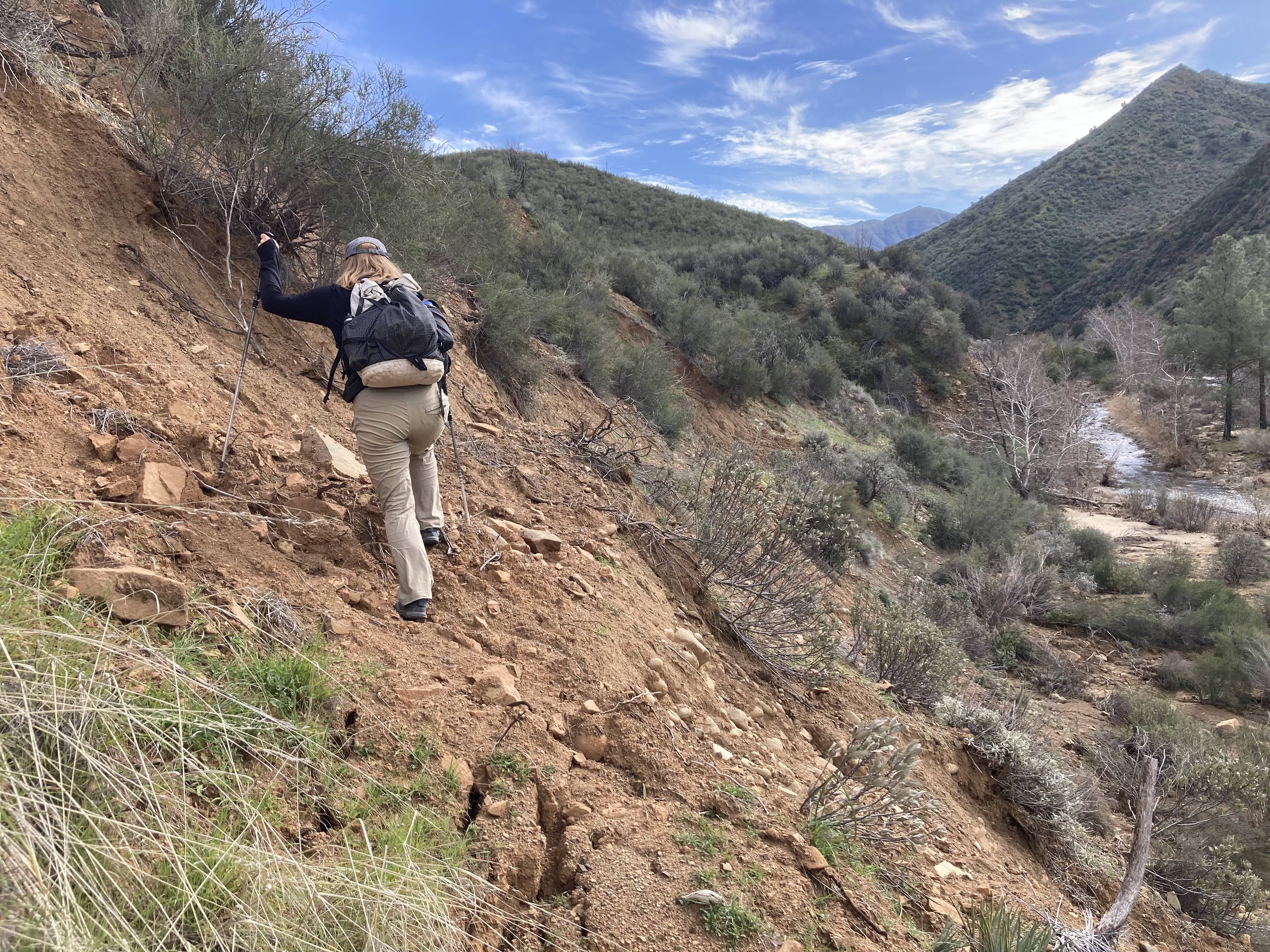
Hello Friends,

Due to the massive amounts of recent rainfall and subsequent forest-wide damage to trails, roads and infrastructure, the Forest Service has issued a forest-wide closure of the Los Padres Forest effective Friday January 13. The closure comes in advance of this weekend’s storms, which are forecast to dump additional inches of rain across the forest.

Obviously no one is happy about the closure, but there is just too much damage across the forest at the moment. In the days following the last storm, we’ve had many volunteers attempt to survey trails and forest roads. Literally every report we’re seeing, every attempt to drive a road, every attempt to hike a trail, is coming back reporting massive damage. We’ve seen damage like this in the past, but it’s largely been isolated to portions of a county or within specific fire scars. What’s different this time is that the destruction is at a forest-wide scale and even beyond that when you look at neighboring counties such as Santa Cruz, Los Angeles, etc…

The closure order states that the closure will last 60-days but we’re hopeful that it can be revised or modified on a local level as portions of the forest are surveyed, cleaned up and repaired. We are working closely with the Forest Service to help survey and document the damage and are looking forward to getting our boots on the ground ASAP to repair the trails. We’ll be out in force once the Forest Service gives us the green light. Please consider donating to our Trail Fund if you can, we’ve got lots of collective work ahead of us.

If you have any photos of trail or road damage from this past week, please forward on to us of the Forest Service.

Sorry for the bad news on a Friday the 13th and stay safe everyone……

Unrecognizable? That’s Montecito Hot Springs. Not a social media sensation at the moment.