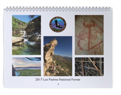
LOS PADRES Concessionaire Changes & More……

Chuchupate Camp, Showing Signs of Changechuchupatecamp
LOS PADRES CONCESSIONAIRE CHANGES

Big changes within the Los Padres are upon us, perhaps you’ve heard, if not, then brace yourself… For the past three decades the Los Padres National Forest has relied on as many as six different privately run concessionaires to help manage some of the campgrounds, day use areas and trailheads around the forest. You’ve seen these concessionaires at the campgrounds along Paradise Road, at Wheeler Gorge Campground, McGill, Bottcher’s Gap, Cerro Alto, Kirk Creek, etc, the list goes on and on. In an effort to consolidate these concessionaires, the Forest Service has selected Parks Management Company to become the sole concessionaire across the Los Padres. This went into effect November 1.

Yet, in addition to taking over the existing concessionaire operations and as part of their new agreement with the Los Padres, Parks Management will be adding quite a few new recreation sites to their list of concessionaire sites. This is where it gets a little painful, as some of the sites you’ve been using for free or as part of the Adventure Pass program are now going to be managed by Parks Management and will cost quite a bit more to use than in the past. Campgrounds like NIRA, Pine Mtn and Chuchupate, that used to accept a $5 Adventure Pass, are now going to charge $20/night. And certain trailheads like Upper Oso and NIRA, which also used to either require a $5 Adventure Pass or were free, are now going to cost $10/day to park. Ouch.

We’ve met with the FS and Parks Management multiple times expressing our concerns and hearing their sides of the concessionaire triangle. We all know how rundown some of the campgrounds are and we hear about how the Forest Service budget has been cut by 50% over the past decade. Like it or not, the FS doesn’t have the capacity to adequately manage all the recreation sites across the forest. As it was explained to us: with the current budget, it’s either accept a broader concessionaire program or run the risk of losing those recreation sites altogether. It’s a depressing situation and we’re not sure anyone knows a perfect solution.

While these price increases are going to be a tough blow for those of us who regularly use the forest, we’re already starting to see improvements at many of the campgrounds across the forest. These improvements include freshly painted bathrooms, new campfire rings, brush removal around campgrounds, new tables, etc…. For only being two weeks into their new agreement, it appears Park Management is headed in the right direction. Lets hope they keep it up.

One of the downsides of the new concessionaire plan is that it’s caused quite a bit of confusion trying to figure out which campsites require which permit. In order to help, we’ve created a GoogleDoc spreadsheet listing all the recreation sites mentioned in the concessionaire change documentation. We’ve listed all the sites, what the previous regulations were, previous costs and then what the current regulations/costs are:

Click here and you can sort through and check out the sites that most interest you.

As you will see, there is a lot of change. Most of it translates to more cost for the forest-user but hidden in the new program are some good changes as well. Some additional tidbits:

  • Parks Management will sell a $50 annual day use pass that is good across the forest.
  • The Adventure Pass remains in effect at select sites, see GoogleDoc.
  • Parks Management will provide 50% campground discounts with the America the Beautiful annual passes.
  • Many of the Parks Management campgrounds will be available for online reservation but they will keep some first-come-first-serve sites within the campgrounds as well.

As mentioned, this change went into effect November 1 and Parks Management expects it to take a few months in order to get all the iron rangers installed and signage changed across the forest. It’s going to be a tough pill to swallow, especially as we all learn what exactly this means and what the long-term ramifications are of this program. Lets hope that this is a positive in the long run.

— • — • — • —

Autumn Super Moon, photo Humphreysupermoon

CURRENT CONDITIONS

It’s been a minute since we sent out a forest update.  Amazingly, quite a few of you missed the update and checked in asking if everyone was going okay.  The answer is YES, things are great, just a little too busy the past month to put one of these emails together.  Since it has been a while, we wanted to send out an update on the current conditions, closures and restrictions across the LP.

LEVEL IV FIRE RESTRICTIONS
The forest remains in Level IV fire restrictions, which means no campfires, no target shooting and no stoves outside of designated campfire use sites.  You can see the restriction order here.  While the forest has received some substantial rain this season, the fire restrictions are generally not lifted until the entire forest receives at least two inches of rain.  Last year the restrictions were not lifted until early January.  There are rumors that the restrictions may be downgraded to allow portable camp stoves in the backcountry, if anything changes we’ll let everyone know.

SOBERANES FIRE CLOSURE
The Soberanes Fire burned over 130,000 acres across Monterey County from July 22 until October 22.  Soberanes ended costing more to fight than any fire in US history.  In response to the fire, the Forest Service closed the Monterey Ranger District on September 2 and that closure remains in effect.  While the Soberanes Fire is 100% contained, it continues to burn and smolder within the fire perimeter.  No news on when the closure will be modified but we expect the fire perimeter to remain closed at least until the end of next spring.  We’ll keep you posted……  In the meantime some of the campgrounds along the Big Sur Coast have reopened.  The Forest Campgrounds off Hwy 1 are open as well as Andrew Molera State Park.  If you’re planning a trip through Big Sur, be sure to check on campground availability before you hit the road.

SANTA LUCIA RANGER DISTRICT
Many of the roads and recreation sites around Figueroa Mountain remain closed due to hazard trees.  Fig was hit perhaps harder than anywhere else in the Los Padres by the drought and subsequent beetle infestation.  Take a look at Figuera Mountain next time you’re in the Santa Ynez Valley and you can clearly see the swath of brown dead trees.  The closure includes Catway Road, Figueroa Lookout, Pino Alto, Cumbre and East Pinery Road.  You can read more here.

SANTA BARBARA RANGER DISTRICT
The Rey Fire perimeter remains closed within the SBRD.  This includes all trails up the Buckhorn Rd above Upper Oso Campground as well as the burn areas accessed from the Indian-Mono Trailhead near Mono Campground.  While there might be some minor adjustments in the closure order, we do expect the Buckhorn Road and trails to remain closed to hikers, OHV and mountain bikers at least through the winter.  Stay tuned.

Also in the SBRD we have remaining closures as a result of the June Sherpa Fire.  The closure mostly affects West Camino Cielo.

OJAI & MT PINOS RANGER DISTRICTS
Recurring theme, the Pine Fire closure from earlier this summer remains in effect.  The closure specifically affects the Reyes Peak Trail and the Piedra Blanca Trail between Upper Reyes Creek and Pine Mtn Lodge.  The Forest Service has been busy installing warning signs where the trails enter the burn area.  While warning signs might indicate that people will soon be allowed into the burn area, no dates have been announced when the closure will be lifted.  Hang tight……

The Ojai Ranger District announced their seasonal road closure schedule.  This year the gates to Dough Flat (at Tar Creek), Reyes Peak (Pine Mtn), Cherry Creek and Nordhoff Ridge will close on December 16.  The Pines Campground above Ojai remains closed due to hazard trees.

Mt Pinos District is doing something a little different this year and will be locking gates along their seasonal roads based on rain events rather than specific dates.  The gates will close after the first large rain.  This is a great approach and I’m sure most of us reading this are happy to hear about the change in policy.  For more details or to check on gates, give MPRD a call at 661.245.0521.

Whew, that’s a lot of information.  Let us know if you have any questions or if we messed anything up.  Thanks everyone for the updates……

— • — • — • —

McKinley Mtn View, October 2016 Mission Pine Working Vacationmckinleypano

UPCOMING EVENTS
A few upcoming dates, events, projects, presentations or things you might want to know.
If you have any forest-related events to add to this list, let us know and we’re more than happy to pimp your event!

November 20: SBMTV San Ysidro Trail Work & Ride
November 27: LPFA Manzana Trail Tree Clearing

December 3-4: LPFA VWR Headquarters Cabin Cleanup
December 18-20: LPFA Judell Trail Maintenance Project, details upcoming

January 21-22: UTMC Crosscut Certification, Chuchupate Ranger Station


MISSION: Mission Pine

Mission Pine View, September 2016
missionpineoverview
MISSION PINE WORKING VACATION
October 21-30
    The LPFA will be hosting our next Working Vacation along the Mission Pine Trail in the San Rafael Wilderness from October 21-30.  We’ll be driving up from Cachuma Saddle to McKinley Saddle and backpacking 8 miles from there to our basecamp at Mission Pine Basin.  While the project will cover 10 days, we’ll have multiple entry-exit windows to choose from that will allow volunteers to participate for shorter periods of time.  The project will be supported with pack stock and all food will be provided.
The ‘WORK’ will consist of crosscutting any downed trees off the trail and clearing brush from the trails that radiate out from Mission Pine Basin.  These include the uppermost part of the Santa Cruz Trail and our primary objective of brushing the Mission Pine Trail east from the Basin towards West Big Pine.  There is plenty of work to be done.
The ‘VACATION’ portion of the trip will be spending time outdoors, with friends while enjoying this incredible slice of pine-studded Santa Barbara Backcountry awesomeness.  Mission Pine Basin is over 5,000 ft in elevation and has tremendous views of the Channel Islands to the South, Big Pine to the East and the Sisquoc Valley to the North.  It really is a great spot to hunker down and work the trails.
    We are looking for volunteers to help with the trail work as well as someone (or team of someone’s) to help with the cooking.  If you like backcountry cooking, I can assure you there will be plenty of hungry volunteers happy to have you there.
Space is limited, you must be able to backpack 8 miles, if you are interested in volunteering/cooking or would like to learn more, email us (INFO@LPForest.org) and hope to see you out there in late October.  More photos are on the LPFA Facebook page here.


Top of the Forest, photo Beemanpinosbeeman

SOBERANES UPDATE & MORE

• The Soberanes Fire continues to make history within the Monterey District of the Los Padres.  We’ll get into more details when it’s officially snuffed but for now it’s racking up some pretty horrifying statistics:

  • 132,069 acres, 94,875 of those are within the Los Padres Forest.  That’s the 16th largest wildfire in California history.
  • 92% containment with estimated 100% containment being October 15.
  • Today marks the start of the 11th week Soberanes has been burning.  71 days!
  • Soberanes is the most expensive fire to fight in history!  Well over $200,000,000 has been spent fighting the fire.  That does not include damages.
  • Good news is that both Church Ranch and the famous Jack English Cabin in Pine Valley survived!  Both were wrapped in fire-resistant foil and cleared before the fire came through.
  • Most evacuation orders have been lifted and life is starting to return to normal for some people affected by the fire.
  • That being said, life around Soberanes is certainly not back to normal for everyone.  The LP within Monterey County remains closed, this includes all campgrounds other than the few along Hwy 1.  All California State Park campgrounds remain closed as well.
  • We remain optimistic that portions of the forest will reopen once Soberanes reaches 100% containment and we’ll certainly keep you posted as things unfold.

RAIN?  Yes, rain.  This past week saw almost a half inch of rain fall in some parts of the Southern Los Padres, mostly in the Mt. Pinos and Ojai Ranger Districts.

• And don’t forget the LPFA Used Camping Gear Sale tomorrow, 10am at Tucker’s Grove in Goleta!  It’s not too late to donate as well.  Just bring your used camping gear to the sale at least 30mins before the sale starts.

That’s it for now folks…..  Coming soon we’ll share an update from National Public Lands Day on the Lion Canyon Trail, some exciting news about Matilija, the year in Wheeler Gorge, hunting season, upcoming campground changes and more…..  Hang in there and have a great weekend!

Lion Canyon NPLD Project FINAL UPDATE

Hello Everybody,

We are now a day or two (depending on when you plan on arriving) away from our National Public Lands Day trail maintenance project on the beautiful Lion Canyon Trail in the magical Ventura Los Padres Backcountry.  Included here is hopefully everything you’ll need to know about the weekend but if I forgot anything, please don’t hesitate to email or call me directly (805.405.8628).  Here we go…….

WHERE THE…..?
The project will be based out of Middle Lion Campground, which is located about 40mins up Hwy 33 from Ojai.  Take Hwy 33 north, turn right on Rose Valley Rd and then follow the signs to Middle Lion Campground, which is located on the right fork end of the road.  Google Directions here and lat/long here.  There is no gas once you leave Ojai.

WHEN THE…..?
The Forest Service is reserving the campground for us starting Friday at noon.  They’ll be clearing out all the non-NPLD campers and dropping off a 250 gallon water tender.  You are free to arrive anytime tomorrow.  Camping is available for Friday and Saturday nights, both or none.  We’ll be there.

MIDDLE LION CAMPING
…..?
There are about 8 individual campsites within Middle Lion Campground.  While we have all the sites at our disposal, we’re going to put a little method to the madness and keep the scouts sequestered near the restrooms.  See the attached map ‘Middle Lion Camp Map.pdf’.  The sites in green and blue are for the scouts, yellow are reserved for the cooks and tools, feel free to grab any of the gray sites when you arrive.  It will be snug but we’re all on the same team.  Parking may be an issue, so if you can, drop your stuff off and then park along the road outside of camp and walk back.  That would work well.

FOOD…..?
We’ll be providing:

  • A light breakfast and coffee on Saturday morning.
  • An early dinner on Saturday which will be served at 3pm.
  • A light breakfast and coffee on Sunday morning.

Bring dinner for Friday night if you are camping.  Bring snacks and lunch for Saturday.  If you are camping Saturday night you might want to bring some extra food for normal dinner time or a late night snack.  We will have a camp kitchen setup with stove that you can use but it might be easier to bring your own camp stove.  No campfires are allowed at this time but stoves are fine.  PLEASE bring your personal cutlery, dishes and cups.

DRINK…..?
The Forest Service is providing us with 250 gallons of potable water.  We’ll be using this water for camp kitchen stuff, coffee, some showers and of course to drink.  Surf Brewery in Ventura was nice enough to donate a pony-keg of fantastic cold beer for the volunteers.  We’ll tap the beer on Saturday afternoon once all the work is completed and everyone is back in camp.  As mentioned, coffee will be provided each morning.  You are on your own for any other drinks or beverages that you might need/want/crave/etc…..  PLEASE bring a cup, mug, glass, etc…..

TIME SCHEDULE…..?
The trail project will start promptly at 8am on Saturday morning.  Please try to get up to Middle Lion around 7:30 in order to get signed in and coffee’ed up before the 8am safety talk.  We’re planning on all work wrapping up at 1pm on Saturday and hope to have everyone back in camp shortly after 2pm.

WEATHER…..?
The forecasts are calling for lows in the upper 40’s and highs in the upper 80’s.  This means pretty hot during the hottest part of the day and pretty cool in the evenings and mornings.  I was out at Middle Lion on Wednesday morning and it was cool up until 9am or so.  The canyon is also very well shaded by the steep mountains, so plan on it being a little chilly at times.  The winds are forecast to kick up a little this weekend as well.  That might keep things a little cooler during the day and should knock away any flies or other bugs that are out and about.  There were no flies on Wednesday.  Be sure to drink lots of water in the days leading up to trail projects.  Hydration is key and starts days before you are actually in the heat.

THE TRAIL WORK…..!
I hiked the trail yesterday to take a look at the current conditions and put together a gameplan for how to attack 3miles of trail with 100 volunteers.  The trail was looking really good but certainly brushy in sections and could use some TLC.  The trail gently climbs Lion Canyon with great views and some diverse plants along the way.  It’s going to be perfect for our crew.  You can see pictures here.  After the safety talk we’ll be breaking into 5 groups and starting work on the trail.  The scouts will be working the farthest section of trail up by the backpacking camps and then the rest of us will break into 4 teams that are assigned specific sections of trail with 1-2 designated leaders on each team.  See the attached map for the breakdown.  It should work out great and we’ll do our best to accommodate and special needs or preferences you might have.  That’s the fun part!

There are some Personal Protective Equipment (PPE) items that each of us will need to bring.  These include long pants, sturdy boots, eye protection (sunglasses are fine), work gloves and head protection.  We’ll have some hard hats and gloves available but it would help a lot if you could PLEASE BRING PERSONAL WORK GLOVES AND/OR A HARD HAT/BIKE HELMET.  And if you have A FAVORITE PERSONAL TRAIL TOOL, PLEASE BRING THAT AS WELL.  We’re hoping to outfit each worker with 1 tool for the project but could always use more.

ODDS & ENDS…..?
That should just about cover it but a few other things…….

  • DOGS: While I am a huge dog lover and have two of my own, they are not good to bring on the trail project.  Feel free to bring your pooch but please keep them tied up at camp while you are on the trail project.  We’ll have someone in camp the entire time who can look after your dog but we really can’t have them up on the trail while the work is going on.  Call me if you have any questions or concerns.  And of course all the dogs will be well-behaved and perfect gentlemen/ladies.
  • POISON OAK: There is a little PO along the trail but it is avoidable.  If you are super allergic we can find places along the trail where you can work away from the PO.
  • DIETARY CONCERNS: If you have any special dietary concerns or needs, please provide your own food.  I’m sure the cooks will have something you can eat and of course you are welcome to eat what you can but we’re not designing the menu around special needs.  Cool?
  • CREEK: The creek is flowing pretty nicely above the camp and there are even some smallish pools about 1/4 mile up-canyon.

So much for the quick email, why does this always happen to me?  Thank you all in advance, we’re looking forward to hanging out this weekend, doing some great work along the Lion Canyon trail and most importantly having a good time.  Let me know if you have any questions and see you soon……
Bryan

middle-lion-camp-map lion

—- • —- • —-

LOOKOUT, Rey Fire Closure Changed

Little Pine Cribwall Panoramic, Santa Cruz Trail
littlepinecribwall

Good Afternoon Everyone,

The Rey Fire closure order which spanned most of the Santa Barbara Backcountry for the past few weeks has been rescinded.  A new closure order was issued earlier today that covers only the Rey Fire burn perimeter, see attached map for details.  This is hot off the presses so expect more information through your usual channels within the next day or so.  Note that all trails and roads within the fire perimeter are closed.

— • — • — • —
DID YOU LOOKOUT?
For those who missed it last night, Craig Carey gave an alarmingly excellent talk last night covering the history of the LP lookout towers.  We had a lot of fun, it was a great turnout and we wanted to thank everyone who attended.  We’re already looking forward to the next one……  Stay tuned…..
craigcareylookout
— • — • — • —

Los Padres Fire Related Closures

LP FOREST CLOSURES
lpclosure

Hi Everyone,

We hope you’ve been enjoying the unseasonably cool weather of late.  Fall is certainly in the air, at least for now.  The major headlines across the LP remain Fires and Fire Related Closures.  The Soberanes Fire is nearing two months old and continues to chug across the Ventana Wilderness.  It’s burned over 107,000 acres and is about to crack the list of top 20 largest wildfires in California history.  As a result of Soberanes, the entire Monterey Ranger District remains closed.  Further south, the Rey Fire is just about wrapped up and listed at 96% contained.  While the flames have subsided, there remains a closure across most of Santa Barbara County.  The FS is hopeful the closure will be reduced in the coming days and we’ll be sure to share with you as soon as any new information is received.  Further south still was the Sherpa Fire, which burned for a few days in mid June (remember that?).  There remains a closure in effect within the Sherpa fire scar which includes West Camino Cielo OHV.  And finally to the east is the Pine Fire, which burned 2,300 acres back in early July.  The Gene Marshall Piedra Blanca Trail remains closed between Upper Reyes Camp and Pine Mtn Lodge as does the Reyes Peak Trail from the trailhead down to Haddock Camp.  We don’t know when these closures will be lifted but we’ll provide updates via email and on Facebook / Twitter as soon as anything comes down the pike.  Quite a summer, stay with us……
 –

lookout
LOOKOUT!

What are you doing next Tuesday night 9/20?  The answer should be “going to Santa Barbara to learn about the History of the Los Padres lookout towers”!  If that was not your answer, you still have time to change it.  We invite you to join us on Tuesday night at the Balboa Building in SB to hear Craig Carey talk about the LP lookout towers.  This is the third event in the LPFA Trail Talk Series and is sure to be a good time.  We’ll have a raffle, some beverages, trail updates, listen to Craig amaze us with his knowledge and have some fun chatting with friends and fellow-forest-lovers.  FREE for LPFA members and just $10 for guests.  Hope to see you there……..  Get your tickets here or see here for more information.

gearup
USED CAMPING GEAR SALE – OCT. 1

LPFA Friends and Supporters – Fall is in the air, that means local camping season is right around the corner.  We’ll be hosting our 2nd annual used camping gear sale on October 1 at Tucker’s Grove in Goleta.  Super volunteer Rik Christensen has been working day and night over the past 12 months gathering, cleaning and preparing used camping gear for this one special day.  There will be plenty of gear to check out but we’re also looking for gear donations.  If you have any used camping gear you aren’t using anymore, we’ll gladly take it off your hands and see if we can find a new home for it.  Tax write-offs will be provided but more than that you’ll be helping raise funds for the LPFA and ensuring your gear makes it back into the forest, where it belongs.  INFO@LPForest.org with questions.

Mono-Alamar Trail Maintenance

bannerlogos
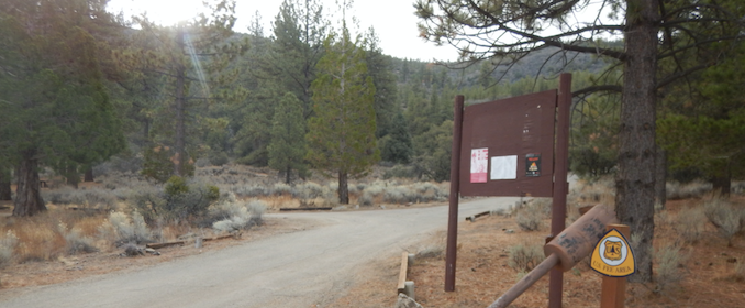
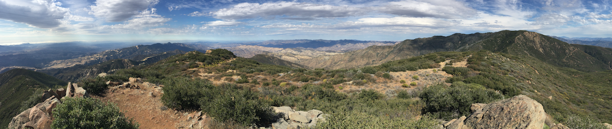
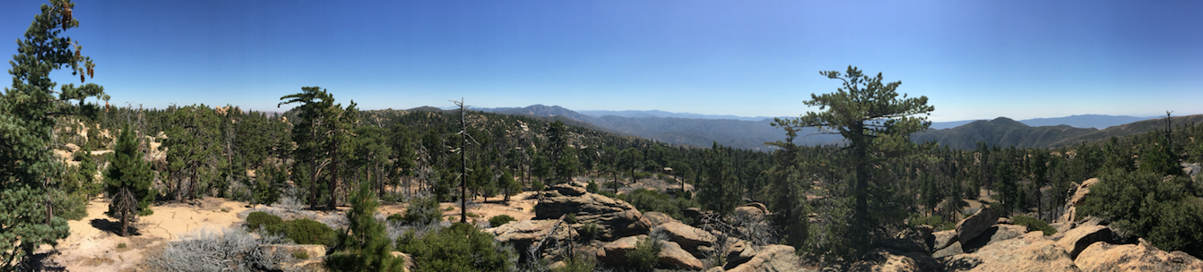
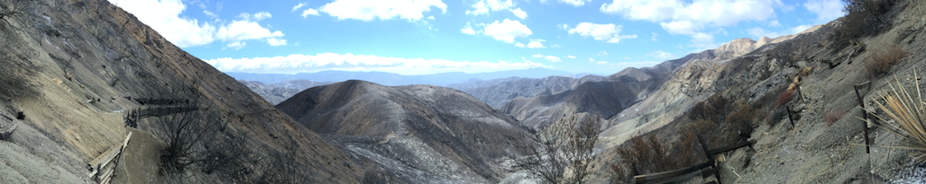
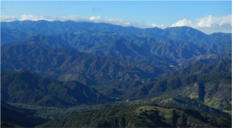
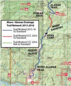
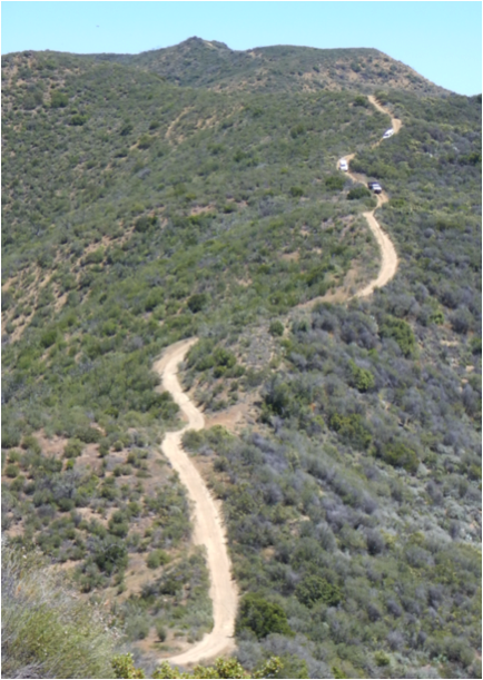
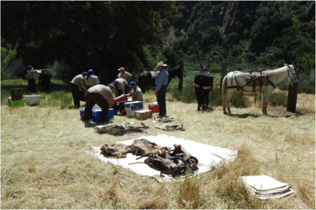
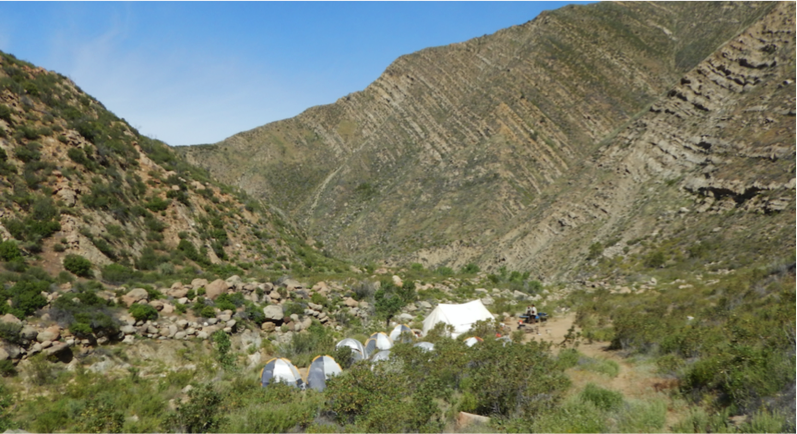
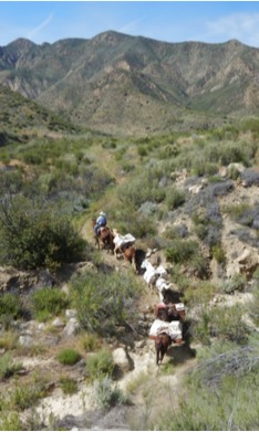
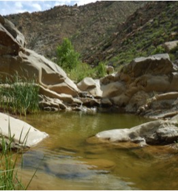
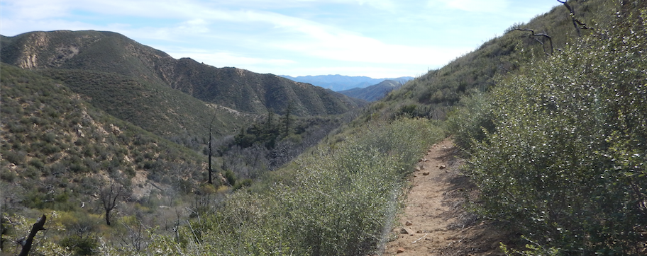
CCC Mono-Alamar Trail: Caracole Section
April 18 – May 4, 2016

cccoverview

CCC Headed Home After a Long Day Working Trail


Trail Organizations: Los Padres Forest Association, California Conservation Corps

Volunteers: Otis Calef, Richard Waller, Ed Fuentes, Kathleen Phelps, Rik Christensen, Don Jack, Bryan Conant

Trail Miles Worked: 2.86 miles

Camps & Trails Surveyed: Pie Canyon Jeepway, P-Bar Campground, Mono-Alamar Trail, Upper Mono Camp, Caracole Camp, Alamar Trail, Poplar Trail

monodrainage

Mono Drainage

Project Description: The LPFA setup, supported and managed what ended up being a two-week California Conservation Corps (CCC) project along the Caracole section of the Mono-Alamar Trail and lower portions of the Poplar and Alamar Trails.  These sections of trail were some of the hardest hit by the Zaca Fire and were in horrible shape.  The LPFA spent a two days flagging the trail ahead of time so that the CCC would have a route to follow, otherwise it would have been nearly impossible to determine where the trail went.  The CCC completed much of the trail to standard but focused primarily on opening up the trail corridor and treading along the steeper and sketchier sections of trail.  All in all it was a very successful project along a harsh, remote and overgrown section of the Los Padres Forest. The entire Mono-Alamar Trail is now stock passable.

monoalamarmap

Project Accomplishments: As part of the RIRI Zaca Restoration program, the LPFA put together a plan to restore the Mono-Alamar Trail. The Mono-Alamar was damaged in the 2007 Zaca Fire and had not received any substantial trail work since then. It had been flagged a few times but remained more of a route than a trail. The proper trail was unfindable for most of the route and as a result hikers were basically taking the path of least resistance and following the creek. The first step in the restoration of Mono-Alamar was two successful projects in Fall 2015 clearing the trail from the Mono-Alamar Trailhead to the Mono Narrows. The third scheduled project was to spike a CCC crew 1.75miles above Ogilvy Ranch and have them work the Caracole section of the Mono-Alamar Trail, which goes from Mono Narrows up to Loma Pelona and Alamar Hill. Here is the link to the pre-project photos and instructions for the CCC:

http://arcg.is/25unIWI

piecanyondescent

Steep Going, Pie Cyn Jeepway

After hours of logistical planning, we were ready to get started. First we had to get the packers out to Ogilvy Ranch, which would be the base of operations for the CCC spike. We met the packers (Kathleen Phelps, Ed Fuentes & Otis Calef) at the Mono-Alamar trailhead on the morning of April 18 and then after getting them set-off, met the CCC at P-Bar Campground. The CCC initially sent out a three-person team on April 18 to get the spike camp setup before the main crew arrived on the 19th.  After meeting at P-Bar, we drove the hour over the 4×4 Pie Canyon Jeepway before eventually getting to Ogilvy Ranch. Once at Ogilvy Ranch we rendezvoused with the packers and took a load up to the spike camp, which was 1.75miles above the Ogilvy Adobe.  The CCC team stayed at the spike camp while the packers returned to Ogilvy to camp at the upper Adobe. The next morning (4/19) the packers took a second load up to the spike camp while LPFA returned to P-Bar in order to meet the main CCC crew and escort them in to Ogilvy. Everything went as planned and the full CCC crew met the packers at Ogilvy in the early afternoon. The packers then took a third load that afternoon and after briefing the CCC crew leader on work expectations, the project was ready to roll. The next morning, the packers, the initial CCC team and LPFA left Ogilvy and returned to civilization. The CCC were supposed to be at the spike camp for 7 days.

ogilvyplane

Ze Plane, Ze Plane

Two days later, the LPFA got a phone call from the CCC indicating that there was a mixup and that a cooler of luncheon meat was accidentally sent on a different CCC hitch and that they needed to get 50lbs of meat out to the Mono-Alamar spike camp. Rather than having the CCC spend over 8hrs driving to Ogilvy, we were able to find a Santa Ynez pilot named Doug who frequently flew into Ogilvy using their private landing strip. Doug happily volunteered to fly in a cooler of luncheon meat and after having the CCC drop off the cooler at the Santa Ynez Airport, Doug flew in later that afternoon and dropped off the cooler next to the airstrip. He buzzed the CCC spike camp in order to give them a literal heads up that the food had been delivered.

ogilvypacking

Packing CCC at Ogilvy

Two days after that we received phone calls from both the CCC spike crew leader and CCC staff in SLO that there was a substantial wind storm at the spike camp and that the crew was unable to work due to high winds estimated at 60mph. They were unable to walk or negotiate creek crossings due to the high wind. After consulting with CCC staff we made the decision to evacuate the spike crew and get them out of the Mono. The crew broke down half of their camp, buried whatever food they could and returned that evening to the Ogilvy Adobe camp. The next day the CCC staff from SLO drove back to Ogilvy and were able to get the crew out of the backcountry. By Sunday April 23 the spike camp was abandoned and all work had stopped.

monospikecamp

CCC Spike Camp

cccworker

Plymale, Going Ultralite

Starting the next day, the LPFA and CCC got to work trying to figure out how to proceed with the project. We put together an plan that a smaller Santa Maria based CCC crew would head back in to the Mono spike camp that next Wednesday and pick up the work where the first SLO based crew left off. A smaller CCC crew arrived on Tuesday 4/26 and once again hiked up to the spike camp to ascertain the damage from the windstorm, unearth the buried food and setup the camp. On Wednesday 4/27 it was deja vu all over again as the packers met at the Mono-Alamar Trailhead (this time Otis Calef, Richard Waller and Rik Christensen) and after getting them set off, LPFA returned to P-Bar to meet the Santa Maria CCC crew and usher them out to Ogilvy. We once again met at the upper Ogilvy Adobe and took in one load that afternoon up to the spike camp. After once again briefing the crew leader on expectations, we packed a load of trash back to Ogilvy and settled in for the night. The next morning the packers took a final load up to the spike camp and returned along with LPFA back to the trucks and out to civilization.

monopacktrain

The Otis Pack Train

Now all the drama was done for the project* and the crews could focus on what they do best: clearing the trails. Between the two crews and over two weeks on the project they were able to work on the trail 8 days.  The goal for the week was to clear 2.86miles of trail to standard from Mono-Narrows up to the junction of the Alamar / Mono-Alamar / Poplar Trails and then work the Poplar Trail up to the bottom of Loma Pelona and work the Alamar Trail to the top of Alamar Hill. The work was completed to standard over the first 1.5miles above Mono Narrows along the Mono-Alamar Trail and the rest of the trail was cleared but does require additional tread work in order to get to standard. The crew made the correct decision to get the entire 2.86miles of trail open rather than to only get a portion of that completed to standard. It was the correct decision.  Fortunately, they were able to complete the worst section of trail called the Caracole, which is a series of winding switchbacks that climb steeply out of Mono Creek with quite a few sheer drop-offs along the way. This section was certainly not passable to stock and borderline passable for foot traffic. At the completion of the project, both Otis and Ed Fuentes were able to get their mules all the way along the 2.86miles of trail.

On Tuesday May 3 we once again met the packers (Otis Calef, Don Jack & Ed Fuentes) at the Mono-Alamar Trailhead, drove in to the Ogilvy Adobe and began a two-day, 3 load extraction of the CCC crew. All went well enough as we were able to cleanup the spike camp, get the crew out and return over the mountain to civilization once again. Quite a few twists and turns for a one-week hitch, but at the end of the project we were happy with the work completed and the Mono-Alamar Trail can be safely hiked or ridden once again.

ccccrew

CCC Trail Crew

ADDITIONAL PHOTOS

Mono-Alamar Trail: https://goo.gl/photos/o3XDYMDpYh2TPR149

 Alamar & Poplar Trail: https://goo.gl/photos/ud36DVZVDxrtkHrS9

Project Notes:

  • There was plenty of water for the CCC crew although we did see it starting to dry up between when we started and when the hitch was completed.
  • The CCC saw one other hiking group during their two combined weeks on the Mono.
  • We did fix and replace a broken trail sign post on the Ogilvy property.
  • We also did a little trail work along the Ogilvy bypass section of the Mono-Alamar.

Future Projects Needed:

  • We’ll need to send in another crew to complete the work along the upper 1/2mile of the Mono-Alamar and then the section of Alamar Trail up to Alamar Hill and the section of Poplar Trail up to the Lomas.
  • Most of that work will be grubbing out rootballs within the tread, water control structure creation and light brushing.
  • There is one large downed sycamore near Caracole Camp that the CCC could not cut with their 18” chainsaw bar. We should send in a crosscut crew or a larger saw to remove that tree.
monopool

Spike Camp Pool

Fire Updates & Major SB County Closure

Big Pine View, Dick Smith Wilderness, photo Lee Neuenschwander
bigpinesummit

Hi Everyone,

We hope you’ve got a great Labor Weekend planned ahead of you.  A couple quick fire updates today and some other odds and ends, then off to your weekend….The Soberanes Fire continues to eat up acreage on her southern journey across the Ventana Wilderness.  Today marks the start of the 7th week Soberanes has been burning (not a typo).  The fire has now burned almost 95,000 acres and remains 60% contained.  There have been some evacuation orders as fire crews continue to fight on the south western front.  Fire personnel assigned to the fire has dropped to just over 1,000.  This is down from over 5,000 a few weeks back.  You can follow more on Twitter, Big Sur Kate or Inciweb.

Just south of Soberanes is the Chimney Fire, which is now 95% contained and has burned 46,344 acres.  Chimney never burned into the Los Padres but it came real close.  You might even say that it licked the Los Padres.  More information available on the Cal Fire website.

And further south, in the Santa Barbara Backcountry is the Rey Fire.  Rey is holding tight at 32,606 acres and is 96% contained.  More information on Rey including forest road closures can be found on Twitter, Inciweb or the Forest Service website.

REY FIRE CLOSURES
Late last week the Forest Service closed a large portion of the Santa Barbara Backcountry.  This was in response to the rapid spread of the Rey Fire, the threat of additional fire and a lack of available fire resources.  See the map below for details but basically all wilderness areas within Santa Barbara County are closed.  As is much of the neighboring backcountry forest land.  This will mostly affect A-Zone South hunters who are already being impacted by the closures up in Monterey County.  There is no word as to when the SB closures will be lifted but it’s probably a good idea to stick to the beaches this weekend, road trip to the Sierras or head to SLO or Ventura Backcountry if you really need your LP fix.


Yellow hashed areas are the closures
reyclosure

Los Padres Back to School Week

Imagine back to school week at the Manzana Schoolhouse, photo James Wapotich
ManzanaSchoolhouse

It’s BACK TO SCHOOL WEEK, which might be the most universally hated week of the year.  First off, for many people it means the end of summer.  That alone could be reason for the hatred.  It also means daily rituals changing for parents, traffic patterns fluctuating around the crazy kid-drop-off schedules and the dreaded H WORD (homework).  And we’re not even talking about how teachers must feel this week.  But, for the Los Padres, Back to School Week is a slight indication that our backcountry season is not too far off into the future.  It might seem impossibly far right now, with all that’s going on with the fires, but trust me, it’ll be here before you know it.  So, in honor of Back to School Week and with backcountry season coming up soon, we wanted to focus this email on a few upcoming educational opportunities that you might want to check out.  Tis the season…….

HappyBackpackers
BACKPACKING FUNDAMENTALS CLASS
If you haven’t discovered backpacking or you’re interested in improving your gear, improving your skills, or meeting some new friends to explore the trails with this Fall; this is a great class for you to check out!  Curt Cragg is the lead instructor and brings in a wide variety of local experts to discuss all topics backpacking related with an emphasis on local Los Padres backpacking.  Topics include what and how to eat along the trail or in camp, basic trail first aid, how to avoid getting lost, what you should and shouldn’t be afraid of, the latest in gear, where you should get your gear, ultralight backpacking…. it’s all covered.  This will be Curt’s 5th time teaching the class and it’s been great watching the new backpackers hit the trail after the class and keep coming back for more.  We’ve actually gotten to know quite a few of the graduates on some of our backpacking trail maintenance projects as well.  To learn more or sign up, check it out at the link HERE.  The classes will be hosted at the Santa Barbara Botanic Garden and all proceeds go to LPFA Trail Care.


Class in session, photo Terry Wright
WheelerTeachings
WHEELER GORGE VISITOR CENTER
If you haven’t made it out to Wheeler Gorge yet this summer, there is still time!  LPFA super-volunteer and board member Gordie Hemphill continues to organize weekly interpretive events each Saturday at Wheeler Gorge Visitor Center.  Most of the talks start around 11am and cover a wide variety of topics ranging from local critters to dinosaurs to geology to trees.  The talks are designed mainly for kids and young teenagers but I promise you that there is something for everyone.  Not to mention any excuse to drive up Highway 33 is a good excuse.  Upcoming talks include:
  • August 27 – Into the Wild (Naturalists & Forester) Programs
  • September 3 – Saving the California Condor
  • September 10 – Rescuing Ocean Animals
  • September 17 – Amazing World of Bears
  • September 24 – Chumash Storytelling with Julie Tumamait

You can learn more here, or email WHEELER@LPForest.org with any questions you might have!  We hope to see you soon up at Wheeler………


REI WILDERNESS FIRST AID CLASSES
REI is teaming up with the Wilderness Medicine Institute (WMI) to offer a series of classes this Fall focused around wilderness first aid (WFA).  These two-day classes offer advanced teaching on how to handle medical emergencies when you can’t call for an ambulance.  Certainly skills that are worth having and could save a life.  The classes are at Camp Arnaz in Ventura.  REI and WMI are offering two classes, information below:

October 29-30: http://bit.ly/2bkg79H
November 12-13: http://bit.ly/2biQOmE


IndianCreekTrail
LPFA USED GEAR SALE: October 1
Now you’ve learned how to backpack, how to do wilderness first aid and how to save the Condor; the only thing left is getting some new trail gear.  The LPFA will be hosting our 2nd Annual Used Gear Sale on Saturday October 1 in Santa Barbara (location TBD).  Similar to last year, we’re collecting lightly used gear, cleaning it up and making it available for you to purchase.  Gear guru Rik Christensen is heading up the event and if it is anything like last year, you better get there early!  If you have any old gear that you’re interested in donating/selling, there is both direct sales and consignment options available.  We’d love to help take any old gear off you and make it available for someone else to use.  All sale proceeds this year will go towards the restoration of South Fork Station, Dabney Cabin and eventually the Manzana Schoolhouse.  We’ll provide more details soon.  If you have any questions, please email: INFO@LPForest.org

There’s a lot going on.  We hope to see you at some of these events and best of luck with Back to School Week!

— • — • — • —
UPCOMING EVENTS
A few upcoming dates, events, projects, presentations or things you might want to know.
If you have any forest-related events to add to this list, let us know and we’re more than happy to pimp your event!


September 10: NPLD Jesusita Trail
September 11: Island View Trail Race
September 14: LPFA Backpacking Fundamentals Class
September 20: LPFA Trail Talk Series, History of Los Padres Lookouts by Craig Carey
September 24: National Public Lands Day Trail Project, Lion Canyon Trail, Ojai


October 1: LPFA Used Gear Sale
October 16: D-13 Hunting Season Starts
October 22-30: LPFA Working Vacation, Poplar Trail (ON HOLD)
October 29: LPFA First Aid & CPR Training
October 29-30: REI Wilderness First Aid Training

November 12-13: REI Wilderness First Aid Training


Fire, Fuego, Feuer, Feu, Fuoco: Update & Restrictions

Rey Fire, Friday August 19 the Day it Got Away, photo Mike Kent
ReySunset
Hello Everyone,

Obviously the conversation these past few days, weeks and now months has been centered around the fires raging across the Los Padres.  First we had Coleman, then Sherpa, Pine, Soberanes, Rey and even the Chimney Fire is now threatening LP lands.  And this list doesn’t include the hundreds of smaller fires that we never even hear about.  I was fortunate today to attend the Rey Fire morning briefing at fire camp.  I’d never really been in a fire camp before.  The amount of organization involved in fighting a large fire is simply incredible.  There were lines of fire engines waiting to fill up at water tenders, food stations prepared to feed thousands of meals each day, crews from all over the place, what seemed like miles of tents, countless trucks color coordinated into neat sections (FS green over there, Cal Fire red that way, etc…) and all the sanitation needs from trash to porta-potties to hand washing stations.  It was part music festival, part sporting event; without the festivity and with an air of stern professionalism.  A portable city that moves around the Western US as needed and where needed with the sole purpose of stopping fires.  This was clearly not their first rodeo.


Lead pilot Doug is the man!  photo Humphrey
LeadPlaneDoug
It’s easy for those of us watching the fires from the sidelines to ‘Monday morning quarterback’ and complain about why they didn’t save our favorite campsite or how they couldn’t hold that ridge.  Trust me, I’m guilty.  But we have to remember that they are the professionals.  They are out there cutting lines in 100˚ heat.  They are flying through smoke a mere hundred feet above flames.  They are the ones balancing resources and making decisions where life is literally on the line.  A bad decision here or there could lead to injuries or potentially a city burned to the ground.  That’s heavy.  Trails can be reworked, plants (mostly) will grow back and we’ve seen animals will survive.  It sucks that we’re all dealing with fires but after today it was crystal clear that once you have a wildfire, you have to trust the process and believe in the fire crews.  This is not their first rodeo (this month).

Rey over Mono Jungle, photo Ray Ford
MonoRey

Leaving the fire camp this morning I wanted to cheer on the crews as they left to cut lines or coordinate air attacks.  I literally wanted to stand on the side of the road and cheer them on as if they were an NFL team running out of the tunnel and onto the field.  And I wanted to wave a flag that said “WHATEVER YOU DO, PLEASE SAVE ALAMAR TRAIL”.  Momentary kidding aside, thank you to everyone involved in the fire.  EVERYONE.  They say it takes a village, but in this case I can tell you it takes more than that.  It takes a city, and sometimes more than one.

— • — • — • —

If you want to follow the progress of the Chimney, Soberanes or Rey Fire, the best place is on Twitter and search for that fire.  We’ve been updating information on the LPFA Facebook page and Twitter page or you can check Inciweb as well.  There is no shortage of information out there.

— • — • — • —
Along these lines, the Los Padres Forest went into Level IV fire restrictions earlier today.  See attached PDF for more information.  Basically Level IV prohibits any campfires within the Los Padres Forest.  PERIOD.  The difference between this years restrictions and those of the past few years is that this year the use of portable stoves outside of the designated campfire use sites is also prohibited.  This means anyone venturing outside of the campfire use sites or into designated wilderness areas will be eating cold food and drinking cold drinks.  Again, see attached PDF for more details and please follow these restrictions.

— • — • — • —
UPCOMING EVENTS
A few upcoming dates, events, projects, presentations or things you might want to know.
If you have any forest-related events to add to this list, let us know and we’re more than happy to pimp your event!


September 10: NPLD Jesusita Trail, Santa Barbara Frontcountry
September 11: Island View Trail Race, Franklin Trail, Carpinteria
September 14: LPFA Backpacking Fundamentals Class
September 20: LPFA Trail Talk Series, History of Los Padres Lookouts by Craig Carey
September 24: National Public Lands Day Trail Project, Lion Canyon Trail, Ojai


October 1: LPFA Used Gear Sale
October 16: D-13 Hunting Season Starts
October 22-30: LPFA Working Vacation, Poplar Trail (ON HOLD)
October 29: LPFA First Aid & CPR Training

What Dog Days?: Madulce Trail Project, Soberanes and much much more…….

Madulce Peak & Trail
MadulceTrail
Hi Everyone – Happy Thursday,

Even though we’re in the dog days of summer, there is no shortage of activity across the Los Padres.  We’ve got a jam-packed email focusing on many of the events and incidents within the LP; lets get to it!  If there is anything missing or you’d like included in future emails, please let us know……..

MADULCE TRAIL PROJECT
The LPFA is leading a trail project along the Madulce Trail in the Dick Smith Wilderness on the weekend of August 12-14.  We’ll be driving in to Alamar Saddle and setting up basecamp at Alamar Camp.  It will be a car-camping trip with a short drive up to the Madulce Trail to work both Friday afternoon and Saturday.  The work will be mainly logging and tread work along the top 2 miles of the Madulce Trail.  The work site is around 6,000ft, on the north side of Madulce Peak and mostly shaded by pine trees.  It should be a good location for working even in hotter temperatures.  Mike Smith is the project lead and we’re hoping for 15-20 volunteers.  Food and tools will be provided by the LPFA.  It’s going to be a great time and a nice opportunity to get into the backcountry to help any NDD issues you might be suffering from.  If you are interested in joining please email INFO@LPForest.org or check Facebook or Meetup for more details.  Hope to see you there………

Soberanes Fire – August 4, MappingSupport.com

Soberanes160804
SOBERANES FIRE
Quick update on Soberanes in the Monterey Ranger District.  The fire continues to grow and is primarily burning south into the Los Padres and Ventana Wilderness.  The fire has currently burned 51,000 acres and is 27% contained.  The FS just issued a new closure order, see attached PDF map for details.  The cause of the fire was revealed yesterday as being an illegal campfire in Garrapata State Park.  Twitter remains the best source for up-to-the-second information and Inciweb is the place for official information related to the fire.  There is some good news and bad news that also surfaced this week.  Good news is that there is a large-scale weather change in the forecast that will bring higher humidity and cooler temperatures to the area starting this weekend.  That will help.  The bad news is that fire personnel have been mentioning that Soberanes has the potential to burn over 170,000 acres before it’s all said and done.  The steep terrain and inaccessible country that we all love about the Ventana is making constructing fire lines virtually impossible.  Everything to the immediate south of the current fire perimeter is within wilderness, which means that very few man-made structures are at risk.  Mix in the cost and safety concerns associated with fighting fire in the difficult to access portions of the Ventana and it appears that the current strategy might be to construct fire lines around much of the Ventana and let the backcountry burn inside those fire lines.  This is the same approach that was used in the 2007 Zaca Fire.  If you look at the image above, red indicates the current fire perimeter and the blue lines are the projected fire lines.  We’ll keep you posted as the fire progresses and lets all be sure to thank the fire and support crews and wish them the best of luck as they continue to get the upper hand on Soberanes.

FOREST 411
Reyes Peak (aka Pine Mtn) Road has reopened in the Ventura Backcountry.  Along with the road reopening both Pine Mtn and Reyes Peak Campgrounds have also been reopened.  Note: Reyes Peak Trail towards Haddock remains closed as does the Piedra Blanca Trail between Upper Reyes and Pine Mtn Lodge.  These closures were a result of last months Pine Fire.

• The Los Padres National Forest is hiring within the Wildland Firefighter Apprenticeship Program.  Interested candidates can apply at www.USAJobs.gov starting 8/11 – 8/25.  Additional information available here.

SLO based VWR’s Bill and Sandy Obermeyer, Debbie and Ron York & Ashley and Joe Dillard
worked the access road for Rinconada Trailhead making it drivable for equestrian trailers once again.  A+!
RangerBill
UPCOMING EVENTS
A few upcoming dates, events, projects, presentations or things you might want to know.
If you have any forest-related events to add to this list, let us know and we’re more than happy to pimp your event!


August 7: West Fork Cold Spring Trail Maintenance, SBMTV, Santa Barbara Frontcountry
August 11: Santa Ynez Valley Historic Museum, Chumash Trails
August 12-14: LPFA Madulce Trail Sawyer Project
August 13: A-Zone South Hunting Season Starts

September 8: Santa Ynez Valley Historic Museum, Walking El Camino Real
September 11: Island View Trail Race
September 14: LPFA Backpacking Fundamentals Class
September 20: LPFA Trail Talk Series, History of Los Padres Lookouts by Craig Carey
September 24: National Public Lands Day Trail Project, Lion Canyon Trail, Ojai

October 13: Santa Ynez Valley Historic Museum, Rangers of the San Rafael Wilderness
October 16: D-13 Hunting Season Starts
October 22: LPFA Used Gear Sale
October 29: LPFA First Aid & CPR Training