Los Padres Fire Restrictions & Lots of Good News

“Because in the end, you won’t remember the time you spent working in the office or mowing your lawn. Climb that ____ mountain.” – Jack Kerouac
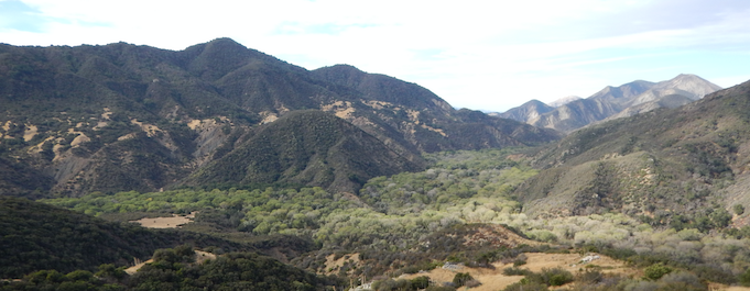
Black Canyon of the Los Padres, November 2019, photo M. Wallace

Hello Friends,

The big forest news this past week was the Forest Service announcing that the Los Padres is going into Extreme Fire Danger restrictions until at least December 31, 2019.  We’ve all seen the recent devastating wildfires across California.  The raised restrictions are intended to help prevent similar wildfires here in the Los Padres.  Under Extreme Fire Danger restrictions:

  1. Wood and charcoal fires are prohibited in all areas of the Los Padres Forest.
  2. Camping stoves are allowed only within Designated Campfire Use Sites and with a California Campfire Permit.
  3. No camp stoves are permitted outside of the Designated Campfire Use Sites, meaning no camp stoves in the backcountry.
  4. No smoking outside of a Designated Campfire Use Site or inside an enclosed vehicle or building.

That being said, current conditions across the Los Padres are prime for hiking, exploring, riding, backpacking and/or wandering.  While the idea of camping without a fire or backpacking without a stove might sound unpleasant, give it a shot and you might end up liking the weight savings, extra sleep or simplicity that “cold camping” provides.  There’s an old saying that challenges are opportunities for improvement or when life gives you lemons make lemonade.  With that in mind, here are a few tips you can try in order to turn your fire’less camping into a safe, fun and memorable camping experience:

The weather has been great, there’s still good water in the usual good water places and remember that HikeLosPadres.com has lots of current camp and trail condition reports to help with your trip planning.  Regardless of fire or stove, we hope you find some time over the coming weeks to visit your favorite trail, check out that hidden canyon you’ve always wanted explore or grab a friend and seek out those fall Los Padres colors.

— • — • — • —

2020 LOS PADRES CALENDAR

The LPFA will once again publish a wall calendar for 2020 featuring the vistas, mountains, waterfalls and plants/animals we love from across the Los Padres. This will be our 8th year organizing LP calendars and we are looking for photos from you to include within the calendar. The calendars should print in early December and be ready in time for the holidays. If we use one of your photos, we’ll of course credit you within the calendar and also send you a calendar to hang up in your kitchen, gear nook or office. The calendars will be available online as well as at your local LP Ranger Station or Visitor Center.

If you have a photo you’d like to submit, please email INFO@LPForest.org or you can check the link below for more information. Thanks in advance and looking forward to hearing from some of you soon…..

https://lpforest.org/2020-los-padres-calendar/

— • — • — • —

Grapevine Sunrise & Moonset, LPFA Working Vacation, October 2019

FOREST 411

• Over the past month sections of the following Los Padres trails have been maintained by the Forest Service or your friendly neighborhood trail group: Madulce Peak Trail, Big Pine Spring Camp Trail, Deal Connector, Rancho Nuevo Trail, Matilija Falls Trail, Pine Ridge Trail, Arroyo Burro Trail, Santa Cruz Trail, Gridley Trail, Camuesa Connector Trail, Cold Spring Trail, Hot Springs Trail, Romero Trail, San Ysidro Trail, Baron Trail, Fishbowls Trail, Jesusita Trail, Tunnel Trail, Cedar Creek Trail, Grapevine Trail, Sisquoc Trail, Big Cone Spruce Trail and Matilija Trail.

• As we approach the rainy season expect to see some of the gates across the Los Padres swing shut due to the seasonal gate closure regulations.  We’ve not heard of any closures as of yet but all the Ojai area gates will close by December 15 and the other gates should shut as storms begin approach.  If you’re heading out to a trailhead and you’re unsure if the gate might be open or closed, we strongly suggest contacting the local Ranger District before you head out.  We’ll keep you posted as gates start to shut.

• For those of you who hike the far Southern Los Padres or plan on doing the Condor Trail, we’ve heard a rumor that the Pothole and Agua Blanca Trailhead will be moving before the end of the year from the Lake Piru Campground to right next to the start of the Pothole Trail.  This will mean that the public will be able to drive all the way to the start of the Pothole Trail rather than having to walk miles along the paved Piru Lake Road.  The plan to move the trailhead has been in the works for a few years now but it’s looking like it might actually happen by late 2019.  We’ll keep everyone posted on this as well.  This will be terrific……

More Condor Trail, it was announced earlier this week that 800 acres of the Trout Creek properties above Arroyo Grande were transferred from the Wilderness Land Trust to the Los Padres Forest.  The Trout Creek properties were purchased by the Wilderness Land Trust earlier this year from private sellers and as a result are now protected for public enjoyment.  The Condor Trail passes through Trout Creek.

• Speaking of condors, the population of California condors has now surpassed 100 across the central California region.

• CalTrans announced that they will continue the preemptive closure of Hwy 1 during large storm events for the 2019-2020 winter season.  The closures will be south of Big Sur, keep this in mind if you have plans to visit the area over the winter months.

• Speaking of Big Sur, the Ventana Wilderness Alliance has been working hard to reopen the Los Padres portion of the famed Pine Ridge Trail.  They have trail crews scheduled to work the trail for much of the fall and again starting back up next spring.  Three cheers – hip hip hooray for VWA!  In the meantime we want to remind everyone that the Pine Ridge Trail remains closed to the public due to dangerous trail conditions.  If all goes according to plan, the PRT should reopen sometime in the next year or two.  We’ll keep you posted…..

• And speaking of awesome people doing awesome things for our trails, the 5th Annual Turkey Trot fundraiser for the Franklin Trail successfully launched earlier this month.  The Franklin Turkey Trot is an excellent example of trail lovers finding creative ways to support the trails they love most. Very cool……

• For years and years people have been enjoying the famed mountain biking trails along West Cuesta Ridge in San Luis Obispo.  While the trails were in good shape and frequently used, they were never officially part of the Forest Service inventory of System Trails and as such were technically illegal trails.  Thanks to the local SLO trail community and the Forest Service working together, the NEPA process has begun to adopt and legalize many of these West Cuesta trails.  The Forest Service is accepting comments regarding the West Cuesta Trails through November 24.  Click here for more details.  This is a terrific example of the FS and the trail community working together towards a mutually beneficial goal.  Cheers again!

• The Forest Service issued a forest order on October 22 to close Dry Canyon and Dome Springs Campground in the Mt. Pinos Ranger District due to potential live explosives and artillery.  Read more here and closure map here.

Dave Weaver Award Winners (L to R): Mickey McTigue, Jasonn Beckstrand, Otis Calef, Mike Smith. Missing from the photo are Rik Christensen and Bob Burtness
Photo Dan Najera

• LPFA President Jasonn Beckstrand was recognized earlier this month as the 2019 winner of the coveted Dave Weaver Wilderness Award.  The Dave Weaver Award is named in honor of the late Dave Weaver who helped start the Volunteer Wilderness Ranger Program here in the Los Padres Forest.  Dave was a huge advocate for volunteers working with the Forest Service to accomplish mutual goals. Dave’s spirit lives on in so much of what we do across the Los padres and his award is given annually as a lifetime achievement for outstanding Los Padres volunteers.  Jasonn is the 6th award winner joining Rik Christensen (2014), Mickey McTigue (2015), Mike Smith (2016), Bob Burtness (2017) and Otis Calef (2018).

— • — • — • —

The Infamous Devil’s Slide, Upper Sisquoc Trail
Recently restored by the LPFA Trail Crew and LPFA Volunteers as part of a NFWF Trail Grant, photo J. Morris

RIP Madulce and D13 Kick Off

Madulce Cabin, circa 1983, photo Eldon Walker

Hello Friends,

20 years ago today (Oct 11, 1999) the Madulce Cabin was tragically burned to the ground as a result of either an accidental burning or arson (click here for more of the history).  The historic Madulce Cabin site is located in the heart of the Santa Barbara Backcountry, within the Dick Smith Wilderness and has a rich history dating back long before the Los Padres was known as the Los Padres. Before going up in flames, the much beloved Madulce Cabin was open to the public for shelter during bad weather or to briefly relive times long gone when forest rangers lived in cabins, stations and lookout towers across the Los Padres. It’s hard to imagine how different the forest must have been back then. Phone lines stretching across the mountains, connecting stations with fire lookouts and horse mounted rangers regularly patrolling the backcountry. Allow yourself to dream of how immaculate the trails must have been back then? Insert dream……. Times have changed, for better or worse, and the idea of phones across the mountains might not sound so good these days but back then it must have been a sight to behold. The Madulce Cabin site remains on the National Register of Historic Places but without the cabin it’s hard to recreate the feeling of what this site must have felt like during its heyday. There was some talk a few years back of trying to rebuild the Madulce Cabin. Local backcountry historians drafted a blueprint of the cabin and had secured private funding to rebuild an exact replica of the Madulce Cabin. Yet the story goes that due to modern Wilderness regulations the Forest Service was not able to permit the rebuilding of the Madulce Cabin. Pros and cons…..

In recent years, Madulce has been the location of quite a few LPFA trail projects and Working Vacations and remains a fantastic place to visit for backpackers or horse/mule packers. The area was mostly burned in the 2007 Zaca Fire but a few mature cedars and pines are still standing next to the cabin site. The horse corral remains along with some other remnants of the cabin era. Times change and perhaps one day a replica of the cabin can be rebuilt at Madulce to once again aid backcountry travelers. Maybe people will again seek refuge from snow storms inside the cabin and wait out the weather next to the wood burning stove. Then again, maybe not. Either way, today we look back at 20 years ago when the Madulce Cabin burned to the ground and along with it a treasured part of Los Padres history.  Lets hope that even without the cabin the memory and history will live on at least another 20 years too…..

— • — • — • —

Doe a Deer D13, Summer 2019

D13 DEER SEASON

The general deer hunting season in Zone D13 starts this weekend October 12 and lasts through November 10. Within the Los Padres, D13 covers the Mt Pinos Ranger District east of Hwy 33 and the Ojai District north and east of Sespe Creek. Expect to see a lot more activity within D13 over the next month and in particular this long holiday weekend. If you aren’t planning on hunting, you may want to choose a different location for your LP adventures this weekend and over the coming few weeks.  Be safe, tread lightly, remember fire restrictions and good luck……

— • — • — • —

National Public Lands Day Volunteers on Lion Canyon, photo Josephine Liu

FOREST 411

• While wildfire season is now a 12 month endeavor, we’ve got some “fire weather” headed our way over the coming days that include red flag warnings and potential preemptive power outages.  Be safe.

• There have been a few smaller wildfires within the Los Padres over the past month including the October 1 Ranch Fire (55 acres) near Pozo and the September 21 Lopez Fire (220 acres) outside of Arroyo Grande. The Lopez Fire was started by an improperly extinguished campfire.  Please, even if you are in a designated campfire use site, always remember to properly extinguish your campfire, it’s not worth doing it half ash. Like that?  It’s an original.  Royalties?

• Lastly, regarding wildfires, there were a couple articles recently written and a podcast related to the Los Padres and wildfires.  Check out History of Wildfires in Big Sur, an Outside Magazine Podcast about defending your home from wildfire and a LA Times piece discussing fuel breaks as related to the Thomas Fire. 

• Last month SLO based super meteorologist John Lindsey scientifically prophesied that “we could see lower than average amounts of rainfall in California this winter“.  And so the prediction game begins.  In the past we’ve heard weather predictions ranging from acorn droppings to ant activity but Mr. Lindsey is a living legend and a genius when it comes to weather.  We’ll see what happens…..  What do you predict?

• Over the past month sections of the following Los Padres trails have been maintained by your friendly neighborhood trail groups and the Forest Service: Lion Canyon Trail, Sisquoc Trail, Tunnel Trail, Jesusita Trail, West Fork Cold Spring Trail, Romero Trail, San Ysidro Trail, Franklin Trail, Pine Ridge Trail, Potrero John Trail, Reyes Peak Trail

• Big thanks to volunteers from Southern California Edison who showed up at toasty Dough Flat on a late July Saturday to help clean up the trailhead, paint the bathrooms, install signs and spend a little time clearing the trail up to the Condor Observation Point.  Thanks also to United Trail Maintainers of California for providing the trailhead sign and the Forest Service for the support!

What’s the opposite of a power outage? SCE volunteers bringing it!

Two more steel debris flow nets are being installed above Montecito on San Ysidro and Buena Vista creeks.  These two new nets will bring the total nets installed to sixNote that the information on the link is out of date.

• Here’s an feel-good story about some stranded hikers along the Arroyo Seco who were unable to reach the Police and cleverly used a message in bottle in order to get help.

• The Los Padres Forest and Ventana Wilderness Alliance will be moving forward with a trail reroute along the Pine Ridge Trail.  The PRT was damaged during the 2016 Soberanes Fire and subsequent 2017 storms to the extent that a reroute is needed near Barlow Camp.  No date has been set as to when the trail may reopen but hopefully sometime within the next year. Stay tuned…..

• Late last month the State Water Resources Control Board voted that more water needs to be released from Cachuma Lake in order to support the steelhead population.

• Super Volunteers, friends of the LPFA and Gossamer Gear ambassadors Rik and Paul were featured this past month in a Gossamer Gear profile series, click link above.  We know Rik and Paul really well, they are the main driving force behind so much good stuff across the forest including the LPFA Used Gear Sale, but it’s always cool seeing their influence extend beyond the Los Padres.  Great work guys!

• LPFA supporter and friend of the forest Kevin Cody has started a Facebook fundraiser on behalf of the LPFA.  We’ve known Kevin for many years and over that time he’s become somewhat famous for his dedication to keeping the forest litter free.  In particular he has a hatred of stray helium balloons.  It is not uncommon to be running or hiking with Kevin and then all of a sudden see him swimming through brush or scaling hillsides to retrieve that stray helium balloon that happened to plunge down in the Los Padres.  We’re willing to bet that no one has recovered more lost helium balloons than Kevin has.  Setting a great example Kevin and thanks for the additional support.  Happy Birthday!  If you’d like to support Kevin’s fundraiser, click here.

— • — • — • —

Kevin Cody doing what he does, days deep in the Caliente Drainage

Opening Soberanes – Get Your 2018 Calendar!

Mid-Fall Colors, Mono Jungle, November 2017
Hello Friends,

It is fall and the weather is changing.  These past few weeks we’ve seen our Los Padres autumn colors coming in, temps are cooling quickly and we’ve even had a few early season storms knock back the summer dust and in some places ash from the 2017 wildfire season.  While we haven’t seen a whole lot of rain up and down the forest, most of the Northern Los Padres has received over an inch of rain with select locations closing in on 2 inches.  Many of the creeks are starting to flow again as the riparian trees settle into their winter dormancy cycle and the trails are ripe for exploring.  Hope you get out there soon and be sure to check the latest conditions of your favorite trail or camp at HikeLosPadres and share your experiences after you get back.

— • — • — • —


Highway 1 at Carmel River, Sign Slightly Modified

BIG SUR & MONTEREY OPENING UP
In case you’ve missed the last few episodes, there have been some recent developments in the never-ending epic saga: The Sometimes Island of Big Sur.  As you should know, access to Big Sur and the Monterey Backcountry has been severely limited over the past 17 months due to the 2016 Soberanes Fire followed by 2017 winter storm damage.  After many months of being isolated and/or closed, the area is slowly opening back up:


THE ROADS

• The first domino to fall was the October reopening of the Pfeiffer Canyon Bridge, which amazingly reopened after only 7 months of being closed (BIG round of applause to all involved).  The reopening of the Pfeiffer Bridge once again allowed vehicles to travel between Big Sur and Monterey along Hwy 1.
• Unfortunately, Hwy 1 still doesn’t connect with San Luis Obispo due to the Mud Creek slide in Southern Monterey County.  Mud Creek remains closed between Gorda and the Salmon Creek Guard Station.  Crews continue to work on the slide but Hwy 1 at Mud Creek is expected to remain closed throughout the winter and most likely until summer 2018.
• Access to Bottcher’s Gap Campground and trailhead remains closed as work continues along Palo Colorado Road.
• All other normal public forest access roads should be open across the Monterey Ranger District.  This includes Nacimiento Fergusson, Tassajara, Sycamore Canyon and South Coast Ridge Road.  That being said, this time of year storm closures should be expected so be sure to contact the FS if you have any questions or need clarification.

Western Pine Ridge Trail Remains Closed

THE FOREST

• Effective November 9, the Soberanes Fire closure was adjusted re-opening most of the Monterey Ranger District and Ventana Wilderness areas.  This is good news!
• That being said, it’s not all rainbows and moonbeams just yet.  There was substantial fire damage along the very popular Pine Ridge Trail and as a result the Pine Ridge Trail between Big Sur Station and Redwood Camp remains closed indefinitely.  This includes Sykes, Barlow Flat, Terrace Creek, Ventana Camp, Redwood Camp, Ventana Camp Trail and the Terrace Creek Trail.  There is no established timeframe as to when these camps/trails will reopen.  Patience is the word of the day and hopefully more information on a reopening date will surface in the coming weeks.
• You can view the closer order here and a map of the closure here.
• There are likely quite a few trails within the Soberanes Fire perimeter that have not been properly surveyed.  Be careful if you’re out there and please take photos of any trail slides or downed trees and share them with either the Forest Service, Ventana Wilderness Alliance or post on HikeLosPadres.com.  The more information that is shared, the sooner the trail issues can be resolved.  Thanks…..

— • — • — • —
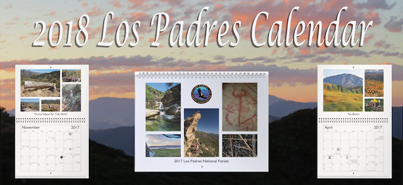
2018 LOS PADRES WALL CALENDAR
For the 3rd year in a row the LPFA will be putting together a Los Padres themed wall calendar!  They’ve been a huge hit and we’re excited to work again this year to collect and compile great photos from across the LP featuring vistas, favorite trails, waterfalls, wildlife, camps and more……  And we can use your help!

Once again, if you have a great LP photo you’d like to share that you think would make a good addition to the calendar, please send it our way and if we use it we’ll send you a free calendar.  All photos will only be used for the calendar and your name will be credited on the month that the photo is used.  We’ve done this the past two years and it’s been a lot of fun seeing the great photos submitted by you and incorporating them into the themed calendar.

Photos should be sent to INFO@LPForest.org and feel free to contact us with any questions you might have. 

You can also pre-order the calendar for $15.00 at the following link: https://lpforest.org/2018-los-padres-calendar/  We plan on having the calendar printed and shipped by mid-December, just in time to stuff the stocking of your favorite Los Padres adventurer!  Happy Holidays…….

— • — • — • —

“Has anyone seen the bridge?” – Newly re-built Pfeiffer Canyon Bridge

Fires, Hunting Season, Volunteer Opportunities, 411

 Whittier’s Final Gasp
FIRE FOREST & RESTRICTIONS

It’s been a fiery few weeks around the Los Padres.  It seems like wildfires are popping up just about every day but thanks to the excellent fire crews most of them haven’t developed into much.  That being said, we’ve had quite a few significant fires that have grown large enough to garner incident names and/or attention:

  • We had Hudson, in the eastern Cuyama, that didn’t get onto the Los Padres but burned just over 1,000 acres.
  • There were a series of seven fires in Santa Paula Canyon that burned 35 acres and has caused the closure of the popular Santa Paula Canyon Trail.
  • The biggest has been the Alamo Fire, which burned over 28,000 acres.  It also didn’t get onto LP soil but came really really close and caused multiple forest access closures.
  • And of course the Whittier Fire, which has burned over 18,000 acres, mostly within the Los Padres and remains 87% contained.  Tragically, 16 residences were destroyed at the hands of Whittier and a Forest Closure remains enforced across the Western Santa Ynez Mountains.

In response to the increase in fire activity, the Los Padres National Forest went into Level III Fire Restrictions effective July 17.  You can read all about it here.  The largest change in this order is the banning of target shooting across the Los Padres.

Summer is a tough time in the Los Padres.  Temperatures are really high across most of the forest and water is becoming scarce.  If you’ve got the itch to get into the forest please be careful and plan on doing most of your moving either early or late……..

A-ZONE SOUTH: August 12
Now, that being said, early August is also one of the busiest times in the Los Padres as A-Zone South deer (rifle) season kicks off.  This years general season goes from August 12 – September 24.  You can see on the map that A-Zone South includes just about all of the Los Padres.  If you are a hunter, have at it, be safe and responsible.  If you are not a hunter, you may want to pick your forest endeavors carefully, especially on weekends.  Be prepared to see more activity than usual along forest roads and at campgrounds and leave your antler hat at home.  If you have any questions, please contact your local Ranger District.
— • — • — • —


Four Fingers View, Channel Islands, Madulce Trail

MADULCE TRAIL PROJECT: August 4-6

In case you need a Los Padres Fix for your NDD or more likely your TWDD (Trail Work Deficit Disorder), the LPFA will be squeezing in a trail project August 4-6 along the Madulce Trail in the Dick Smith Wilderness.  Led by Mike Smith, we’ll be working the top mile of the trail from the Buckhorn Road out to the junction with the Madulce Peak Lookout Trail.  Most of the focus will be fixing tread and broken cribwalls on the north slope of the ridge, which in conjunction with the 5,500ft elevation should mean cooler temperatures.  We’ll be driving in from Santa Barbara Canyon and base-camping at nearby Alamar Camp.  If you’ve never been to Alamar or this part of the forest, it is spectacular and a real treat to be able to drive in 2 hours what normally takes 2 days to backpack.  As usual all food and tools will be provided for the volunteers.  If you have any questions or would like to sign-up, please let us know: INFO@LPForest.org

— • — • — • —

Colorful History, Mono Debris Dam

FOREST 411

• Got plans this weekend?  If not, throw the kids in the family roadster and head out tomorrow to Wheeler Gorge Visitor Center to see the Humane Society of Ventura County give a presentation at 11am.  The coolest thing about the Humane Society is that you never quite know what animals they’ll show up with.  They might have a blind corn snake?  They might come with dogs performing tricks?  Maybe a goat?  You never know….  But one thing for sure is that your kids will love it and spend the entire drive home begging you to adopt a cat or a mouse or an iguana.  No thanks needed.  See you tomorrow!

• Were you around 25 years ago?  Does June 19, 1992 mean anything?  It should, that was the day the Los Padres Condor and River Protection Act was signed adding more than 400,000 acres of wilderness and 80 miles of Wild and Scenic Rivers to the Los Padres National Forest.  This included the creation of the Silver Peak, Sespe, Matilija, Garcia and Chumash Wildernesses as well as additional land added to both the San Rafael and Ventana Wildernesses.  That was quite a day, cheers to June 19!

• This week also marks the one-year anniversary of the Soberanes Fire, which burned from July 22, 2016 well into the winter months.  Soberanes consumed over 130,000 acres, destroyed dozens of homes and took the life of a dozer operator working on the fire.  Even a year later, we’re still reeling from Soberanes with road closures and forest closures continuing to impact life in and around Big Sur and the Ventana Wilderness.  More updates next time around….

• A press release was issued earlier this month about the continued closure of Hi Mountain Road in SLO County.  Hi Mtn Rd is an unpaved road that connects Arroyo Grande with Pozo going through both SLO County and Los Padres land.  It leads to a variety of recreational activities and campgrounds but remains closed as SLO and the LP work out an agreement on road maintenance.  The attached PDF tells the story better than we can.  Note that Hi Valley Road remains closed from the first gate down next to the creek coming up from Arroyo Grande out to Pozo.

— • — • — • —

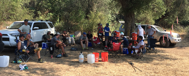
Taking it Easy, LPFA Flume Chute Aid Station, SBER 2017

LOS PADRES Concessionaire Changes & More……

Chuchupate Camp, Showing Signs of Changechuchupatecamp
LOS PADRES CONCESSIONAIRE CHANGES

Big changes within the Los Padres are upon us, perhaps you’ve heard, if not, then brace yourself… For the past three decades the Los Padres National Forest has relied on as many as six different privately run concessionaires to help manage some of the campgrounds, day use areas and trailheads around the forest. You’ve seen these concessionaires at the campgrounds along Paradise Road, at Wheeler Gorge Campground, McGill, Bottcher’s Gap, Cerro Alto, Kirk Creek, etc, the list goes on and on. In an effort to consolidate these concessionaires, the Forest Service has selected Parks Management Company to become the sole concessionaire across the Los Padres. This went into effect November 1.

Yet, in addition to taking over the existing concessionaire operations and as part of their new agreement with the Los Padres, Parks Management will be adding quite a few new recreation sites to their list of concessionaire sites. This is where it gets a little painful, as some of the sites you’ve been using for free or as part of the Adventure Pass program are now going to be managed by Parks Management and will cost quite a bit more to use than in the past. Campgrounds like NIRA, Pine Mtn and Chuchupate, that used to accept a $5 Adventure Pass, are now going to charge $20/night. And certain trailheads like Upper Oso and NIRA, which also used to either require a $5 Adventure Pass or were free, are now going to cost $10/day to park. Ouch.

We’ve met with the FS and Parks Management multiple times expressing our concerns and hearing their sides of the concessionaire triangle. We all know how rundown some of the campgrounds are and we hear about how the Forest Service budget has been cut by 50% over the past decade. Like it or not, the FS doesn’t have the capacity to adequately manage all the recreation sites across the forest. As it was explained to us: with the current budget, it’s either accept a broader concessionaire program or run the risk of losing those recreation sites altogether. It’s a depressing situation and we’re not sure anyone knows a perfect solution.

While these price increases are going to be a tough blow for those of us who regularly use the forest, we’re already starting to see improvements at many of the campgrounds across the forest. These improvements include freshly painted bathrooms, new campfire rings, brush removal around campgrounds, new tables, etc…. For only being two weeks into their new agreement, it appears Park Management is headed in the right direction. Lets hope they keep it up.

One of the downsides of the new concessionaire plan is that it’s caused quite a bit of confusion trying to figure out which campsites require which permit. In order to help, we’ve created a GoogleDoc spreadsheet listing all the recreation sites mentioned in the concessionaire change documentation. We’ve listed all the sites, what the previous regulations were, previous costs and then what the current regulations/costs are:

Click here and you can sort through and check out the sites that most interest you.

As you will see, there is a lot of change. Most of it translates to more cost for the forest-user but hidden in the new program are some good changes as well. Some additional tidbits:

  • Parks Management will sell a $50 annual day use pass that is good across the forest.
  • The Adventure Pass remains in effect at select sites, see GoogleDoc.
  • Parks Management will provide 50% campground discounts with the America the Beautiful annual passes.
  • Many of the Parks Management campgrounds will be available for online reservation but they will keep some first-come-first-serve sites within the campgrounds as well.

As mentioned, this change went into effect November 1 and Parks Management expects it to take a few months in order to get all the iron rangers installed and signage changed across the forest. It’s going to be a tough pill to swallow, especially as we all learn what exactly this means and what the long-term ramifications are of this program. Lets hope that this is a positive in the long run.

— • — • — • —

Autumn Super Moon, photo Humphreysupermoon

CURRENT CONDITIONS

It’s been a minute since we sent out a forest update.  Amazingly, quite a few of you missed the update and checked in asking if everyone was going okay.  The answer is YES, things are great, just a little too busy the past month to put one of these emails together.  Since it has been a while, we wanted to send out an update on the current conditions, closures and restrictions across the LP.

LEVEL IV FIRE RESTRICTIONS
The forest remains in Level IV fire restrictions, which means no campfires, no target shooting and no stoves outside of designated campfire use sites.  You can see the restriction order here.  While the forest has received some substantial rain this season, the fire restrictions are generally not lifted until the entire forest receives at least two inches of rain.  Last year the restrictions were not lifted until early January.  There are rumors that the restrictions may be downgraded to allow portable camp stoves in the backcountry, if anything changes we’ll let everyone know.

SOBERANES FIRE CLOSURE
The Soberanes Fire burned over 130,000 acres across Monterey County from July 22 until October 22.  Soberanes ended costing more to fight than any fire in US history.  In response to the fire, the Forest Service closed the Monterey Ranger District on September 2 and that closure remains in effect.  While the Soberanes Fire is 100% contained, it continues to burn and smolder within the fire perimeter.  No news on when the closure will be modified but we expect the fire perimeter to remain closed at least until the end of next spring.  We’ll keep you posted……  In the meantime some of the campgrounds along the Big Sur Coast have reopened.  The Forest Campgrounds off Hwy 1 are open as well as Andrew Molera State Park.  If you’re planning a trip through Big Sur, be sure to check on campground availability before you hit the road.

SANTA LUCIA RANGER DISTRICT
Many of the roads and recreation sites around Figueroa Mountain remain closed due to hazard trees.  Fig was hit perhaps harder than anywhere else in the Los Padres by the drought and subsequent beetle infestation.  Take a look at Figuera Mountain next time you’re in the Santa Ynez Valley and you can clearly see the swath of brown dead trees.  The closure includes Catway Road, Figueroa Lookout, Pino Alto, Cumbre and East Pinery Road.  You can read more here.

SANTA BARBARA RANGER DISTRICT
The Rey Fire perimeter remains closed within the SBRD.  This includes all trails up the Buckhorn Rd above Upper Oso Campground as well as the burn areas accessed from the Indian-Mono Trailhead near Mono Campground.  While there might be some minor adjustments in the closure order, we do expect the Buckhorn Road and trails to remain closed to hikers, OHV and mountain bikers at least through the winter.  Stay tuned.

Also in the SBRD we have remaining closures as a result of the June Sherpa Fire.  The closure mostly affects West Camino Cielo.

OJAI & MT PINOS RANGER DISTRICTS
Recurring theme, the Pine Fire closure from earlier this summer remains in effect.  The closure specifically affects the Reyes Peak Trail and the Piedra Blanca Trail between Upper Reyes Creek and Pine Mtn Lodge.  The Forest Service has been busy installing warning signs where the trails enter the burn area.  While warning signs might indicate that people will soon be allowed into the burn area, no dates have been announced when the closure will be lifted.  Hang tight……

The Ojai Ranger District announced their seasonal road closure schedule.  This year the gates to Dough Flat (at Tar Creek), Reyes Peak (Pine Mtn), Cherry Creek and Nordhoff Ridge will close on December 16.  The Pines Campground above Ojai remains closed due to hazard trees.

Mt Pinos District is doing something a little different this year and will be locking gates along their seasonal roads based on rain events rather than specific dates.  The gates will close after the first large rain.  This is a great approach and I’m sure most of us reading this are happy to hear about the change in policy.  For more details or to check on gates, give MPRD a call at 661.245.0521.

Whew, that’s a lot of information.  Let us know if you have any questions or if we messed anything up.  Thanks everyone for the updates……

— • — • — • —

McKinley Mtn View, October 2016 Mission Pine Working Vacationmckinleypano

UPCOMING EVENTS
A few upcoming dates, events, projects, presentations or things you might want to know.
If you have any forest-related events to add to this list, let us know and we’re more than happy to pimp your event!

November 20: SBMTV San Ysidro Trail Work & Ride
November 27: LPFA Manzana Trail Tree Clearing

December 3-4: LPFA VWR Headquarters Cabin Cleanup
December 18-20: LPFA Judell Trail Maintenance Project, details upcoming

January 21-22: UTMC Crosscut Certification, Chuchupate Ranger Station


Fire Updates & Major SB County Closure

Big Pine View, Dick Smith Wilderness, photo Lee Neuenschwander
bigpinesummit

Hi Everyone,

We hope you’ve got a great Labor Weekend planned ahead of you.  A couple quick fire updates today and some other odds and ends, then off to your weekend….The Soberanes Fire continues to eat up acreage on her southern journey across the Ventana Wilderness.  Today marks the start of the 7th week Soberanes has been burning (not a typo).  The fire has now burned almost 95,000 acres and remains 60% contained.  There have been some evacuation orders as fire crews continue to fight on the south western front.  Fire personnel assigned to the fire has dropped to just over 1,000.  This is down from over 5,000 a few weeks back.  You can follow more on Twitter, Big Sur Kate or Inciweb.

Just south of Soberanes is the Chimney Fire, which is now 95% contained and has burned 46,344 acres.  Chimney never burned into the Los Padres but it came real close.  You might even say that it licked the Los Padres.  More information available on the Cal Fire website.

And further south, in the Santa Barbara Backcountry is the Rey Fire.  Rey is holding tight at 32,606 acres and is 96% contained.  More information on Rey including forest road closures can be found on Twitter, Inciweb or the Forest Service website.

REY FIRE CLOSURES
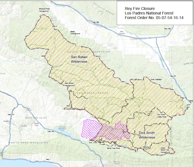
Late last week the Forest Service closed a large portion of the Santa Barbara Backcountry.  This was in response to the rapid spread of the Rey Fire, the threat of additional fire and a lack of available fire resources.  See the map below for details but basically all wilderness areas within Santa Barbara County are closed.  As is much of the neighboring backcountry forest land.  This will mostly affect A-Zone South hunters who are already being impacted by the closures up in Monterey County.  There is no word as to when the SB closures will be lifted but it’s probably a good idea to stick to the beaches this weekend, road trip to the Sierras or head to SLO or Ventura Backcountry if you really need your LP fix.


Yellow hashed areas are the closures
reyclosure

Fire, Fuego, Feuer, Feu, Fuoco: Update & Restrictions

Rey Fire, Friday August 19 the Day it Got Away, photo Mike Kent
ReySunset
Hello Everyone,

Obviously the conversation these past few days, weeks and now months has been centered around the fires raging across the Los Padres.  First we had Coleman, then Sherpa, Pine, Soberanes, Rey and even the Chimney Fire is now threatening LP lands.  And this list doesn’t include the hundreds of smaller fires that we never even hear about.  I was fortunate today to attend the Rey Fire morning briefing at fire camp.  I’d never really been in a fire camp before.  The amount of organization involved in fighting a large fire is simply incredible.  There were lines of fire engines waiting to fill up at water tenders, food stations prepared to feed thousands of meals each day, crews from all over the place, what seemed like miles of tents, countless trucks color coordinated into neat sections (FS green over there, Cal Fire red that way, etc…) and all the sanitation needs from trash to porta-potties to hand washing stations.  It was part music festival, part sporting event; without the festivity and with an air of stern professionalism.  A portable city that moves around the Western US as needed and where needed with the sole purpose of stopping fires.  This was clearly not their first rodeo.


Lead pilot Doug is the man!  photo Humphrey
LeadPlaneDoug
It’s easy for those of us watching the fires from the sidelines to ‘Monday morning quarterback’ and complain about why they didn’t save our favorite campsite or how they couldn’t hold that ridge.  Trust me, I’m guilty.  But we have to remember that they are the professionals.  They are out there cutting lines in 100˚ heat.  They are flying through smoke a mere hundred feet above flames.  They are the ones balancing resources and making decisions where life is literally on the line.  A bad decision here or there could lead to injuries or potentially a city burned to the ground.  That’s heavy.  Trails can be reworked, plants (mostly) will grow back and we’ve seen animals will survive.  It sucks that we’re all dealing with fires but after today it was crystal clear that once you have a wildfire, you have to trust the process and believe in the fire crews.  This is not their first rodeo (this month).

Rey over Mono Jungle, photo Ray Ford
MonoRey

Leaving the fire camp this morning I wanted to cheer on the crews as they left to cut lines or coordinate air attacks.  I literally wanted to stand on the side of the road and cheer them on as if they were an NFL team running out of the tunnel and onto the field.  And I wanted to wave a flag that said “WHATEVER YOU DO, PLEASE SAVE ALAMAR TRAIL”.  Momentary kidding aside, thank you to everyone involved in the fire.  EVERYONE.  They say it takes a village, but in this case I can tell you it takes more than that.  It takes a city, and sometimes more than one.

— • — • — • —

If you want to follow the progress of the Chimney, Soberanes or Rey Fire, the best place is on Twitter and search for that fire.  We’ve been updating information on the LPFA Facebook page and Twitter page or you can check Inciweb as well.  There is no shortage of information out there.

— • — • — • —
Along these lines, the Los Padres Forest went into Level IV fire restrictions earlier today.  See attached PDF for more information.  Basically Level IV prohibits any campfires within the Los Padres Forest.  PERIOD.  The difference between this years restrictions and those of the past few years is that this year the use of portable stoves outside of the designated campfire use sites is also prohibited.  This means anyone venturing outside of the campfire use sites or into designated wilderness areas will be eating cold food and drinking cold drinks.  Again, see attached PDF for more details and please follow these restrictions.

— • — • — • —
UPCOMING EVENTS
A few upcoming dates, events, projects, presentations or things you might want to know.
If you have any forest-related events to add to this list, let us know and we’re more than happy to pimp your event!


September 10: NPLD Jesusita Trail, Santa Barbara Frontcountry
September 11: Island View Trail Race, Franklin Trail, Carpinteria
September 14: LPFA Backpacking Fundamentals Class
September 20: LPFA Trail Talk Series, History of Los Padres Lookouts by Craig Carey
September 24: National Public Lands Day Trail Project, Lion Canyon Trail, Ojai


October 1: LPFA Used Gear Sale
October 16: D-13 Hunting Season Starts
October 22-30: LPFA Working Vacation, Poplar Trail (ON HOLD)
October 29: LPFA First Aid & CPR Training