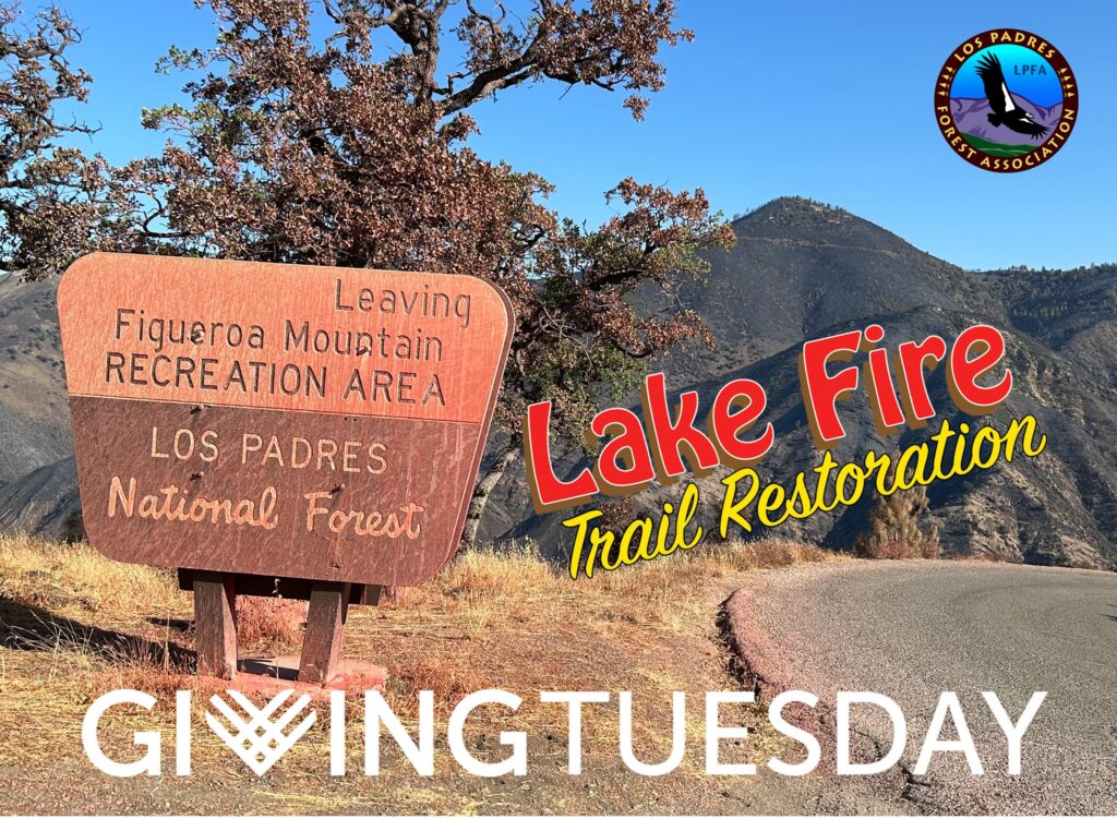
Lake Fire + Trail Work = #GivingTuesday


Hello Friends, 

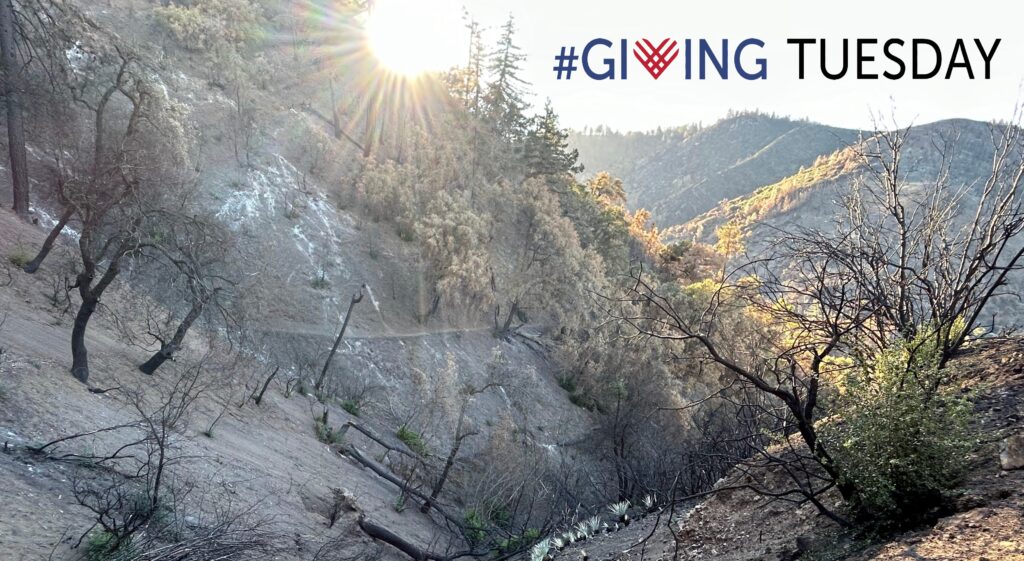
We won’t take up much more of your time this evening, we’re sure you’ve had plenty of #GivingTuesday emails already, but we did want to share a short YouTube video that we created. The video highlights some of the pre-fire beauty around Figueroa Mountain including critters, flora and of course trails. It also shows some of the Lake Fire damage and many of the obstacles we’ll be facing as we work to restore and reopen the trails. Most of the trails are covered with downed trees and narrowing tread and it’s only going to get worse with the winter rains. Hopefully you’ll enjoy the video and please stay tuned for more forest updates in the near future. 

As always, let us know if there is anything forest related we can help you with: INFO@LPForest.org


LPFA: It’s Gotta Be #GivingTuesday Somewhere


Lake Fire 
Los Padres Trail Restoration


‘It’s gotta be Tuesday somewhere’

Hello Friends,

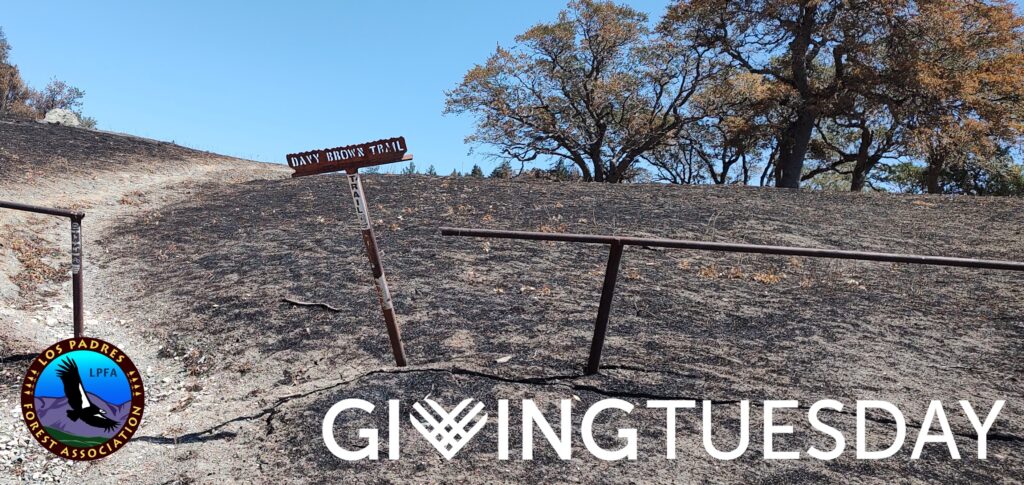
#GivingTuesday is just about here and we wanted to remind everyone that the LPFA will be focused this year on raising funds to help repair and reopen the fire damaged and currently closed forest trails within the Lake Fire scar. We’ll share more details on Tuesday but the impacted trails include: 

  • Davy Brown Trail (trailhead shown above)
  • Munch Canyon Trail
  • White Rock Trail
  • Willow Spring Trail
  • Sunset Valley Trail
  • La Jolla Trail
  • Sulphur Spring Trail
  • Zaca Peak Trail
  • and a few other trails that include Connector or Spur in their names….

You’re sure to receive dozens of #GivingTuesday emails and we appreciate your support of the LPFA and our continued efforts to keep the trails passable and open. 

Thanks again everyone and sleep well! See you on #GivingTuesday….. 


  –  UPCOMING VOLUNTEER TRAIL DAYS  –  


December 13: Tunnel Trail, Santa Barbara 

December 5 & 7: Matilija Trail, Ojai 

December 15: Pothole Trail, Lake Piru 

Los Padres LPFA Updates & Lake Fire #GivingTuesday


Lake Fire Los Padres

Trail Restoration


Hello Friends,

25 miles of Los Padres Forest trails, mainly located within the Figueroa Mountain Recreation Area, were burned this past July during the nearly 40,000 acre Lake Fire. These trails are currently closed. The LPFA has been working with the Forest Service on a plan and schedule to restore and reopen these trails. We got some great news earlier this week that the LPFA won a grant from the Santa Barbara Foundation that will go towards the restoration of the trails burned in the Lake Fire. #AwesomeAmazingThankYou! While the actual trail work can’t begin until the spring, we’ll be busy throughout the winter planning and getting ready to roll. 

The past four years we’ve had very successful #GivingTuesday campaigns. We raised money in 2020 to restore over 10 miles of National Recreation Trails within the Los Padres along the Piedra Blanca Trail and Santa Cruz Trail. 2021 was focused on repairing the scary Alder Creek Slide in the Sespe Wilderness. In 2022, #GivingTuesday supported massive storm repairs along the lower Santa Cruz Trail and last year #GivingTuesday helped reopen sections of the Sespe River Trail as well as the Piedra Blanca Trail.  

This year our #GivingTuesday (technically December 3) campaign will go towards helping out the forest trails within the Lake Fire scar. If you’d like to help the trails, please click the link below. We’ll be organizing plenty of volunteer projects in the spring as well. More to come next week, THANK YOU!


Before (2023) and After (2024) images of the western side of the Hurricane Deck Trail showing some great trail work accomplished this year by LPFA volunteers and the LPFA Trail Crew. Questions: email INFO@LPForest.org


FOREST 411 & VOLUNTEER DAYS

• Get it on your calendar! Saturday May 3 is our Open House at Wheeler Gorge Visitor Center outside of Ojai. Games, education, forest fun and a whole lot more…. Get ready! 

• After being closed for nearly 5 years due to Dolan Fire damage, the Nacimiento-Fergusson Road has reopened. This is great news as the road provides crucial access across the forest from the Big Sur Coast out to Fort Hunter Liggett. 

• We wanted to congratulate Santa Lucia Ranger District’s Helen Tarbet for being recognized by the Forest Service for her continued educational contributions across the forest. Helen is probably most known for her regular Figueroa Mountain flower reports but more than that, she embodies the stoke of the forest. If you have kids interested in the forest, make sure they find Helen. Good luck Helen, thank you! 

If you are looking for an excuse to work off some of that Thanksgiving turkey or pumpkin pie, we’ve got you!

Sat Nov 30: Pothole Trail

Sun Dec 1: Matilija Trail

Led by legendary LP Super Volunteer Alan Coles, we’ll be continuing work opening up the lower Agua Blanca Trail and Pothole Trail within the Sespe Wilderness. Plan on meeting at Lake Piru on Saturday morning. To sign up or for more information please email VOLUNTEER@LPForest.org

Rumor has it that Matilija Road may reopen soon and we’re working hard to make sure the trails are ready for when it does. Peter Wilder will once again lead the charge up Matilija this coming Sunday. To sign up or for more information please email VOLUNTEER@LPForest.org.


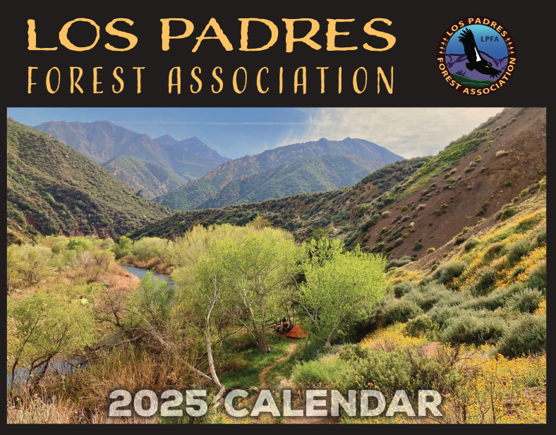
The 2025 calendars are just about ready and should be waiting for you at your local REI as early as next week. Stay tuned for more….

Lake Fire Closure Update


LAKE FIRE CLOSURE UPDATE


Hello Friends, 

When we last wrote, the Lake Fire was tearing up Figueroa Mountain and seemed destined to burn much of the Santa Barbara Backcountry. Fortunately, thanks to all the great work completed by fire personnel and some favorable weather, the Lake Fire was held at 38,664 acres. You can see more detailed maps here but basically the Lake Fire burned diagonally from Cachuma Saddle in the south, up to the Sisquoc River and between Manzana Creek and the edge of the Santa Ynez Valley. There were some lost structures and approximately 50 miles of trail burned but all things considered, the Lake Fire could have been much worse. Again, HUGE THANKS to everyone involved with the Lake Fire efforts – GREAT JOB! 

The Forest Service just issued a revised closure order for the Lake Fire. Somewhat surprising yet very much appreciated, the FS has reopened a lot of access into and through the fire perimeter. You can see the closure order here and the closure map here.

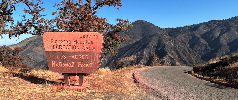
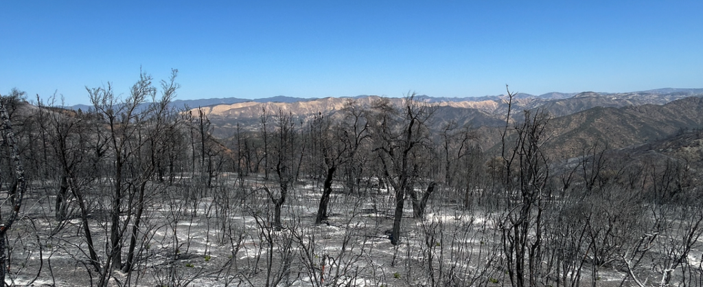
The LPFA was able to survey a few of the burned trails and the fire severity was extreme in some areas and very light in others. It’s turned out to be one of the splotchier fires we’ve seen, which hopefully means many of the trees are still alive. We shall see ~ keep your fingers crossed. In addition to the closed Forest Service trails, the Midland trails currently remain closed as well. Stay tuned for updates. 

Also note that while the camps along the lower Manzana did not burn, they are closed due to potential dangers associated with upstream burned areas. 

Last but not least, we all should be very happy that the Forest Service has reopened access through the Lake Fire. Please be careful, follow the rules and most importantly don’t be an idiot. We collectively want access to remain open to the campgrounds and trailheads impacted by the Lake Fire and the best way to ruin that is by driving off road or doing stupid things. No stupid things please. 

What Remains Closed

  • Closed Recreation Camps:
    • Ballard, Coldwater, Figueroa, Horseshoe Bend & Potrero Camps. 
  • Closed FS Roads
    • Figueroa Lookout Road 
  • Closed FS Trails
    • Fir Cyn / Davy Brown, Munch, Munch Conn, White Rock, White Rock Conn, Willow Spur, Willow Spring, Sunset Valley, La Jolla & Zaca Peak Trails. 

What is Open

  • Happy Canyon Road 
  • Sunset Valley Road 
  • NIRA Trailheads & Campground 
  • Davy Brown Campground 
  • Manzana Trail 
  • Figueroa Mtn Road 
  • Catway Road  


Fresh Oak Sprouts Encouraged by Zaca Peak – August 8, 2024


  • We are now midway through A-Zone general deer hunting season. A-Zone is the largest hunting season here in the Los Padres and covers all of the forest other than the D13 Zone in portions of the Mt Pinos & Ojai Ranger Districts. A-Zone will last through September 22. Until then, you should expect to see more hunter activity at many of the trailheads and trails across the forest. Good luck and stay safe! 
  • Reminder that campfires are currently only allowed within Designated Campfire Use Sites across the Los Padres Forest.  
  • The Mt Pinos RD has two other active fire closures for the Post and Apache Fires. Read more here
  • The Romero-Camuesa Road connecting Romero Saddle with Juncal will be closed for repairs September 16 – October 1. For more information contact the SBRD
  • With summer slowly coming to an end that means the beginning of Trail Work Season ~ woot woot! We’re still working on our fall schedule (including NPLD) and hope to release that information within the next week. Teaser, we’ve got projects in the works along Alder Creek, Santa Cruz, Hurricane Deck, Santa Barbara Cyn, Santa Paula Cyn, Potrero John, Matilija, Piru Creek, Rattlesnake and Piedra Blanca amongst others. Keep an eye out for updates or sign up here…. 
  • The LPFA will also be hiring for both our Trail Crew as well as an information position within the Santa Barbara Ranger District. We’ll share more next week as well but if you’d like to get a jump on the competition you can always email us for more information

As if the Hurricane Deck isn’t otherworldly enough, lets add a Fig Mtn Moonscape ~ August 8, 2024


Fire Restrictions, the Lake Fire, and Fire History

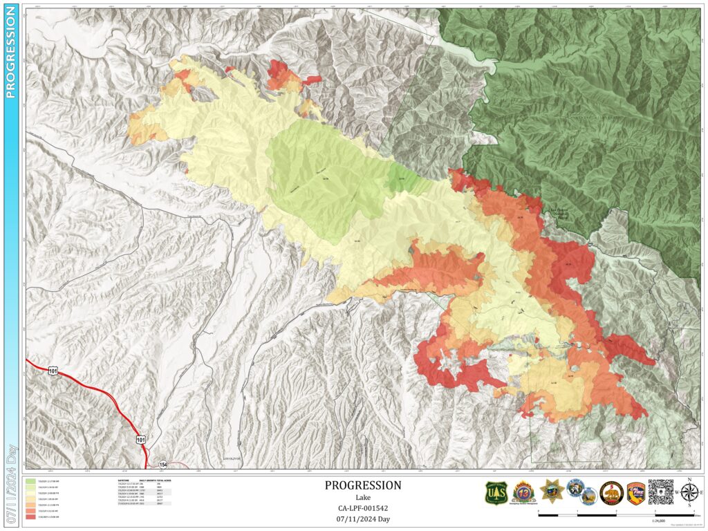
Lake Fire Progression Map as of 7/11/24, courtesy of Inciweb.

FIRE RESTRICTIONS AND THE LAKE FIRE

Fire restrictions went into effect across the Los Padres Forest on June 29th as fuel moisture levels dropped toward record low levels. Restrictions mean a few things, including no open fires, campfires or charcoal fires permitted outside of developed recreation sites or designated Campfire Use Sites, as well as no smoking. However, stoves are still permitted in the backcountry and you can grab your fire permit here. Remember to view the full order on the Forest Service website.

The Lake Fire ignited in the late afternoon on Friday, July 5th near Zaca Lake, just days after forest-wide fire restrictions went into place. The fire began during a record-setting heat wave that hit most of the state, with some areas of the Los Padres seeing temperatures as high as 116 degrees. As of today, the Lake Fire has burned over 34,000 acres and is trending in a southeast direction toward Sunset Valley Road and the southern San Rafael Wilderness. There are over 3,000 personnel on the fire. The most up to date info can be found here.

The Lake Fire has prompted a special Forest Closure Order which includes the Figueroa Mountain Area and portions of the southwestern San Rafael Wilderness near Manzana Creek. A detailed map of the closure area can be viewed here. Also, check out below for a map-based look at nearby fire history, as well as some alternative options for summer in the LP.

Stay safe everyone, and thank you firefighters!

The Lake Fire Forest Closure includes the Figueroa Mountain area, as well as much of the southern San Rafael Wilderness.


Mapping of fire history can help predict new fire activity.

What can fire history tell us?

The Lake Fire started in the late afternoon July 5 somewhere in the Zaca Lake drainage. The cause of the fire is still under investigation. The Lake Fire ignition point was very close to where the Zaca Fire had started 17 years and 1 day earlier on July 4, 2007. If you are reading this, then you probably have some interest in this wildfire and where / what it might burn in days, weeks and perhaps months ahead. 

While the weather will largely dictate the direction and duration of the Lake Fire, we can also look at the behavior of past wildfires and study decisions made during those fires to help understand where this current wildfire might be headed. This is known as the fire history. Fire history is a tool that can show us many things such as the strategy of how previous wildfires were fought, where historic firebreaks have held or lost the fire, how many years (or decades) of vegetation fuel might be ahead of the fire and more. 

Just to be clear, we’re not professional fire predictors by any means. We aren’t meteorologists. We aren’t fire behavior specialists. We don’t have a seat at the table when fire decisions are being made. But we know the Los Padres and we have seen too many wildfires ravage our beloved forest. If you spend any time in this forest, you know how devastating these fires can be to the vegetation, the waterways, the critters, the trails and our ability to recreate in the forest we love. That being said, let’s take a closer look at the Lake Fire and the fire history in this part of the Los Padres. Perhaps we’ll see some trends to help figure out where and for how long the Lake Fire might be burning. Click here for an in-depth look at the fires surrounding the Lake Fire burn area! 

Los Padres Summer Locales

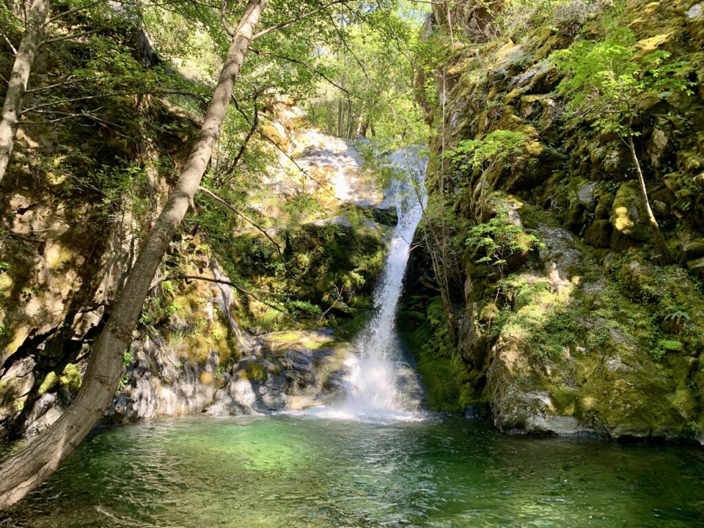
There are still lots of refreshing swimming holes to be found this summer….

Luckily, it seems the extended heatwave of the past week is on its way out. And if you’re looking to get out into the forest this summer, there are still great places to explore in the Los Padres:

  • Highway 1 north of Big Sur is open and the area offers great coastal access, as well as numerous trailheads into the *usually* cooler coastal side of the Ventana Wilderness. Much of the coastal Silver Peak Wilderness can be accessed from Highway 1 north of San Simeon as well.
  • Arroyo Seco Day Use Area has reopened on weekends, from 8am – 6pm. Though the official parking area will be limited to the first 100 cars each day. Get there early and enjoy the day cooling off in Arroyo Seco River
  • It’s still looking hot this weekend, but don’t forget that higher elevations will be cooler! Recreating in the Mount Pinos area is great this time of year, as well as exploring the higher elevations of the Sespe Wilderness. Don’t forget to check HikeLosPadres.com before your trip to estimate water availability, and make sure to leave a report when you return so others can do the same!

Lake Fire History: July 11, 2024

The Lake Fire started in the late afternoon July 5 somewhere in the Zaca Lake drainage. The cause of the fire is still under investigation. The Lake Fire ignition point was very close to where the Zaca Fire had started 17 years and 1 day earlier on July 4, 2007. If you are reading this, then you probably have some interest in this wildfire and where / what it might burn in the days, weeks and perhaps months ahead.

While the weather will largely dictate the direction and duration of the Lake Fire, we can also look at the behavior of past wildfires and study decisions made during those fires to help understand where this current wildfire might be headed. This is known as the fire history. Fire history is a tool that can show us many things such as the strategy of how previous wildfires were fought, where historic firebreaks have held or lost the fire, how many years (or decades) of vegetation fuel might be ahead of the fire and more.

Just to be clear, we’re not professional fire predictors by any means. We aren’t meteorologists. We aren’t fire behavior specialists. We don’t have a seat at the table when fire decisions are being made. But we know the Los Padres and we have seen too many wildfires ravage our beloved forest. If you spend any time in this forest, you know how devastating these fires can be to the vegetation, the waterways, the critters, the trails and our ability to recreate in the forest we love. That being said, let’s take a closer look at the Lake Fire and the fire history in this part of the Los Padres. Perhaps we’ll see some trends to help figure out where and for how long the Lake Fire might be burning.

This first map shows the Lake Fire perimeter as of July 10, 2024. The fire started near Zaca Lake and initially headed west from there. Over the past few days, as the western winds returned to normal, the fire has been mostly pushing to the east, northeast and lightly to the north. Most of the firefighting efforts have rightfully been aimed at keeping the fire from heading south and west into ranches, vineyards and communities. The fire crews did a great job over the initial days of the Lake Fire to slow the fire down and protect the communities. Bravo.

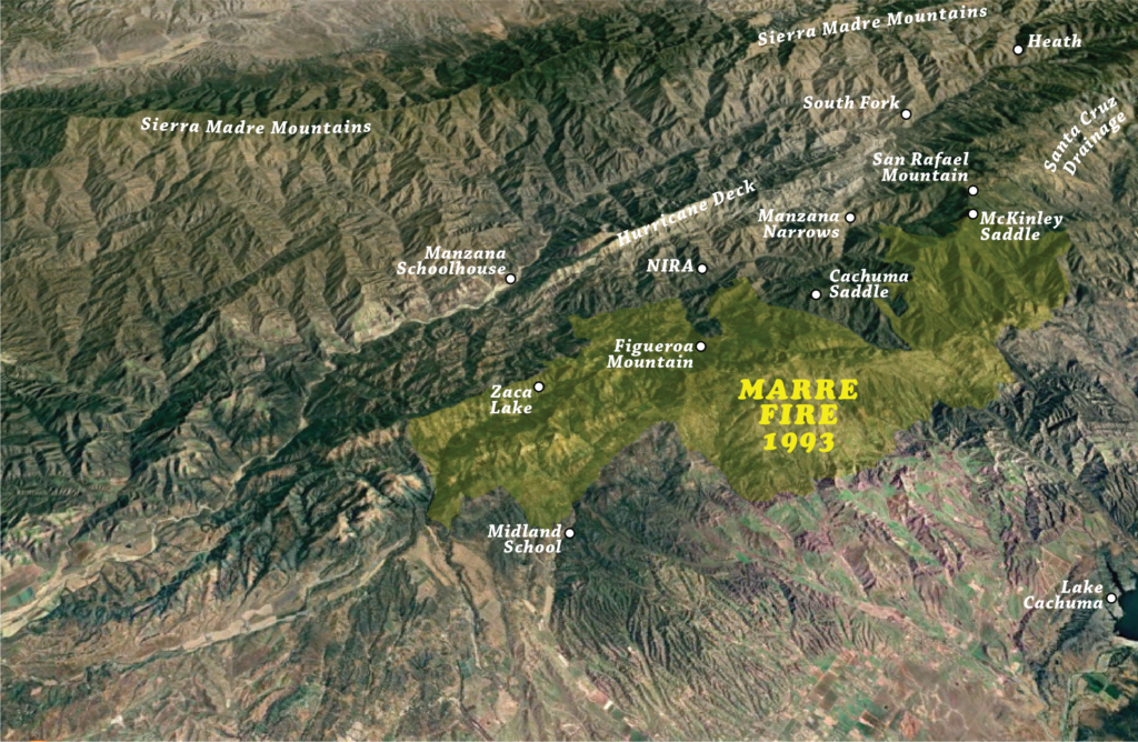
This second map shows the perimeter of the 1993 Marre Fire. Most of the terrain that the Lake Fire has scorched as of today was last burned in the Marre Fire. The Marre Fire was started on the edge of the Los Padres, east of Los Olivos by a discarded cigarette. It burned over the course of a couple weeks in September and October 1993.

This third map is an overlay of the Lake Fire in green, the Marre Fire in orange’ish and the overlap of the two in yellow. You can see that while both fires did spread west, most of their progress was to the east. This is due to a combination of firefighting efforts focusing on protecting communities to the south as well as the predominantly western winds pushing the fire to the east. We also see that the majority of both fires were along the south facing slopes of the San Rafael Mountains. This makes sense as fires generally burn up slopes faster than down slopes. Of interest on this map is that while the Marre Fire did slop down into the upper Manzana and up to Manzana Creek, it was stopped before spreading across the majority of the backcountry. At that time, most of the Manzana had not burned in over 50 years and there was certainly plenty of fuel to keep the fire going. We’re not sure how or why the fire stopped where it did but the fact that it did stop at the Manzana even with all that fuel is promising for the future of the Lake Fire.

This fourth map shows the Lake Fire in green and the beginning of the massive 2007 Zaca Fire in purple with overlap in blue. You’ll see that as of right now there hasn’t been much overlap between the two fires and perhaps the Lake Fire is slowing as it burns into the Zaca scar. There is “only” 17 years of fuel buildup in the Zaca as compared to 31 years within the Marre scar. In its early days, the Zaca Fire burned slowly east up the Manzana before stalling in the bowl between Big Cone Spruce and McKinley Saddle. It seemed that Zaca would die out in that bowl but eventually the fire escaped the Manzana, crested McKinley Saddle and tore off into the Santa Cruz drainage and beyond.

This fifth map shows the Lake, Marre and Zaca Fires. It appears that the 31 years of regrowth within the Marre Fire has provided plenty of fuel to keep the Lake Fire going. If the Lake Fire continues east along its current path and the path of the Marre Fire, it will eventually become surrounded by the Zaca scar up near McKinley Saddle and the Big Cone Spruce bowl. Will the relatively light 17 years of Zaca regrowth be enough to slow the Lake Fire down or will the Lake Fire follow the path of Zaca and continue over into the Santa Cruz and beyond? McKinley Saddle was where the Zaca Fire was lost and could likely be the site of an important stand for the Lake Fire as well.

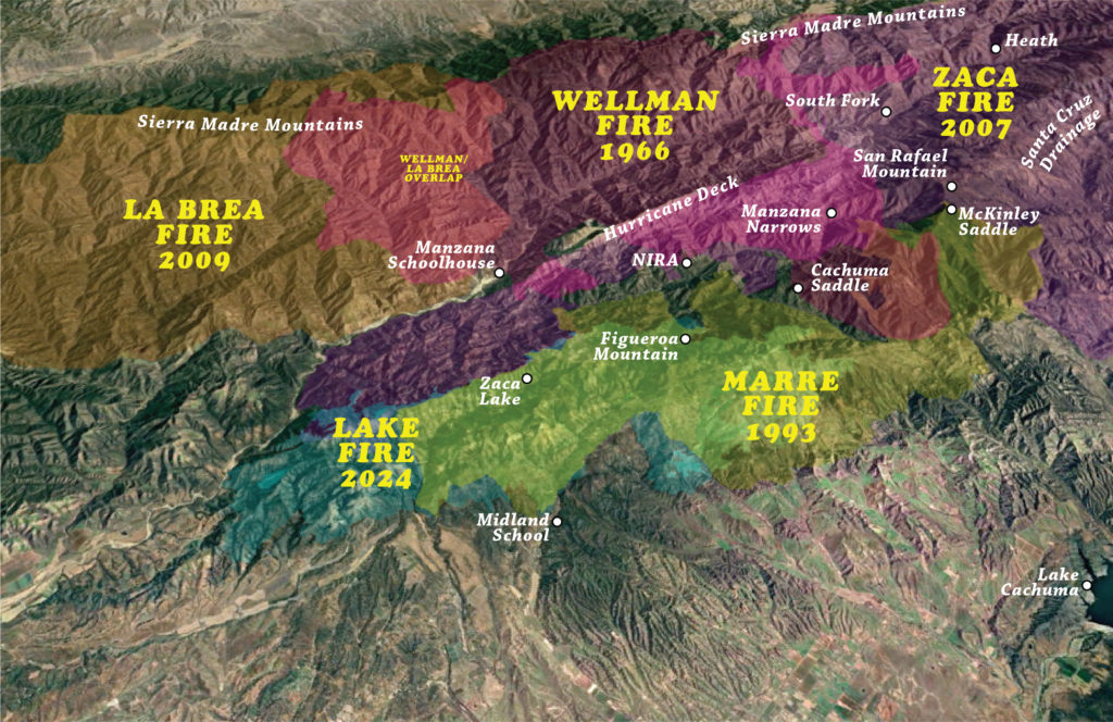
This sixth map shows some of the wildfire history to the north of the Lake Fire. This may become important should the Lake Fire cross the lower Manzana and perhaps ultimately the lower Sisquoc. You’ll see the 2009 La Brea Fire in brown, the 1966 Wellman Fire in purple and the overlap in red. La Brea was recent enough that the fuel load could slow things down but the 58 years or regrowth within the Wellman scar probably won’t hinder the fire at all.

And this seventh and final map shows the collection of wildfires that have impacted this part of the Los Padres. There are other wildfires not shown like the Cachuma, Sedgewick, Hurricane and others that have had smaller footprints within this area but probably won’t impact the overall path of the Lake Fire. It’s sad that there aren’t many islands of non-burned areas left and we’ll certainly lose more of them over the coming days and weeks. 

Since the onset of the Lake Fire, we’ve spoken with many Forest Service staff, fire crews, local historians and amateur fire gurus. There are serious concerns that the Lake Fire might turn into another Zaca and burn for months on end across the entire Santa Barbara backcountry from the Schoolhouse to Hwy 33 and from the Sierra Madre to the Santa Ynez. If you don’t remember the Zaca Fire, it was too big, bigger than it needed to be. Those who fail to learn from history are doomed to repeat it. Let’s pray for the safety of the fire crews, hope the winds work in our favor and have belief that 17 years of Zaca Fire regrowth isn’t enough to fuel the Lake Fire into a multi-hundred-thousand-acre backcountry chewing mega-fire.