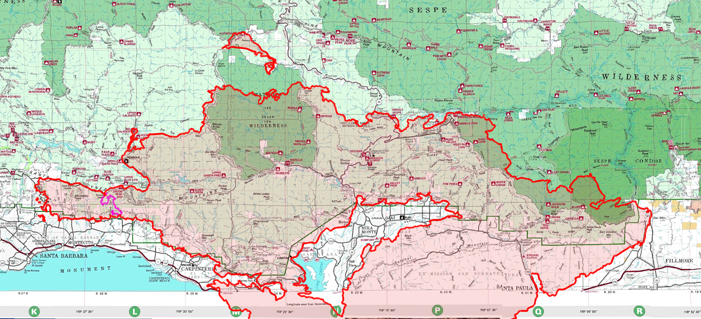
Thomas Fire Perimeter as of December 22, 2017
• 272,800 Acres Burned (12.22.17)
• 34 Los Padres System Trails Damaged
• 52 Recreational Trails & Roads Damaged
• 127 Miles of Trails Damaged (approximate)
• 100 Miles of FS Recreational Roads Damaged (approximate)
• 24 Forest Service Campsites Damaged
— • — • —
The Thomas Fire started December 4 near Santa Paula and spent the next three weeks raging across Ventura and Santa Barbara Counties. Thomas has been a horrible fire. The Los Padres is no stranger to wildfires and Thomas has literally broken all the records with regards to acreage burned, damage caused, overall destruction and impact to the communities. This fire has been a nightmare and even after the flames are extinguished and Thomas is fully contained, we will still be dealing with that nightmare due to fire-related storm damage. Thomas will continue haunting us in one form or another for many years to come…..
In addition to the horrible lose of homes and personal property; the Thomas Fire has destroyed so much of the Los Padres Forest including 24 campsites and over 200 miles of trails and Forest Service recreational roads. It’s overwhelming to think that all the frontcountry trails from Santa Paula to Santa Barbara were burned. This includes all of Ojai, Nordhoff Ridge, Matilija, Rose Valley, Franklin Trail, Jameson Lake watershed and all the Montecito trails east of Gibraltar Road. Right now it’s hard to grasp the magnitude of work needed to restore these trails but don’t worry, the chaparral will grow back and along with it the need to get boots on the ground and start pushing dirt and clearing downed trees.
From the onset of the Thomas Fire the LPFA has been involved in helping the forest however we can. We assisted the fire fighting effort by providing crews with intel updates on road and trail conditions. We’ve helped inform the public as best we can and now that the flames are dying down we’re getting ready to turn our focus towards restoring the damaged trails. The first step will be surveying the 34 FS system trails to ascertain the extent of the damage and provide that information to the FS to help with their management of the land. The process of surveying the trails will occur repeatedly throughout the winter and spring depending on our storm season. After each survey, that information will be passed to the FS as well as the public (www.HikeLosPadres.com). Depending on the trail damage and how the FS manages the Thomas Closure, we’ll get to work partnering with as many trail groups as we can to raise money, organize volunteers and get out onto the trail to swing Pulaskis and chain saw downed trees from the trail corridor.
It’s going to be a bit of a shock as we get back onto our familiar trails and realize that we don’t recognize them anymore. That shock will be followed by a feeling of being overwhelmed at just how much work is needed to restore the trails. We’ve been through this before with previous fires like Day, Zaca and Jesusita. It may take a while but together with the Forest Service and partnering trail organizations we’ll get the trails back on the ground and feet/tires/hooves back on the trails.
If you’d like to help you can donate to the LPFA and note that you’d like your donation to go to Thomas Fire Trail Fund. You can also donate to other trail organizations and of course get ready for lots of volunteer help needed over the coming months….. Stay tuned and thanks for your help.
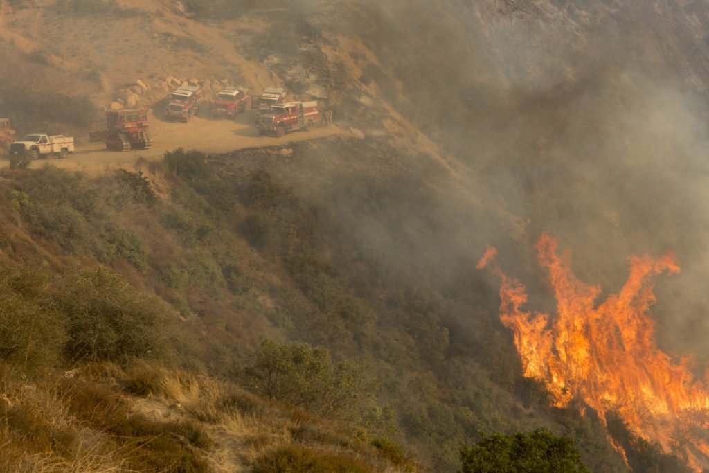
Thomas Fire tearing up Romero Canyon, photo USFS
