LP STORMS 2017: The Good, the Bad and the Ugly

That’s not the Mississippi!  Santa Ynez River at Sage Hill, February 17, photo Chris Orr
Good Morning Everyone and Happy Presidents Day!

We are in the midst of what is clearly going to be remembered as an epic winter here in the Los Padres.  Last Friday, during the heart of the latest storm, some of us were watching the real-time flow rate in Sespe Creek.  The website lists the historic flood level crests along the Sespe and as the latest crest continued to climb, it started to creep up towards the all-time winters like 1978, 1969, 1983 and 2005.  Last Friday’s storm didn’t quite crack that list, at least along the Sespe, but we’re certainly headed towards 2017 being remembered in a similar fashion with those other most epic winters.  While we’ve all been praying for a season like this, it hasn’t been all rainbows and green grass for everyone around the forest.  The rains have certainly caused some challenges and will continue to do so.  Lets take a quick look at the GOOD, the BAD and the UGLY:
— • — • — • —
Matilija Overflowing
THE GOOD
Last February the LPFA hosted a volunteer trail maintenance project up Santa Barbara Canyon.  We camped on a bench overlooking the dry creek (note: this is not an insignificant small creek) and had to have mules haul in water for the 3-day project.  There was no water in February!  That is not a problem we’ll have to worry about this year.  The creeks are flowing, rivers are raging and best of all, the lakes and reservoirs are filling up.  Water levels within the reservoirs are climbing fast.  There were reports that Lake Cachuma climbed 25ft this past weekend.  That’s great news and we should have nice flowing water for months to come!
— • — • — • —
Rain Soaked Trail Damage, see the People on the Trail?
THE BAD
We’re getting reports from across the forest about damaged trails, downed trees, rutting, boulders, holes, slides and even NO MORE TRAIL!  After 4-5 years of drought, many of the trees have been compromised and with the saturated soil and wind, they are toppling down.  Same goes with water related soil damage like slides and sink holes.  The Forest Service, as well as volunteer groups from across the Los Padres, are working as hard as they can to get the trails cleared and safe for travel again.  The best thing you can do if you come across a trail hazard or downed tree is document that trail hazard and share that information.  www.HikeLosPadres.com is a great resource for sharing trail conditions or email a trail report to your local trail organization or FS trails person.  Speaking for all the trail maintenance people, we can’t help the trails unless we know where the trail damage is.  It really helps to take photos of the damage and include as much information as you can about the location and size/extent of the damage.  The trail-users far outnumber the trail maintainers, sharing information is a key component to making the trails good again.
— • — • — • —
Highway 1, South of Big Sur, photo Father Zack, from BigSurKate
THE UGLY
Do you see the “PLEASE DRIVE CAREFULLY” Los Padres Forest sign in the photo above?  It might need to be changed to say “YOU WON’T BE DRIVING FOR A WHILE”.  The roads in and around the Los Padres have clearly been the ugly casualty of the storms so far.  Most of the dirt roads around the LP have been closed for the winter (TBD the extent of the damage on those roads) but even the paved major access roads have been getting hammered:

  • Highway 33 out of Ojai has been closed on/off all winter and remains closed today due to slides.
  • Hwy 41 finally reopened after being closed for over a month due to a landslide.
  • I5 near Gorman sustained some major damage this past weekend.
  • And other temporary closures including Hwy 154, Lockwood Valley Rd, 101, etc……

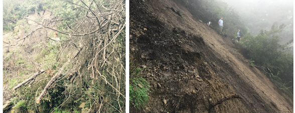
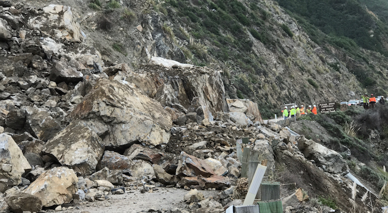
But none of this compares to what has been happening along the Big Sur Coast.  It’s been a tough year to say the least.  First, the massive Soberanes Fire and now crazy amounts of rain followed by flooding and landslides.  Hwy 1 remains closed between Ragged Point (southern end) and Big Sur Station (northern end).  Slides, such as the one in the photo above, have been regular occurrences along Hwy 1.  It seems that as soon as one slide is cleared or mitigated, another slide occurs.  At one point there were reports of over 20 slides blocking Hwy 1.  In addition, the Forest Service has closed the Nacimento-Fergusson Rd west of Coast Ridge Rd due to road slippage.  And as if that was not enough, structural damage was discovered on the Pfeiffer Canyon Bridge (just south of Big Sur Station) which has completely blocked access along Hwy 1 in Big Sur.  A slide has developed under the bridge that has caused the structure to move 7 inches within the past week.  Quite a mess!  We won’t try to predict a timeframe as to when Hwy 1 will reopen in Big Sur, but it’s looking likely it will be closed for quite a while.

Sorry for the UGLY news last.  I wish they had called that movie The Ugly, the Bad and the Good.  Oh well.  In time the Ugly will be repaired, the Bad will be maintained and we’ll be left with beautiful creeks flowing well into summer and more water than we’ve seen in quite some time.  That is Good.  Until then, please be careful and never underestimate water.

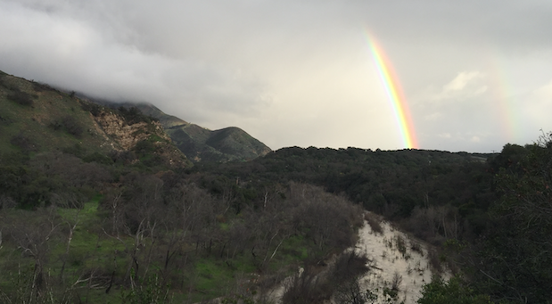
Santa Ynez Double Rainbow