Condor, Sycamore and Baer……. OH MY!

BAER Trail Protection, San Ysidro Trail, photo Carr
Hello Friends – We hope you are doing well and finding some time to splash in the puddles!

If you’ve been anywhere near a fire over the past few years, you’ve probably heard the words “BEAR WORK” and might not know exactly what that means.  We get asked about it all the time and it’s BAER WORK (pronounced BEAR).  So what is BAER?  This is directly from the Los Padres NF website:

The US Forest Service Burned Area Emergency Response (BAER) team’s purpose is to assess threats to life, property, and cultural and natural resources from fire-induced changes to the watershed that can cause erosion, sedimentation, flooding, and debris flows.
Basically what happens is that after any larger scale fire, the USFS dispatches a team of specialists to study and survey the future impacts that fire might play within the downstream communities and to the resources within the forest.  This team is called the BAER team (see acronym above) and they’re usually the first people on the ground as the flames die down.  The BAER team studies all the potential risks from the fire, generates reports outlining those risks, prescribes treatments designed to mitigate those potential risks and then performs those treatments within the forest.  BAER studies include archaeology, road engineering, trail protection, fisheries, soils, hydrology and more.  All the Thomas Fire reports are published on the FS website in case you are interested in the details.  So remember, the next time you hear a post-fire BAER reference, you can amaze your friends by telling them it has nothing to do with Smokey or Boo-Boo and then for bonus nerd points follow that up with a NIRA reference (National Industrial Recovery Act).
— • — • — • —

It just feels like Burkittsville, along the Condor Trail
CONDOR TRAIL TALK
Is the Condor Trail on your bucket list?  Do you fear you’ll kick the bucket if you attempt the Condor Trail?  Do you enjoy exploring new places across the Los Padres?  If you answered YES to any of those questions then you have to come to the Condor Trail Talk on Friday March 23 at the Balboa Building in Santa Barbara.  The Trail Talk is being hosted by the Condor Trail Association, LPFA and REI and we’ll be welcoming 4 sets of hikers who either finished the CT in 2017 or came really really close.  Each set of hikers will share stories from their journey across the Los Padres and it should be really cool hearing how different each journey was based on time of year and what they encountered along the way.  The talk is free, doors open at 6:30pm, we’ll have a raffle, silent auction, maybe a game or two and some beverages to kick your weekend off in style.  Come one, come all – as long as space allows!  Hope to see you there……
Condor Trail 2017 Hikers
Friday March 23 – Doors Open 6:30pm
Balboa Building – 735 State Street – Santa Barbara
*parking can be tough, suggest Paseo Nuevo*
— • — • — • —
Toejam Taking in the Lower Sisquoc, January 2018
LOWER SISQUOC WORKING VACATION
Sycamore Camp, April 14-22
We’re happy to announce our latest and greatest LPFA Working Vacation, this time along the Sisquoc Trail, based at Sycamore Camp in the spectacular San Rafael Wilderness.  The plan is to drive in to the Jackson Trailhead along the Sierra Madres on Saturday morning April 14.  From there we’ll backpack 4 miles down to Sycamore Camp, which will be our camp for the week.  We’ll be joined by the usual cast of mule packers and exquisite backcountry cooks that make camping life so enjoyable while on a Working Vacation.
Our mission for the week is to clear the trail from Sycamore Camp downstream to Big Bend Canyon. As mentioned, we’ll have mule support to bring in tasty food and cold sudsy beverages while Rich Scholl will once again be cooking up a storm, providing the best in wilderness camp cooking, including the now infamous “COFFEE’S READY, HUH!”.  No joke, some people come just to hear coffee’s ready, huh!  Or is it the Woot Woot that they come for?  Either way, all food is provided for volunteers and we promise you’ll never leave hungry.
While we’ll be at Sycamore for a whole week, there will be plenty of opportunities for shorter stays and we’ll make room for you if you can spend 3, 4, 5 or more days on the Working Vacation. Let us know what works for your schedule and we can most likely make it work for us.  You will have to backpack in 4 miles to the camp, including a hard steep hike back out at the end of the WV.  We usually work from 8am – 3pm but we’ll take however many hours you’re willing to give.  Most of the work will be using loppers to cut back the brush, the occasional sawing of a branch and clearing ravel from the trail corridor.
The Working Vacations are always a great time! It’s a terrific way to give back to the trails you love, explore some new parts of the forest, get into a backcountry groove and meet great friends along the way.
To sign up or to learn more please email: INFO@LPForest.org

— • — • — • —

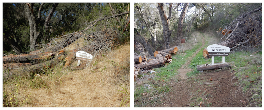
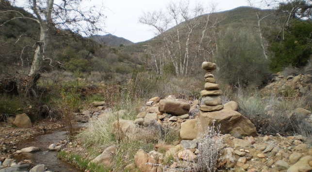
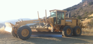
Doesn’t that look a whole lot more inviting!

FOREST 411
– There has been a bit of controversy surrounding post-fire reseeding and if it’s beneficial or not, in particular with the recent Thomas Fire.  We reached out to the FS as well as the California Chaparral Institute to learn about what their recommendations are.  Attached you’ll find some notes and letters with opinions.  Enjoy……

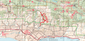
– Tragically, on February 15 there was an accidental self-inflicted gunshot caused death at the Glass Factory target shooting area along East Camino Cielo.  Due to the investigation of the shooting, the Glass Factory will remain closed until March 27.

– Highway 1 along the Big Sur Coast remains closed just north of Salmon Guard Station at Mud Creek.  There have been a few additional slides that have caused delays and/or closures due to the recent storms but all of those have been cleared.  If Hwy 1 is on your radar, be sure to check CalTrans or BigSurKate ahead of time.

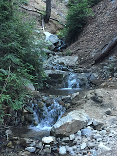
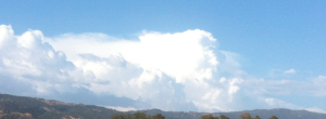
– Even with the recent “March Marvel” (we can’t call it a miracle just yet), we remain well below the average rainfall totals across the forest for the season.  We’re still fighting to overcome a February that had single digit percentages of average rainfall across most of the Los Padres.  Figueroa Mountain received only 2% of their average rain in February, Three Peaks in the Silver Peak region only 7%.  By comparison, Fig Mtn is 174% of normal for March so far and Three Peaks is a whopping 757% of normal!  March is off to a good start and fortunately the storms have been light and steady within the fire areas.  Lets pray for more of the same……

– In case you hadn’t heard, the Whittier Fire closure has been lifted and West Camino Cielo is once again open, barring temporary rain closures.  Please tread lightly.  While West Camino is open, the Tequepis Trail remains inaccessible due to the closure of Circle V Ranch.

– Speaking of the Whittier Fire, the cause of the fire was released last month, read here for more information.

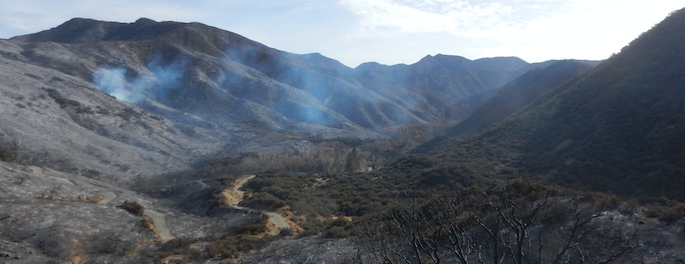
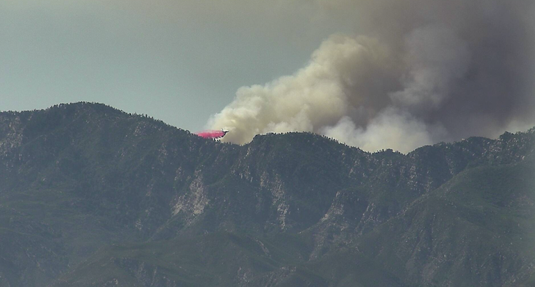
– The Thomas Fire closure remains in effect with all of the burned areas (the black) still closed to public access.  This includes access east of Gibraltar Road along East Camino Cielo and all the trailheads accessed via Rose Valley (yes, even Piedra Blanca Trailhead).  There has been no timetable set as to when the Thomas closure will be lifted.

– There’s been some good news coming from the Thomas Fire specifically related to fire impacted animals surviving the fire.  Here’s one about the use of fish skin bandages to help repair burns and the release of two of those bears and a mountain lion cub.  And this article talking about condor #871’s first flight across the Sespe.

– Thanks to the fantastic work of CalTrans, Highway 33 has remained open through all the past series of storms.  Those guys are amazing!  Thanks CalTrans!  That being said, if you plan on driving Hwy 33, please be aware that it could close at any moment and especially around rain events.

– The Los Padres Forest is requesting comments to reissue power-line permits through the forest.  For more information start here.

— • — • — • —

Smokin Hot, Cold Spring Sunset

Condor Trail Talk: CANCELLED

Cold Spring Trailhead, Montecito, January 9.  
Where’s the trail?  For that matter where’s the road?  Like a giant spoon was drug down the canyon.
Photo
Ray Ford

CONDOR TRAIL TALK: POSTPONED

Due to yesterdays tragic debris flows that ravaged the Thomas Fire and communities downstream, we’re postponing the Condor Trail Talk tonight and will reschedule for early February.  Words can’t describe the devastation that was witnessed yesterday, mainly throughout the Montecito community.  As I’m sure you all know, access along Hwy 101 is closed from Ventura to Santa Barbara and most of the side streets remain closed due to piles of debris, downed trees and everything else stacked up along the creek banks and roadways.  Much of the community remains isolated and it seems likely even more devastation and loss will be uncovered as crews work to regain access.  While most of the news understandably has been focused on Montecito, there has to be similar mudslides and flows in other communities as well.  From what we’ve heard, Ojai seems to have fared okay but Hwy 33 is closed due to road damage above Wheeler Gorge (see photo below).  We’ll certainly hear more in the coming days and lets hope for better news than we received from Montecito.  It’s even scarier that this storm won’t be our last and most likely won’t be the largest either.  Round 1 is in the books, Mother Nature 1, People 0.

The promising news is that warm drying weather is in the forecast for the next week or more.  Access in and around the Los Padres will remain limited with closures occurring yesterday on just about all the Highways used to access the LP from Hwy 1 in Big Sur to Hwy 166, 150, 33 and of course 101.  Be safe everyone and we hope to see you at the Condor Trail Talk in February.

— • — • — • —

Highway 33 Undercut, photo CalTrans

Lets Talk Condor Trail & Winter Storm Warning

The Thomas Fire Didn’t Burn Everything, It Just Feels Like It Did
CONDOR TRAIL TALK
Wednesday January 10 – 6pm – Balboa Building – 735 State St – Santa Barbara
The LPFA and Condor Trail Association are partnering this Wednesday (Jan 10) to host a special Trail Talk focused on the Class of 2016-17 Condor Trail hikers.  We’re really fortunate to have 4 groups of hikers at the event this Wednesday to share stories and photos from their individual exploits along the Condor Trail.  While each of them hiked the same miles, their journeys along those miles are very very different.  It doesn’t matter if you’re dreaming of one day doing the CT or happy just weekend warrior’ing around the Los Padres; you’ll enjoy hearing the fun and sometimes sketchy adventures of these brave CT hikers.  421 miles across the Los Padres – that’s a long way!  Come on out to the Balboa Building at 6pm on Wednesday to hear their tales from the Condor Trail.

In addition we’ll dedicate some time to discuss the Thomas Fire and what the fire means to the Los Padres Forest.  We’ll also have a raffle, some frothy beverages to enjoy compliments of Hollister Brewing Company and enough time to catch up with old fiends and hopefully meet some new ones too.  We hope to see you there.

Any questions or inquiries, please email: INFO@LPForest.org


The Class of 2016-2017 CT Hikers
— • — • — • —


Matilija Trout, Facing Some Rough Days Ahead, photo Humphrey
THOMAS FIRE UPDATE
Speaking of the Thomas Fire, the predicted containment date of January 7 has come and gone with the fire holding at 92% containment and having burned 281,893 acres.  The containment % should see an increase over the next few days as most of the Los Padres braces itself for the first large storm of the season.  The storm is currently hitting the Northern Los Padres and has dumped close to two inches already along the Big Sur Coast.  The majority of the storm will hit this evening into tomorrow morning with forecasts predicting 2-6 inches of rain in select locations with downpours potentially at the rate of one inch per hour.  Due to the potential for flash flooding within the fire areas and subsequent debris flows downstream from the fire areas, mandatory evacuations have been issued for most communities under the burn scars covering over 60 miles east to west from Santa Paula Canyon to Refugio including the Thomas, Sherpa and Whittier burn areas.  It’s crazy that less than a month ago the Thomas Fire was threatening to burn houses and now those same houses are threatened from flash flooding.  Good luck to everyone and your homes, be safe……

The closure order for portions of the Los Padres remains intact, closing all forest entry into areas that burned during the Thomas Fire.  There has been a lot of confusion and frustration regarding the closure, including the temporary closing of some of the trails outside the burn area.  Suppression repair is wrapping up and BAER (Burned Area Emergency Response) teams remain on the ground working to protect resources in advance of winter storms.  It’ll be a while before the Thomas closure is lifted, please remain patient and obey the closures.

— • — • — • —
Thomas’ Final Gasp?  Lion Canyon, January 2
FOREST 411
• Nearly 6 months after starting on July 8, 2017, the Whittier Fire was officially declared “out” on January 1, 2018.  While flames and smoke stopped months ago, there were a few hot spots that remained in portions of the canyons that were too steep and access too difficult to fully extinguish.  An IR flight team flew the Whittier Fire en route to the Thomas Fire and no heat was sensed from within Whittier.

• Sadly, a 40lb bear was euthanized earlier this week along the Sisar Trail.  The bear was burned during the Thomas Fire and was unable to recover.

• Much of the access to the Los Padres is in jeopardy at the moment due to the oncoming storm.  Slides are expected along forest access roads from Hwy 1 in Big Sur (Soberanes Fire) to 154 in Santa Barbara (Whittier Fire) and down through Hwy 192, 150 and 33 (Thomas Fire).  If you have plans to travel through the forest over the coming week, be sure to check access before you head out.  The CalTrans website is a great resource.

— • — • — • —

Great work by VWA volunteer sawyers along the Spruce Creek Trail in the Silver Peak Wilderness, photo Cypher

LP Trivia Night & Wilderness Bill Update

Shall We Play A Game? – Los Padres Trivia Night
LP TRIVIA NIGHT – DRAUGHTSMEN – 6PM

Hello Friends !

In case you haven’t heard, the LPFA is hosting a Trivia Night tomorrow 10/18 at Draughtsmen Aleworks microbrewery and taproom in Goleta – 6pm.  Draughtsmen chose the LPFA as the non-profit benefactor for the month of October offering a donation of $1 for each Karma Tap beer consumed over the course of the month.  As part of the month-long celebration, we decided to try a Los Padres themed Trivia Night that should be a lot of fun.  It’s going to be typical barroom style trivia format where teams of 2-6 players compete for prizes over four rounds of questions.  What’s a little different about our Trivia Night is that our questions will all be Los Padres related and we’ve lined up 4 Los Padres VIP’s to host each of the rounds.  Our VIP’s are SB mountain bike guru Chris Orr, backcountry packer extraordinaire Susie Thielmann, Los Padres historian and author Criag Carey, and Santa Barbara District Ranger Pancho Smith.  We’ve reviewed most of the questions and it’s going to be tons of fun.  There are some softball questions but also some a few that will challenge even the most seasoned Los Padres explorer.  Each of the VIP’s incorporated questions based on their background within the forest so there will be plenty of answer opportunities for all types of different forest users.  Bring your A game and come play with your team or come alone and join on with another team, it’s going to be great!  See you there……..


— • — • — • —


Cairn For the Condor Trail, Get it?
CENTRAL COAST HERITAGE PROTECTION ACT
Earlier this week U.S. Representative Salud Carbajal and Senator Kamala Harris reintroduced the Central Coast Heritage Protection Act, which if passed would designate nearly 250,000 additional acres of wilderness in the Los Padres, create two new scenic areas, over 150 miles of Wild and Scenic Rivers and designate the Condor Trail as a National Recreation Trail.  2017 marks the third attempt for this bill with previous introductions in 2014 and 2015.  Here is a link from KEYT showing the Central Coast Heritage Protection Act introduction on Monday at the Santa Barbara Botanic Gardens and the link above is the actual language of the bill.  It’s not exactly clear if this iteration of the bill will be more successful than the previous two, time will tell.  Stay tuned and keep your eyes peeled for updates……..


— • — • — • —
 

Manzana Trail Cribwall, Before and After, Spring 2017

FOREST 411

• The WHITTIER FIRE was officially declared fully contained on October 5.  Whittier started on July 8 and while the the acreage has not grown over the past couple months, a few pesky hot spots kept the fire from 100% containment.  While the fire is contained the closure order remains in effect within the fire perimeter along West Camino Cielo from Lizard’s Mouth to Refugio including the Tequepis Trail.

• Deer hunting general season started this week in Zone D13, which covers much of the Ventura backcountry mostly within the Mt. Pinos Ranger District.  Click here for a map of D13 and here for general information.  D13 started October 14 and ends November 12.

Fires Wrap Up & Condor Trail Talk

Condor Trail View, SLO Backcountry
BryanConant_SLO2SB_1600x400
TRAIL TALK: Condor Trail with Brittany Nielsen

Don’t forget that the 2nd LPFA Trail Talk event is this Thursday at 6:30 in Santa Barbara.  We’ll be welcoming CT Thru-hiker Brittany Nielsen to talk about her journey and time along the Condor Trail.  Space is limited so be sure to sign up ahead of time.  More information can be found here and you can get your tickets here.  We’ll have a raffle featuring items from Patagonia and REI and some other fun and surprises.  Hope to see you Thursday night!

Also, Brittany will be appearing on KCSB radio 91.9 today at 5:00pm.  Check it out on the air or streaming.

Pine Fire Drop, Ventura County Sisar Peak Camera PineFireSisar

FIRES ON THE MOUNTAIN

The skies are currently clear but it’s already been a busy 2016 fire season.  It seems that as soon as one fire is under control, another one is just getting started.  Lets hope that trend stops with the Pine Fire.  Currently all three major LP fires are over 90% contained with mostly mop-up duties remaining.  While some closure orders remain active, the FS has been reopening some previously closed portions of the forest.  See below for more information regarding each incident and remember that the Los Padres remains in Level III fire restrictions.

COLEMAN FIRE – Started June 4 – 2,520 acres – 96% contained – Monterey County
Inciweb Information
Map Image

SHERPA FIRE – Started June 15 – 7,474 acres – 100% contained – Santa Barbara County
Closure Order
Inciweb  Information
Map Image

PINE FIRE – Started June 30 – 2,304 acres – 93% contained – Ventura County
Closure Order (and attached)
Inciweb Information
• Map Image (see attached)
Article about mules supporting fire crews

See, there still is some water out there!  Big Sur Cascade
Remember to check HLP for more recent water information

BigSurCascade
UPCOMING EVENTS

A few upcoming dates, events, projects, presentations or things you might want to know.
If you have any forest-related events to add to this list, let us know and we’re more than happy to pimp your event!


July 21: LPFA Trail Talk Series, Condor Trail
July 24: REI Trail Run Series, Elings Park

August 11: Santa Ynez Valley Historic Museum, Chumash Trails
August 11-13: LPFA Madulce Trail Sawyer Project
August 13: A-Zone South Hunting Season Starts

September 8: Santa Ynez Valley Historic Museum, Walking El Camino Real
September 11: Island View Trail Race
September 14: LPFA Backpacking Fundamentals Class
September 24: National Public Lands Day Trail Project, Lion Canyon Trail, Ojai

October 13: Santa Ynez Valley Historic Museum, Rangers of the San Rafael Wilderness
October 16: D-13 Hunting Season Starts
October 22: LPFA Used Gear Sale
October 29: LPFA First Aid & CPR Training

Condor Trail Talk Series & Pine Fire

CT_Banner

Hi Everyone,

We’ve got some exciting news to share about the LPFA Trail Talk series of events.  Brittany Nielsen will be coming up to Santa Barbara on July 21 to give a talk about her 2015 experience thru-hiking the 421 mile Condor Trail from Lake Piru (Ventura County) to Bottcher’s Gap (Monterey County).  This is our second Trail Talk Series event and will once again be held at the Santa Barbara Veterans Hall off Cabrillo Blvd right across from the beach.  The talk is free for LPFA members or $10 for guests and includes a complimentary social happy half-hour both before and after the talk.  We’ll top it off with a few additional speakers, some trivia games and a raffle.  You can learn more on www.LPForest.org, become a LPFA Member here or get your tickets directly at EventBrite.  If you have any questions about your LPFA membership, please contact INFO@LPForest.org.  Thanks everyone, Brittany has a great story to share and we hope you are interested in attending.  Looking forward to seeing you there……..
PINE FIRE, SESPE WILDERNESS
PineFireMap160630

Another wildfire started Thursday morning along Pine Mountain in the Ventura Backcountry.  The exact location of the fire is still being worked out but the map above is the best information we could find as of now.  The Pine Fire is along the Gene Marshall – Piedra Blanca National Recreation Trail (also part of the Condor Trail) in the vicinity of Haddock Camp and the upper reaches of Beartrap Canyon.  This is a very steep and rugged portion of the forest in the neighborhood of 6,000ft elevation.  The area features large rock outcrops with patches of chaparral around predominantly pine trees.  The Pine Fire is currently at 300 acres and is being hit hard with air tankers and fire crews.  The weather forecast for the weekend is promising as winds should be light and temperatures are going to be on the lower side.  There are road closures as a result of the fire and both Hwy 33 and Lockwood Valley Rd are scheduled to be closed to thru-traffic this weekend.  If you’d like to keep an eye on the fire, your best bet is to use Twitter and follow #PineFire or on Inciweb.  Both the Wolf Fire (2002) and Day Fire (2006) burned near here but we don’t know when the last time this area specifically burned.

Best of luck and thanks to everyone involved in fighting the Pine Fire!

Los Padres is Large

Santa Barbara Canyon Washout, photo Humphrey

SBCynWashout
Hello Everyone,
The photo above was taken last week along Santa Barbara Canyon in the Mt. Pinos Ranger District.  This was the area hit hardest by the micro-burst tropical storm from three weeks ago.  Just up-canyon from here received over an inch of rain in less than an hour.  This resulted in a flash flood that wiped out the road.  Sort of ironic that too much water is causing problems for the Los Padres this summer.
CONDOR  TRAIL  HIKER  UPDATE
BrittanyCT
Left, Brittany May 13 at the iconic Piru Condor Tree
Right, Brittany June 19 wearing a few pounds of dirt at Bottcher’s Gap
The idea of the Condor Trail started just about 20 years ago with the dream of creating a hiking route that connected trails from Lake Piru to NIRA through Ventura and SB Countues.  Since then the dream has grown and the Condor Trail now spans over 410 trail miles covering the entire length of the Los Padres from Lake Piru (southern Ojai Ranger District) up to Bottchers Gap (northern Monterey Ranger District).  While hikers have done large chunks of the Condor Trail (CT) over the years, no one had ever hiked the entire thing, until now.  Brittany Nielson became the first finisher of the Condor Trail earlier this month when she completed the hike from Lake Piru to Bottcher’s Gap.  She solo-hiked the trail and finished in 37 days.  It was interesting talking with her before and after her hike.  I think she gained an appreciation for the Los Padres and a respect for how challenging our forest can get.  She tackled long sections with no trail, heavy bushwhacking in deep canyons, temps ranging from freezing to triple figures, 15mile stretches with no water and day after day without seeing a single person (less than 20 people along the entire trail).  But, she also hiked under old growth redwoods, covered elevations from over 7,000ft to sea level, saw incredible wildlife, ocean views, deep pools and got to experience the solitude the LP is famous for.  She basically took a crash course in Los Padres Backcountry, learning things in a month that many of us took years and years to learn.  Speaking on behalf of everyone involved in supporting her journey, we’re all so proud of Brittany for her resiliency, tough skin, happy go-lucky attitude and ability to fight through the hard times.  This is quite an accomplishment and one that will no doubt put her somewhere in the LP hall of fame.  What’s next for the Condor Trail and/or Brittany?  She would like to return next season and do the hike again.  Perhaps when she does there will be some other thru-hikers following in her footprints along the Condor Trail as well.
DAVY BROWN TRAIL PROJECT
DB_Trailworkers
Happy Trail Workers
When life gives you lemons, make lemonade.  The Sierra Club offers a variety of service outings that are organized through their national charter.  These service outings take their volunteers across the country doing volunteer work with various agencies and organizations.  When the Sierra Club was told that their service outing to pull non-native plants at El Capitan State Beach was going to be cancelled due to the Gaviota oil spill, they quickly changed their plans and instead spent a day doing volunteer trail work in the Los Padres.  The LPFA got an email saying there were 13 volunteers needing a trail to work, and we knew right where to put them.  Last week we led the 13 volunteers up the Davy Brown Trail in the Santa Lucia Ranger District.  While the temps were hot, we were able to work about 2miles of trail.  It was great seeing people from outside Central California spending their free time helping our forest.  They were impressed with the Los Padres and we’ve already started a dialog where we’re hoping to lead future projects with the Sierra Club service outings throughout the Los Padres.  Lemons into lemonade for sure.

Thunderstorms, Thru-Hikers and National Trails Day

Old Man Thundercloud
OldManThunderhead

Hello Everyone!

What a crazy weather week we enjoyed last week, especially in the Santa Barbara and Ventura backcountry areas.  It started with a tropical storm last Tuesday that dropped significant rain across the forest.  Most of the Forest got rain with the highest concentration (one inch) occurring on the frontcountry above Santa Barbara.  The weather changed on Wednesday and brought in some incredible thunderstorms that blanketed the backcountry through the weekend.  There were reports of flooding along the Cuyama River and Santa Barbara Potrero recorded an inch of rain in just over an hour – that’s a lot!  We had some of the more impressive storms that we get to see around here.  We even heard comparisons to thunderstorms in New Mexico and the south west.  Pretty cool stuff and we’ll certainly take every bit of rain we can get.  The weather has settled back down and most of the interior is HOT with coastal regions displaying the typical June gloom.  Always nice to see some exciting weather………
NATIONAL TRAILS DAY
NationalTrailsDayGroup
There were three trail projects across the Los Padres on Saturday June 6 for National Trails Day.  The LPFA hosted an event along the North Cold Spring Trail.  Our focus was to fix a particularly nasty slide section of the trail that has been causing problems for hikers for most of the past two decades.  We had a great time and did a fantastic job cleaning up the slide.  Big thanks to REI, Figueroa Mountain Brewing, Los Padres Trail Riders, Jack’s Bagels and the Forest Service for their support of the project.  They say a picture tells a thousand words, check the movie below:
CONDOR TRAIL
CondorTrailBanner
Most of you have probably heard about the Condor Trail.  For those who have not, it’s a route of connected trails that cross the Los Padres Forest from the Ventura/Los Angeles County line in the south up to Bottcher’s Gap in Monterey County.  The total length of the trail is 411 miles long.  The concept of the trail has been around for nearly 20 years, headed up by the Condor Trail Association.  Over the years we’ve had a few people attempt to hike large sections of the trail but no one ever attempted to hike the entire thing….. until now.   In mid-May a solo female hiker name Brittany started on the trail from Lake Piru.  She has now been on the trail for nearly 5 weeks and is on pace to complete the trail later this week and become the first Condor Trail finisher.  It’s been a roller coaster journey for Brittany.  She’s had to endure snow, heat and lost trails but along the trail has met new friends and had some amazing experiences.  We’ll keep you posted as the she gets close to finishing.  I’m sure she’ll have some great stories to share.  Most amazing in my opinion is that before she started this hike, she had never set foot in the Los Padres.  Good luck Brittany on her last 60miles of trail.
ROAD UPDATES
GraderBanner

Some quick updates on access issues across the Forest:

ROMERO CAMUESA ROAD
The gate to the Romero Camuesa Rd at Divide Peak is scheduled to reopen Wednesday of this week.  A combination of rain and a crew working on the road has led to the closure.

DOUGH FLAT / SQUAW FLAT
The retaining wall construction continues along the Dough/Squaw Flat Rd in Ojai.  The road is scheduled to reopen June 19 but until then the road will be closed from 8am – 12pm and again from 1pm – 5pm.  Call the Forest Service for more information.

HIGHWAY 1 / NORTHERN SLO / SOUTHERN MONTEREY
There is continued retaining wall construction along Highway 1 near the Monterey/SLO County line.  There seems to be weekly changes as to when the road will be closed or open.  Currently the road is closed at night time for construction and open during the day.  If heading along Highway 1 either to or from Big Sur, you’ll want to contact CalTrans to get the most up-to-date information on closures.  http://www.dot.ca.gov/dist05/road_information.htm

That’s it for now.  Enjoy the week………..

Tar Creek and Biddle Park

Thunder Clouds in April
Thunderheads
What season is it…?  It’s been rather hard to figure that out of late.  This past week we had June gloom, temps in the high 80’s, rain, wind, showers and most surprisingly some rather large summer’esque thunderheads.  There’s been reports from around the Forest that most of the backcountry potreros have turned brown and that the poison oak is already starting to turn red.  We’ve also heard of springs going dry that haven’t done so in decades.  The creeks are still flowing due to the marginal rain season we’ve had but the deep springs are going dry as a result of the 4 years of drought we’re enduring.  That has flipped compared to what we had last year where the creeks were dry but the springs had water.  It’s going to get real interesting once summer truly kicks in and the creeks go dry.  Water will be real scarce.  Until then, almost all the creeks have water at the moment so get it while you can.We’ve got a couple updates and notes to share today.  As always, if you have any information to share, we are more than happy to spread the news……….
T A R   C R E E K   C L O S U R E
There are quite a few designations for protected lands within the Los Padres.  These include wilderness areas, biological and botanical reserves, recreation areas and Condor Sanctuaries. Of all the designations, the one that offers the most protection is the Condor Sanctuaries. Protected and enforced by federal law, Condor Sanctuaries prohibit any human entry onto those lands. There are two Condor Sanctuaries in the Los Padres, the larger being the Sespe Condor Sanctuary in Ventura County. Back before the sanctuary was designated in the mid 1900’s, people would access lower Sespe Creek along a road that dropped down the Tar Creek drainage through what is today the Sespe Condor Sanctuary. When the sanctuary was established, the road was obviously closed. While people stopped driving the road, it was not completely abandoned. The road transitioned into an unofficial trail and continued to be used by recreationalists seeking the water along Tar Creek and the Sespe. This went on for decades even though it was technically illegal to enter the Condor Sanctuary. Unfortunately, over time, Tar Creek gained a bit of a cult following due to its spectacular waterfalls, cliffs and pools. You might say it got discovered – word spread – and it became overrun. Loads of trash, bottle-caps and broken glass accumulated throughout the creek. Sadly, the poop hit the fan in 2009 when a condor was found dead in Tar Creek after getting caught up in some abandoned climbing rope. Not okay. The sanctuary was designed to protect the condor yet it obviously was not working. Something had to give, and now it has. The Forest Service is now enforcing the closure of the Condor Sanctuary and ticketing people who pass along Tar Creek within the Condor Sanctuary. This has been going on for the past months and quite a few tickets have been issued. “Violators are subject to a penalty of $5,000 and/or six months in jail”. You can browse the world wide web and find all sorts of information about the Tar Creek closure and how its being perceived by the public. The Forest Service has created a page that explains the plight of the condor and the closure of Tar Creek, linked here:
Gibraltar
G I B R A L T A R   C L O S E D

Speaking of closures, for those who have plans to access East Camino Cielo and the Upper Santa Ynez River area within SB County, we have some either good or bad news for you. Gibraltar Rd, which is the main artery for accessing this portion of the forest, is closed for repaving and will remain closed until May 25. This is certainly great long term news for cyclists, who will eventually have fresh pavement to ride, but in the short term the closure may put a damper on some of your backpacking, OHV and camping plans. You can still access East Camino via 154 or Painted Cave.  The bad news is that for South Coasters it means a much longer drive, good news is that the crowds should not be an issue for those willing to take the longer drive.  We’ll keep you posted as the project moves on.

E V E N T S: GARCIA  POTRERO

Come join the Los Padres Unit of the Backcountry Horsemen of California and the Condor Trail Association as they host a Wilderness Celebration to raise awareness and fund-raise to build a new trail segment called the Garcia Potrero reroute.  The “trail” through Garcia Potrero has some private property issues and the hope is to build a new section of trail that bypasses the private property.  This is also along the Condor Trail.
The celebration is Saturday May 2 from 11am – 2pm at Biddle Park (Willow Bluff Area) in Arroyo Grande.
There will be Santa Maria Style BBQ, live music, beer, wine, displays, booths and kids activities.  IT WILL BE FUN.  See below for more information.Hope to see you there……….
https://www.facebook.com/events/831496210277754/
—————————————————————————————————
April 17-26: Working Vacation Upper Sisquoc
May 2: Garcia Potrero Wilderness Celebration
June 5-7: National Trails Day, Mono Campground Trail Weekend
June 27: Big Sur Wilderness Celebration
—————————————————————————————————


Logging in progress, Upper Sisquoc Working Vacation, Photo Rik
RikLogging