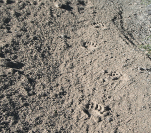
Cuyama River, Two Days After Flooding, Where’d It All Go?

Hello Everyone!
We’ve had some weather. Hurricane Delores did her thing and sent some rain and thunder storms our way last week. It was about as exciting as summer weather gets along the California coastal ranges.
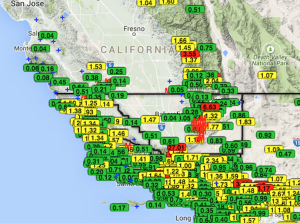
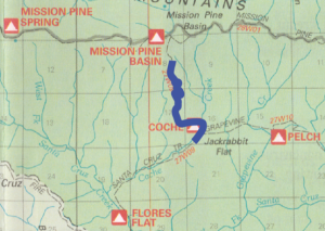
The rain started Saturday with much of Southern California seeing an entire day of rain, very heavy in some places. Sunday through Wednesday was the more typical thunder storms with morning sun being replaced by fluffy thunderclouds and rain by the afternoons. As the map shows above, the rain hit hardest in the southern Los Padres but most of the forest did see some precipitation at some point over the week. Matilija in Ventura County saw the most rain with nearly 4 inches (in July!). Frazier Park recorded 3.5″ which resulted in flash floods and quite a few road closures. At one point on Saturday, all roads between Mt. Pinos and Frazier Park were closed due to floods. There were reports of people being stranded overnight due to the road closures. Santa Barbara didn’t see as much rain but the Sierra Madre received over 2″ at both Bates and SB Potrero. Interestingly, SLO County got more rain than SB with most places having over 1.5″ across the forest. Monterey up into Big Sur didn’t get much rain but did see some incredible lightning and thunder displays. We’ve had reports coming in showing new green grass sprouting across the forest and increased flow in the creeks. If nothing else, this most recent rain might extend the campfire season. We’ll say a fond farewell to Delores and see what comes next.
–
–
–
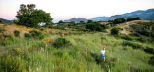
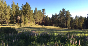
Still Spring on Mt. Pinos
AROUND THE FOREST NEWS
Some stories and links you might find interesting from across the Forest:
–
LOST BIG SUR HIKER
Earlier this month a hiker went missing at Pfeiffer Big Sur State Park. Sadly, after nearly a week, the search was suspended. You can read more about it through a Google search or here.
Earlier this month a hiker went missing at Pfeiffer Big Sur State Park. Sadly, after nearly a week, the search was suspended. You can read more about it through a Google search or here.
–
CONDORS AND TAR CREEK
There was a recent article in the High Country News about the Tar Creek (Ventura County) closure and its influence on the condors in the area. The article highlights some of the Forest Service efforts to control the situation at Tar Creek. Certainly worth a read if interested.
There was a recent article in the High Country News about the Tar Creek (Ventura County) closure and its influence on the condors in the area. The article highlights some of the Forest Service efforts to control the situation at Tar Creek. Certainly worth a read if interested.
–
CONDOR IN SANTA BARBARA
This story made it’s way through Social Media land but in case you missed it, a wild/free condor made a rare visit to Santa Barbara late last month. Yankee Barbareno did a good job of documenting and sharing the information on his blog. You can read it here. Perhaps one day the condor will be feeding along the beaches again, that would be cool to see.
This story made it’s way through Social Media land but in case you missed it, a wild/free condor made a rare visit to Santa Barbara late last month. Yankee Barbareno did a good job of documenting and sharing the information on his blog. You can read it here. Perhaps one day the condor will be feeding along the beaches again, that would be cool to see.